Las Palmas · Canary Islands, Spain
Las Palmas — The Camp by the Ravine
An audio walk through Las Palmas, from the camp Castilian soldiers pitched by a ravine in 1478 to the merchants' quarter that grew across it.
Narration in English · Stop 1 is free
 Tour no. 48
- Stops
- 11
- Distance
- 2.3 km (1.4 mi)
- Time
- About 95 minutes
- Route
- Easy city route
Listen before you buy
Stop 1 · The Vegueta Market
Stop 1 is free. Listen before you buy.
The walk
An audio walking tour of Las Palmas de Gran Canaria from the Vegueta market through the quarter of the conquest to the cathedral square, then across the buried Guiniguada ravine into Triana, at your own pace
Las Palmas de Gran Canaria grew from a camp. On 24 June 1478 Castilian soldiers under Juan Rejón came ashore on the island and set up the Real de Las Palmas where the Guiniguada ravine meets the sea, for its water and wood. Vegueta, the quarter of the hermitage, the cathedral and the governors, grew round that camp, while Triana, the merchants' and sailors' side, spread north across the ravine; in the 1970s its bridges came down and a road was laid over its last stretch. The walk begins at the Vegueta Market by the old ravine mouth and goes back to the camp, the hermitage of San Antonio Abad on its site, and the Casa de Colón, a museum the island council assembled from several older houses in the 1950s. Columbus's own journal says only that the Pinta was repaired at Canaria in 1492; that he called at the governors' house here is a tradition.
From the cathedral square, where eight iron dogs face the front of a church begun about 1500 and left unfinished for two centuries, the route rises to the Plaza del Espíritu Santo, whose fountains were fed from the Morales spring from 1792, and to the Dominicans' square, whose convent burned when a Dutch fleet under Pieter van der Does took the town and set it on fire in 1599. El Museo Canario, founded in 1879, keeps the memory of the Canarios, the people of the island before the conquest, a war that ended in 1483 in enslavement and deportation. The walk then crosses the road on the old ravine bed into Triana, to the Gabinete Literario of 1844, on the ground of an old theatre, the birthplace of the novelist Benito Pérez Galdós, and the theatre that carries his name, gutted by fire on 28 June 1918 and rebuilt.
Route notes
Route and itinerary
About each stop · narration stays in the app
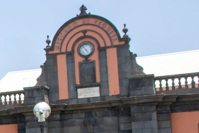
Photo: Mike Peel · Wikimedia Commons source · CC BY-SA 4.0 · Cropped to the recorded 3:2 source rectangle and resized from the exact hash-bound source input. The Vegueta Market
The Vegueta Market is the market hall of dark stone at the old mouth of the Guiniguada ravine, facing the Teatro Pérez Galdós across the road, at the edge of the historic quarter of Las Palmas de Gran Canaria. The route starts here because the architects Manuel de Ora and Manuel Ponce de León y Falcón designed the hall to gather the town's food trade in one place, and because, by the market's own account, its aisles are still where traders and customers swap news and recipes. Its opening times change, so check locally, and the walk reaches it across the busy road on the old ravine bed at the signalled crossing.
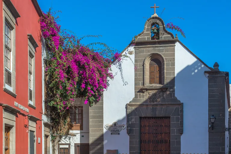
Photo: Bengt Nyman · Wikimedia Commons source · CC BY-SA 4.0 · Cropped to the recorded 3:2 source rectangle and resized from the exact hash-bound source input. San Antonio Abad and the Camp of 1478
The hermitage of San Antonio Abad is the small white chapel of 1757 on its own little square in Vegueta, where the streets Armas, Colón, Pedro de Algaba, Audiencia and Montesdeoca meet. The route stops here for the plain front the chapel turns to the square, symmetrical round a square headed doorway under a baroque bell gable of grey dressed stone, and because the chapel is now one of the exhibition spaces of the Centro Atlántico de Arte Moderno. The walk stays outside the chapel, and the lanes round the square are paved with setts that are uneven in places.
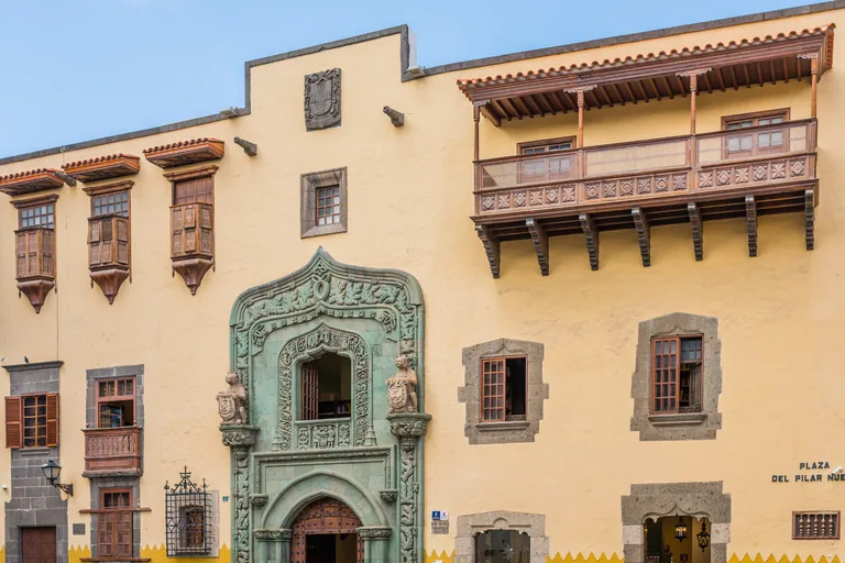
Photo: Bengt Nyman from Vaxholm, Sweden · Wikimedia Commons source · CC BY 2.0 · Cropped to the recorded 3:2 source rectangle and resized from the exact hash-bound source input. Casa de Colón
The Casa de Colón is a museum and study centre of the island council of Gran Canaria, behind the cathedral in Vegueta, made by joining several houses into one building. The route stops here for what the museum keeps round its two great patios: thirteen rooms of permanent displays, four Flemish panels of the sixteenth century that recall the island's sugar trade with Flanders, and a library of about 25,000 volumes on the history of the Americas and their ties with the Canaries. Visits inside are ticketed and their hours change, so check locally; the stop works from the small square outside.
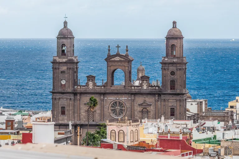
Photo: Bengt Nyman from Vaxholm, Sweden · Wikimedia Commons source · CC BY 2.0 · Cropped to the recorded 3:2 source rectangle and resized from the exact hash-bound source input. Plaza de Santa Ana and the Cathedral
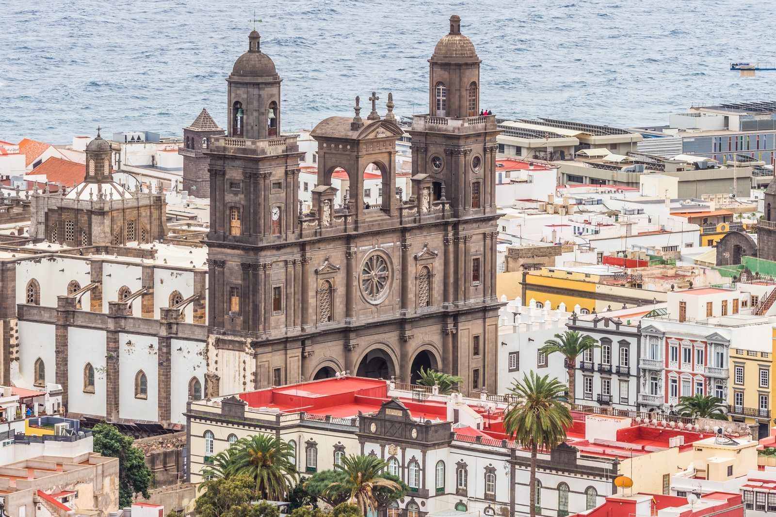
The Plaza Mayor de Santa Ana is the long square in front of the Cathedral of Santa Ana, named for the patron saint of the cathedral and of the city, with the town hall at its far end and the bishop's palace on one side. The route stops here because the conquerors chose this ground as the centre of their new town, because the cathedral joins a late Gothic interior to a neoclassical exterior, and because the eight dogs at the square's end have become one of the symbols of the city. Visits inside the cathedral are ticketed and their times change, so check locally; the square itself is open and paved, with little shade at midday.
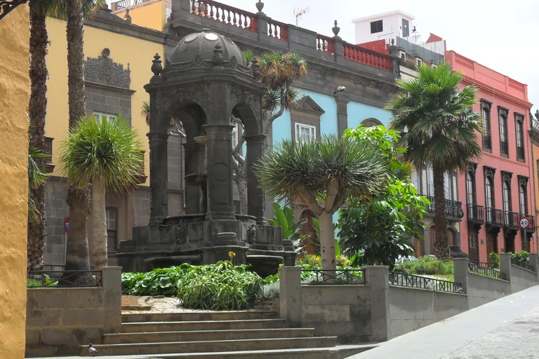
Photo: sailko · Wikimedia Commons source · CC BY-SA 3.0 · Cropped to the recorded 3:2 source rectangle and resized from the exact hash-bound source input. Plaza del Espíritu Santo
The Plaza del Espíritu Santo is a small sloping square in Vegueta with a roofed fountain in a garden at its centre and, at its east end, the hermitage of the Espíritu Santo, whose plain lines the council's panel finds more fitting for the countryside than for the heart of Vegueta. The route stops here for a square the council's panel ties to the town's prosperity in the middle of the nineteenth century, and for the fronts that panel singles out: the Casa Manrique, laid over an earlier house, the house of the León y Joven family, later a school of commerce, and the Casa Llarena. The walk stays outside the hermitage, and the sloping setts of the square can be slippery when wet.
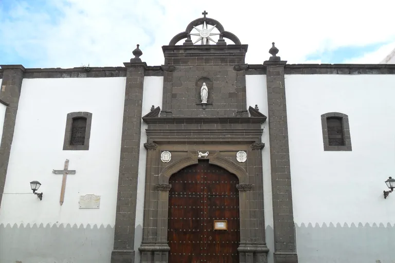
Photo: sailko · Wikimedia Commons source · CC BY-SA 3.0 · Cropped to the recorded 3:2 source rectangle and resized from the exact hash-bound source input. Plaza de Santo Domingo
The church of Santo Domingo, the parish of Santo Domingo de Guzmán, faces its square of old trees in Vegueta and is what remains of the Dominican monastery of San Pedro Mártir. The route stops here for the town's wars at sea: the present church went up early in the seventeenth century after the Dutch fleet of Pieter van der Does took the town in 1599 and burned the convent, and four years before that the fleet of Francis Drake and John Hawkins, bound for Puerto Rico, had turned aside to the island for supplies and been driven off by the garrison and its guns. The walk stays outside the church, and the square rises gently and has little shade at midday.
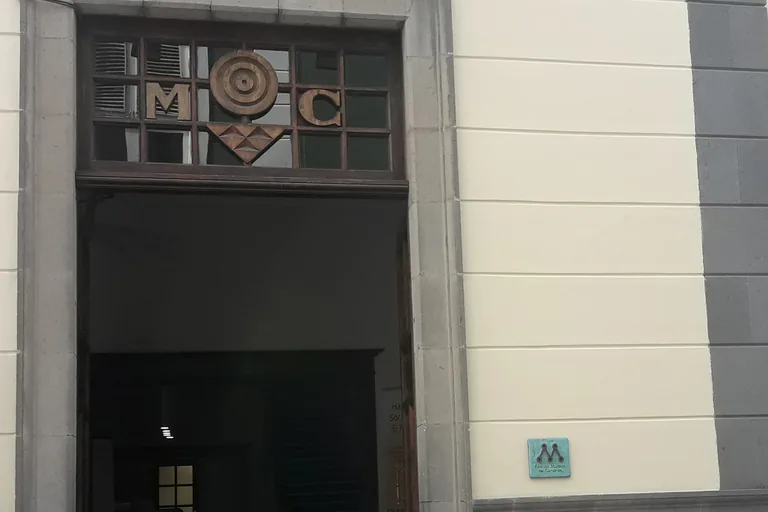
Photo: Beta15 · Wikimedia Commons source · CC BY-SA 4.0 · Cropped to the recorded 3:2 source rectangle and resized from the exact hash-bound source input. El Museo Canario
El Museo Canario is the museum and learned society on Calle Doctor Verneau in Vegueta devoted to the Canarios, the people of Gran Canaria before the conquest. The route stops here for the society's own story: several of its founders kept close scientific ties with French anthropologists such as Verneau, Broca and Quatrefages, its rooms opened on 24 May 1880, and Dr Chil left it this house, his collections and the 7,500 volumes of his library, although the move here waited until 1923 and the doors reopened only at the end of 1930. Visits are ticketed and their hours change, so check locally; the stop works from the street door.
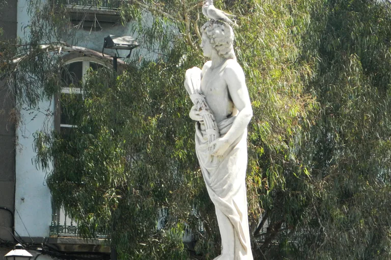
Photo: hh oldman · Wikimedia Commons source · CC BY 3.0 · Cropped to the recorded 3:2 source rectangle and resized from the exact hash-bound source input. The Guiniguada
The Guiniguada is the ravine that once divided Vegueta from Triana; its last stretch now runs under a busy road, between the statues of the Four Seasons at the end of Calle Obispo Codina. The route stops here for the ravine's course and its old role: it rises at about 1,850 metres at the heart of the island and passes Vega de San Mateo and Santa Brígida through valleys of farms and hamlets, it is believed to have marked the border between the Canario realms of Gáldar and Telde, and on its far side Calle Mayor de Triana begins where the wooden bridge stood, a street closed to traffic since the 1980s. Cross the road only at the signalled crossing and wait for the green light.
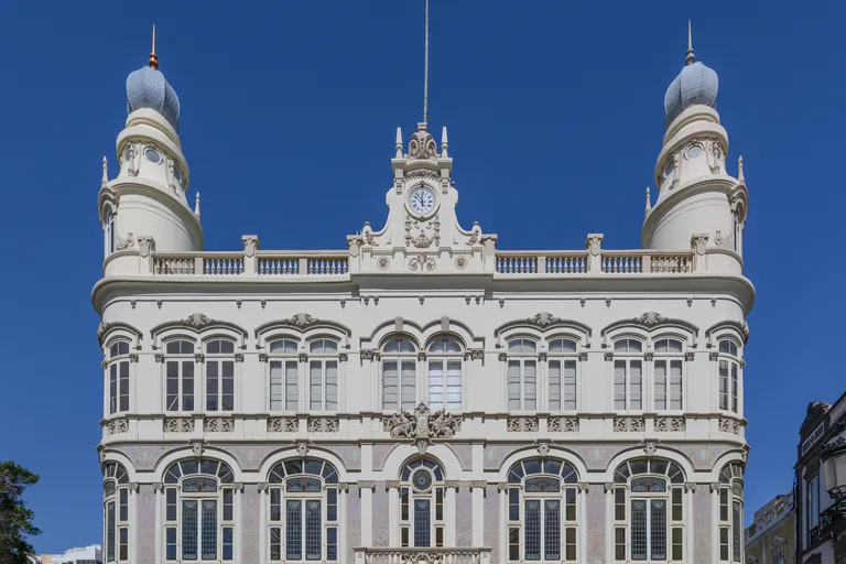
Photo: Bengt Nyman · Wikimedia Commons source · CC BY 2.0 · Cropped to the recorded 3:2 source rectangle and resized from the exact hash-bound source input. Plaza de Cairasco and the Gabinete Literario
The Gabinete Literario is the private society founded on 1 March 1844 as the Gabinete Literario de Fomento y de Recreo, whose white front, between two towers under domes, closes the three cornered Plaza de Cairasco in Triana. The route stops here for the society's place in the town's life: four Gran Canarians founded it, it sponsored the floral games of 1910, which Miguel de Unamuno attended, and upstairs the old ballroom, now the Salón Dorado, has a ceiling of three canvases by Manuel González Méndez showing Apollo, Orpheus and Thalia. The society is private, so the walk stays in the square outside, where the paving on the Triana side is smooth.
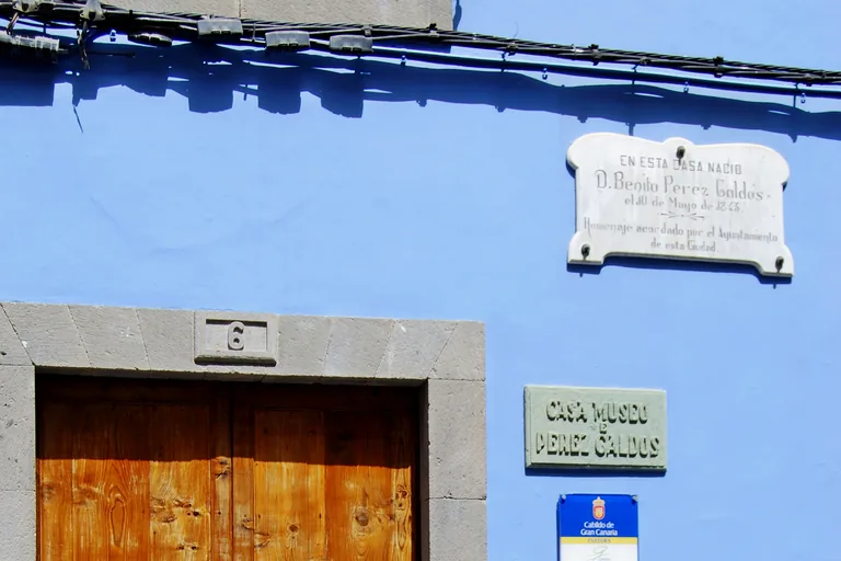
Photo: Felix König · Wikimedia Commons source · CC BY 3.0 · Cropped to the recorded 3:2 source rectangle and resized from the exact hash-bound source input. The Pérez Galdós House
The Pérez Galdós house museum, in the pedestrian Calle Cano in Triana, is the nineteenth century house where Benito Pérez Galdós was born and lived until he was nineteen, now a museum of the island council. The route stops here for what the house keeps: furniture from the homes where he lived in Las Palmas, Madrid and Santander, rooms rebuilt as the study and bedroom of San Quintín, his house in Santander, and, since December 2006, a centre for the study of his work in the building next door. Visits are guided or ticketed and now start from the building next door, and their hours change, so check locally.
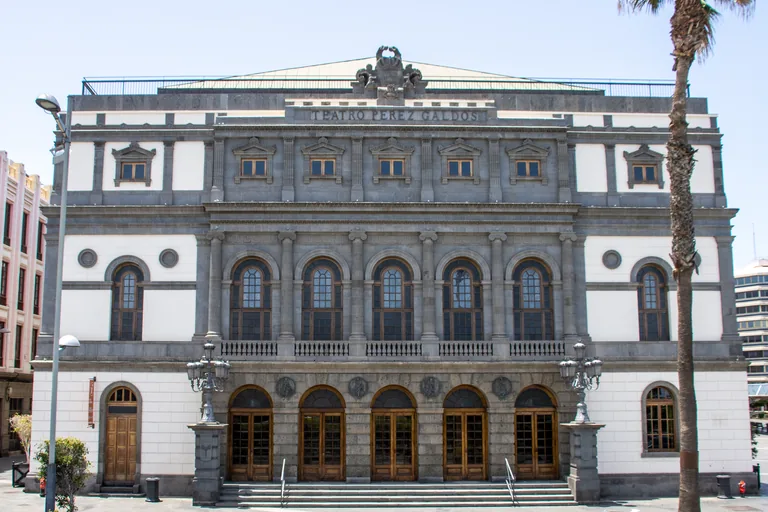
Photo: Mike Peel (www.mikepeel.net) · Wikimedia Commons source · CC BY-SA 4.0 · Cropped to the recorded 3:2 source rectangle and resized from the exact hash-bound source input. Teatro Pérez Galdós
The Teatro Pérez Galdós is the main theatre of Las Palmas de Gran Canaria and the home of the city's opera festival named for Alfredo Kraus, on the left bank of the mouth of the Guiniguada at the south east edge of Triana. The route ends here for a building raised more than once: after the fire of 1918 it was rebuilt on the plan of its architect, Francisco Jareño, a rectangle of 70 by 30 metres in stone and brick with four fronts in an academic classical style, and the painter Néstor Martín Fernández de la Torre decorated the hall with canvases, Apollo and the Muses among them over the stage. The theatre keeps its own programme and box office times, so check locally; the walk ends here, beside the Teatro bus station.


Local context
Before you go
The walk is a loop of about 2.3 km on foot from the Teatro bus station, a terminus of city bus lines, south across the GC-110 on the old ravine bed to the Vegueta Market, through the lanes of Vegueta to the cathedral square and up to the Plaza de Santo Domingo, then back across the road into Triana to end at the Teatro Pérez Galdós, beside the same bus station. The San Telmo bus station, for the island's intercity buses, is about half a kilometre further north along Calle Mayor de Triana.
On the ground
Access and surfaces
A loop of about 2.3 km on foot, mostly level, with a gentle rise inland toward the Plaza del Espíritu Santo and the Plaza de Santo Domingo; allow an hour and a half or a little more with the audio. Vegueta's streets are paved with setts and stone slabs, some uneven and slippery when wet, while the main street of Triana is smooth and closed to traffic. The walk crosses the GC-110, a busy dual carriageway laid in the old ravine bed, twice: use the signalled crossings and wait for the green light. The squares have little shade at midday and the sun is strong all year, so bring water and a hat. The walk stays outside every church; if you go into one, go outside the times of mass, keep your voice down, cover your shoulders and do not photograph people at prayer. The cathedral, the Casa de Colón, El Museo Canario and the Pérez Galdós house are visited with a ticket or by guided visit and their hours change, and many shops close on Sunday, so check locally. Driving into the old town is not recommended.
Frequently asked
Plan the walk
- How long is the Las Palmas audio walking tour?
- Allow about 95 minutes. The route covers 2.3 km (1.4 mi) in 11 stops, including walking and listening time and the short walks from and back to the Teatro bus station.
- Where does the Las Palmas tour start and end?
- It starts at the Vegueta Market, a few minutes on foot from the Teatro bus station across the road on the old ravine bed, and ends at the Teatro Pérez Galdós, right beside the same bus station. The San Telmo bus station, for intercity buses, is further along Calle Mayor de Triana.
- Can I go inside the cathedral and the museums?
- The walk stays outside, and each stop works from the street or square. The cathedral, the Casa de Colón, El Museo Canario and the Pérez Galdós house are visited with a ticket or by guided visit and their hours change, so check locally; if you go into a church, go outside the times of mass and cover your shoulders.
- What should I bring for the walk?
- Water and a hat: the squares of Vegueta have little shade at midday and the sun is strong all year, though morning cloud from the sea is common. Wear shoes with a good grip, since the setts and stone slabs can be uneven and slippery when wet.
Same region