Ronda · Andalusia, Spain
Ronda — The Town and the Drop
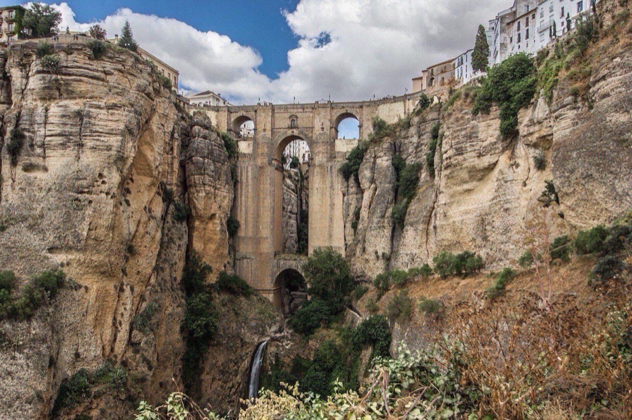
Ronda sits on the flat top of a rock, and for most of its history its water was a hundred metres below.
Narration in English · Stop 1 is free
 Tour no. 11
- Stops
- 11
- Distance
- 2.7 km (1.7 mi)
- Time
- About 150 minutes
- Route
- Moderate walking route
Listen before you buy
Stop 1 · Alameda del Tajo
Stop 1 is free. Listen before you buy.
The walk
A self-guided audio tour of Ronda
Ronda sits on the flat top of a rock, and for most of its history its water was a hundred metres below. That one inconvenient fact built the town: a stair cut down inside the cliff with a water wheel at the bottom, a bathhouse out by the river where travellers washed before they were let in, three bridges across the gap in six hundred years, and a siege in 1485 that ended the moment the water was taken. This walk goes down the way the water came up — past the bullring, over the famous bridge, down to the baths — and climbs back through the old town to the gate the army came through.
Route notes
The stops
About each stop · narration stays in the app
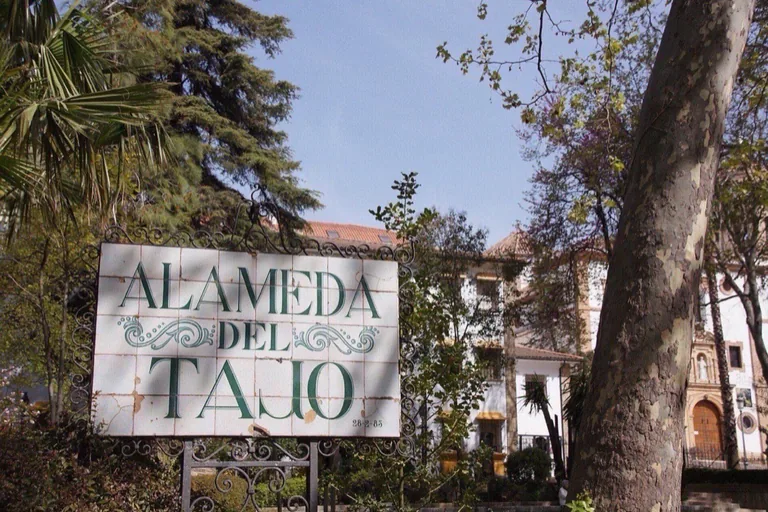
Photo: Fredrik Rubensson · Wikimedia Commons source · CC BY-SA 2.0 · Cropped to the recorded 3:2 source rectangle and resized from the exact hash-bound source input. Alameda del Tajo
Alameda del Tajo is an early-nineteenth-century pleasure garden whose planted avenues end at balconies above Ronda's gorge and mountain basin. The route opens here to establish the landscape and the sheer drop that shaped every crossing and defence ahead. The park is free and mostly level with benches, but its railings stand directly above the precipice.
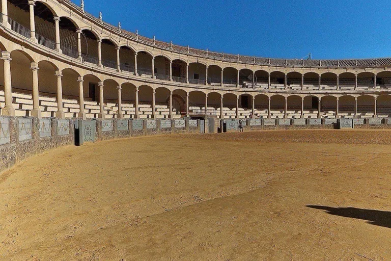
Photo: José Luis Filpo Cabana · Wikimedia Commons source · CC BY-SA 4.0 · Cropped to the recorded 3:2 source rectangle and resized from the exact hash-bound source input. Plaza de Toros de la Real Maestranza
Ronda's bullring was completed in 1785 for the Real Maestranza, a cavalry brotherhood whose equestrian training helped shape public bull spectacles. The stop links the town's aristocratic riding culture to the Romero family's later prominence in bullfighting on foot. The exterior is on level public pavement; ring and museum entry require a ticket.
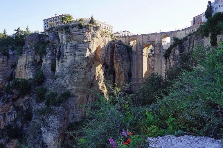
Photo: Julia Kostecka · Wikimedia Commons source · CC BY 2.0 · Cropped to the recorded 3:2 source rectangle and resized from the exact hash-bound source input. Puente Nuevo
Puente Nuevo crosses the Tajo on a great masonry arch completed in 1793 after an earlier bridge collapsed in 1741 with heavy loss of life. The route treats Ronda's postcard as a difficult construction problem that finally joined the old and newer towns. Crossing is free but narrow and busy with traffic; the interpretation room inside the bridge requires steps and a ticket.
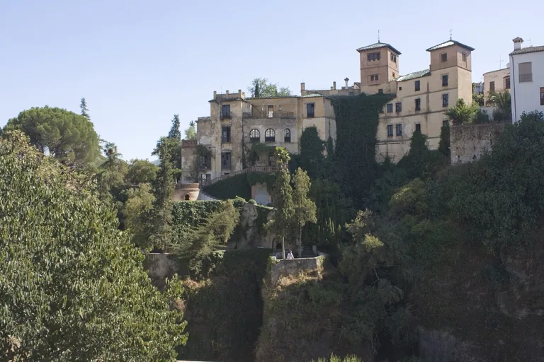
Photo: Daniel VILLAFRUELA . · Wikimedia Commons source · CC BY-SA 4.0 · Cropped to the recorded 3:2 source rectangle and resized from the exact hash-bound source input. Casa del Rey Moro and the Water Mine
The Casa del Rey Moro gardens contain a medieval water mine: a long stair cut through the cliff to a water-lifting chamber near the river. It is central to the route because control of this labour-intensive water supply helped decide Ronda's 1485 surrender. The street stop is complete outside; the ticketed mine descent is steep, wet, lengthy and has no step-free alternative.
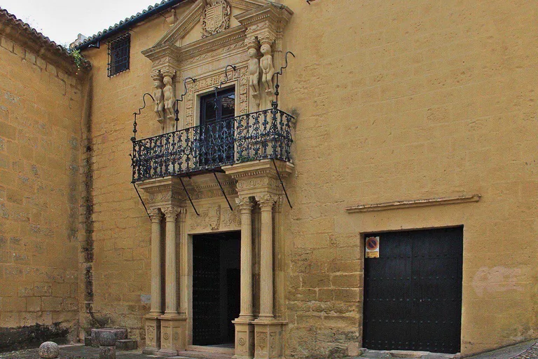
Photo: Fedoce1 (Fernando Domínguez Cerejido) · Wikimedia Commons source · CC BY-SA 4.0 · Cropped to the recorded 3:2 source rectangle and resized from the exact hash-bound source input. Palacio del Marques de Salvatierra
The Salvatierra palace concentrates its Baroque display in a doorway where four small carved figures support the pediment like atlantes. This short stop lets the route glimpse how Ronda's post-conquest elite projected status and a wider imperial horizon. The house is private and viewed only from a narrow, steep cobbled street.
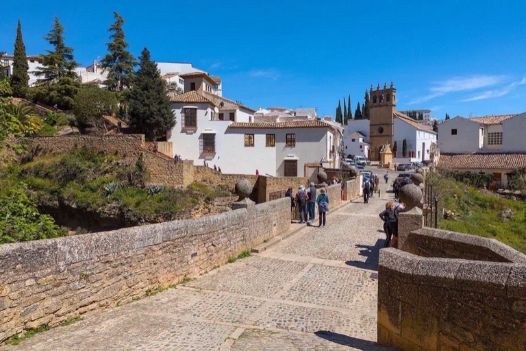
Photo: Benjamin Smith · Wikimedia Commons source · CC BY-SA 4.0 · Cropped to the recorded 3:2 source rectangle and resized from the exact hash-bound source input. Puente Viejo and the Arch of Philip V
Puente Viejo carried Ronda's main crossing before Puente Nuevo took both the traffic and the newer name; the nearby arch widened the route after the first high bridge failed. Together they make the town's changing circulation and repeated repair visible at the older river crossing. The bridge is free, but its cobbled approaches are steep and include steps.
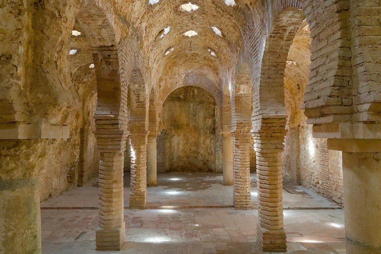
Photo: Benjamin Smith · Wikimedia Commons source · CC BY-SA 4.0 · Cropped to the recorded 3:2 source rectangle and resized from the exact hash-bound source input. Banos Arabes
Ronda's Banos Arabes are a well-preserved medieval hammam beside the former lower suburb, supplied from the nearby stream and water system. The stop shows bathing, craft work and the practical life of a district later damaged and repurposed after conquest. The archaeological interior is ticketed and uneven; the steep descent from the old town makes the outside entrance the required point.
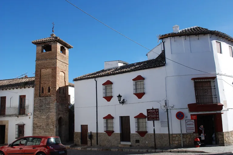
Photo: Gumerg · Wikimedia Commons source · CC BY-SA 3.0 es · Cropped to the recorded 3:2 source rectangle and resized from the exact hash-bound source input. Alminar de San Sebastian
The Alminar de San Sebastian survives from a mosque later replaced by a church that also disappeared, with a Christian bell stage added above the earlier minaret. Its stacked masonry is the route's clearest compact record of religious reuse after 1485. The tower is exterior-only on a narrow, slightly sloping street with limited pavement.
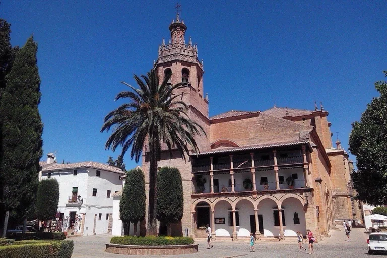
Photo: José Rojas · Wikimedia Commons source · CC BY-SA 4.0 · Cropped to the recorded 3:2 source rectangle and resized from the exact hash-bound source input. Santa Maria la Mayor
Santa Maria la Mayor was developed over Ronda's congregational mosque, retaining part of the former mihrab while later Gothic and Renaissance campaigns reshaped the church. The building lets the route examine conversion as a long physical process rather than a single date. The square outside is level and shaded; interior access is ticketed and schedule-dependent.
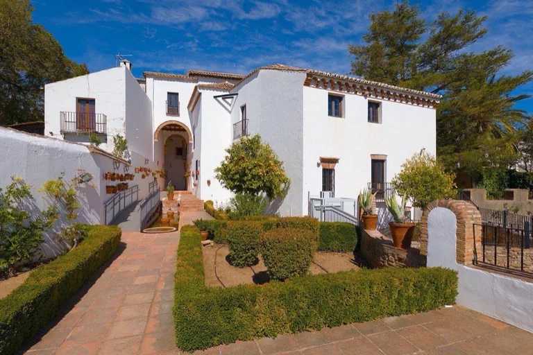
Photo: Benjamin Smith · Wikimedia Commons source · CC BY-SA 4.0 · Cropped to the recorded 3:2 source rectangle and resized from the exact hash-bound source input. Palacio de Mondragon
Palacio de Mondragon preserves the site and foundations of an Andalusi governor's residence beneath a later Mudéjar-Renaissance palace. The route includes it because political occupation changed while parts of the plan and underground fabric remained in place. The exterior square is public; the municipal museum is ticketed and the approach streets are cobbled.
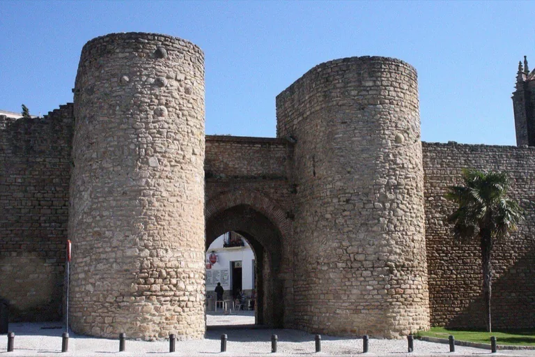
Photo: Michel wal · Wikimedia Commons source · CC BY-SA 4.0 · Cropped to the recorded 3:2 source rectangle and resized from the exact hash-bound source input. Puerta de Almocabar
Puerta de Almocabar is Ronda's southern medieval gate, arranged as successive passages between round towers and later given Renaissance additions. Its name refers to the cemetery once outside, and the route ends where Castilian forces assembled before the town's surrender. The gate and square are free and level, after a long cobbled descent from the old town.


.jpg)


.jpg)


Local context
Before you go
The published route starts at Paseo de Blas Infante, 1, 29400 Ronda, Málaga, España. It begins at Alameda del Tajo and ends at Puerta de Almocabar.
On the ground
Access and surfaces
A descent-and-climb walk, not a level stroll. From the bridge the route drops roughly 60 m down cobbled lanes and steps to the river, then climbs the same height back into the old town before an easy downhill finish to the southern gate. Every stop is written to work from a free public position; the bullring, the water mine, the baths, the church and the palace museum are ticketed and optional. The mine in particular is a long, steep, wet stair cut in rock, with no step-free alternative. Paving is cobbled and uneven throughout the old town, and the bridge deck is narrow and busy.
Frequently asked
Plan the walk
- How long is the Ronda audio walking tour?
- Allow about 150 minutes. The self-guided route covers 2.7 km (1.7 mi) in 11 stops, including walking and listening time.
- Where does the Ronda tour start and end?
- It starts at Paseo de Blas Infante, 1, 29400 Ronda, Málaga, España. The published route begins at Alameda del Tajo and ends at Puerta de Almocabar.
- Will the Ronda audio tour work offline?
- Yes, after download. Audio, stop text, images, and GPS triggering work without data; the live map background still needs a connection.