Rabat · Rabat-Salé-Kénitra, Morocco
Rabat — A Capital Made Twice
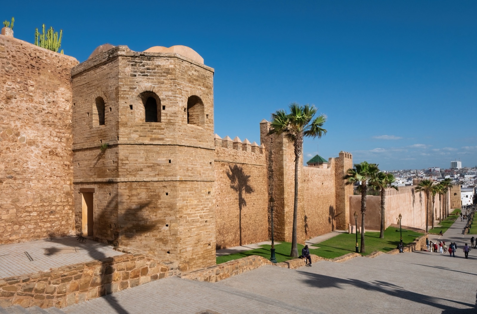
Rabat carries two capital projects in the same walk: Ya'qub al-Mansur's twelfth-century vision, left legible in walls, gates and an unfinished mosque, and the twentieth-century administrative city laid beside the medina.
Narration in English · Stop 1 is free
 Tour no. 13
- Stops
- 11
- Distance
- 5.2 km (3.2 mi)
- Time
- About 165 minutes
- Route
- Moderate walking route
Listen before you buy
Stop 1 · Rabat-Ville Station and Avenue Mohammed V
Stop 1 is free. Listen before you buy.
The walk
A self-guided audio tour of Rabat
Rabat carries two capital projects in the same walk: Ya'qub al-Mansur's twelfth-century vision, left legible in walls, gates and an unfinished mosque, and the twentieth-century administrative city laid beside the medina. Between them are craft streets, a kasbah shaped by Andalusian migration, working river boats and a modern royal memorial. The route reads authority through planning and monuments while keeping the people who used, maintained and contested those spaces in view.
Route notes
The stops
About each stop · narration stays in the app
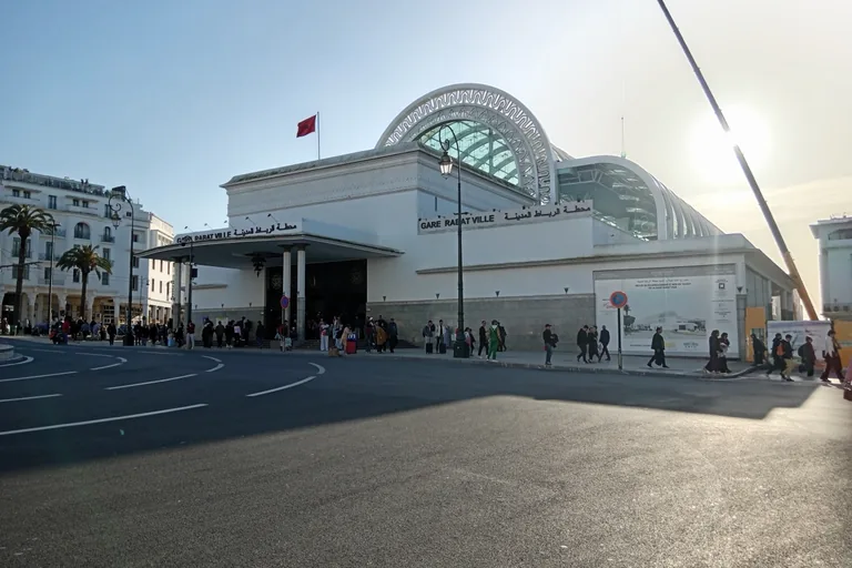
Photo: CAPTAIN RAJU · Wikimedia Commons source · CC0 · Cropped to the recorded 3:2 source rectangle and resized from the exact hash-bound source input. Rabat-Ville Station and Avenue Mohammed V
Rabat-Ville Station opens onto Avenue Mohammed V, the planted civic axis of the twentieth-century administrative capital. The route begins here to make modern planning visible at walking scale before entering the older medina. The forecourt and sidewalks are broad, but traffic crossings and construction conditions can change.
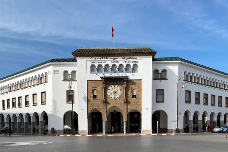
Photo: Boubloub · Wikimedia Commons source · CC BY-SA 4.0 · Cropped to the recorded 3:2 source rectangle and resized from the exact hash-bound source input. Central Post Office and Bank Al-Maghrib
The Central Post Office and Bank Al-Maghrib face one another across the avenue as early civic monuments to communications, finance and state administration. Their arcades, clock and formal placement let the route read the capital as a designed ensemble rather than isolated façades. Both are exterior stops reached on level sidewalks with busy road crossings.
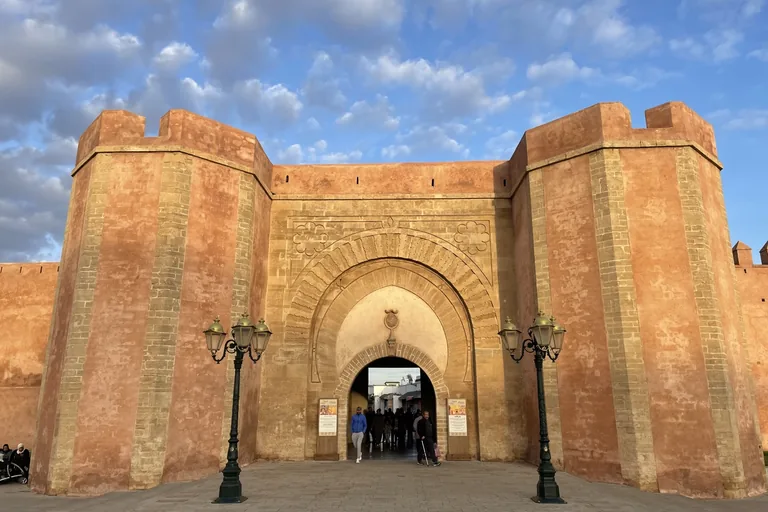
Photo: Photo2023 · Wikimedia Commons source · CC BY 4.0 · Cropped to the recorded 3:2 source rectangle and resized from the exact hash-bound source input. Bab El Had
Bab El Had is a late-twelfth-century Almohad gate whose name recalls the Sunday market once held outside it. It forms the first clear hinge between Rabat's planned modern centre and the older walled city. The public square is busy with traffic and pedestrians, and no entry through the monument is required.
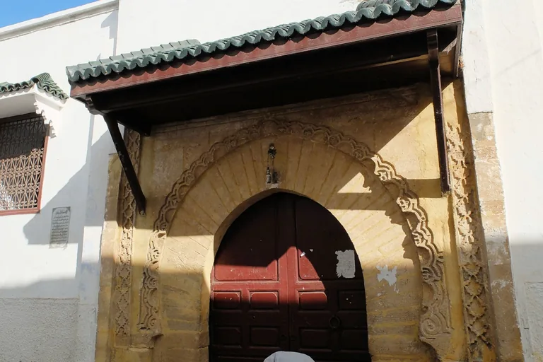
Photo: Robert Prazeres · Wikimedia Commons source · CC BY-SA 4.0 · Cropped to the recorded 3:2 source rectangle and resized from the exact hash-bound source input. Great Mosque of Rabat and Rue Souika
The Great Mosque stands at the commercial heart of the medina, beside Rue Souika, after centuries of rebuilding and expansion. The stop keeps religious practice and market life together before the route turns toward the river and kasbah. The lanes are narrow, uneven and crowded; active worship means the stop remains exterior-only.
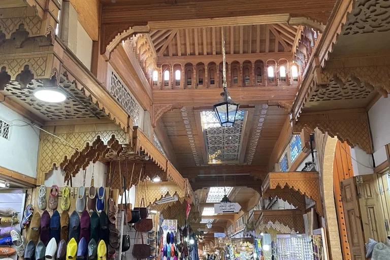
Photo: Photo2023 · Wikimedia Commons source · CC BY 4.0 · Cropped to the recorded 3:2 source rectangle and resized from the exact hash-bound source input. Rue des Consuls
Rue des Consuls housed European commercial agents serving Rabat's river trade before becoming today's craft-lined medina street. Its funduqs, shops and diplomatic history add working commerce to the city's political chronology. Expect a narrow pedestrian route with uneven paving, shop displays and changing crowd density.
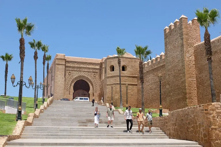
Photo: R Prazeres · Wikimedia Commons source · CC BY-SA 4.0 · Cropped to the recorded 3:2 source rectangle and resized from the exact hash-bound source input. Bab Oudaia
Bab Oudaia is the richly carved Almohad gateway into the Kasbah of the Udayas, built under Ya'qub al-Mansur around 1195. Its bent passage and decorated façades show that the threshold was designed for ceremony as well as defence. The public approach is sloping and uneven, but passing through the gate is not required for the stop.
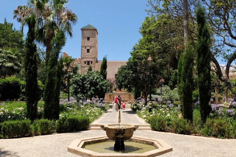
Photo: R Prazeres · Wikimedia Commons source · CC BY-SA 4.0 · Cropped to the recorded 3:2 source rectangle and resized from the exact hash-bound source input. Andalusian Garden and National Museum of Adornment
The Andalusian Garden occupies a sheltered court within the kasbah beside a palace now housing Morocco's National Museum of Adornment. The stop combines a deliberately composed garden with collections that treat jewellery and bodily ornament as cultural practice. Garden and museum hours can differ, and interior galleries may require admission; the surrounding kasbah lanes are uneven.
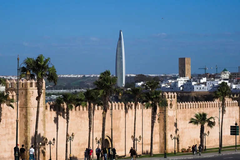
Photo: Petar Milošević · Wikimedia Commons source · CC BY-SA 4.0 · Cropped to the recorded 3:2 source rectangle and resized from the exact hash-bound source input. Kasbah of the Udayas and Semaphore Platform
The Kasbah of the Udayas is a fortified quarter overlooking the Bouregreg, layered from Almohad works through later Andalusian settlement. The semaphore platform gives the route its clearest view of the river mouth, Salé and the strategic geography behind the walls. The platform is reached through sloping cobbled lanes and is exposed to sun and wind.
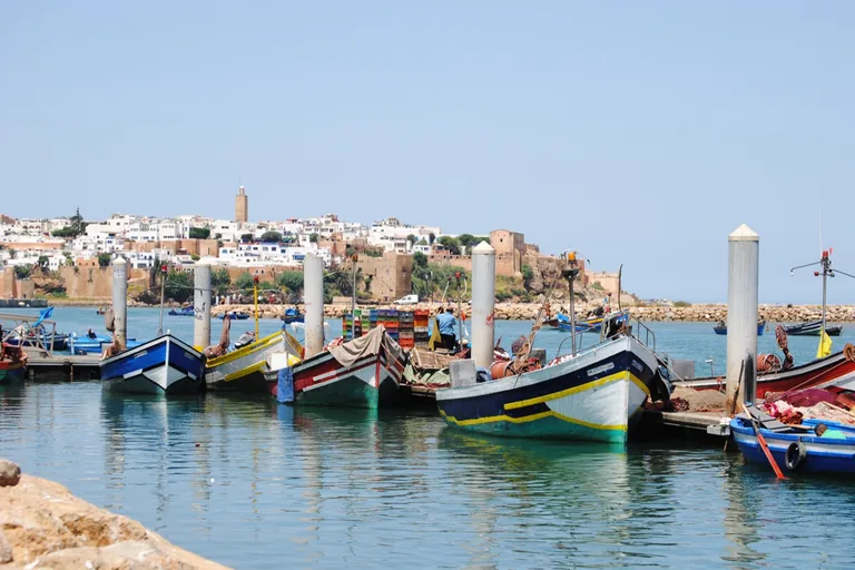
Photo: MarwanAndrew · Wikimedia Commons source · CC BY-SA 4.0 · Cropped to the recorded 3:2 source rectangle and resized from the exact hash-bound source input. Bouregreg River Landing
The Bouregreg landing is a working crossing used by boatmen, fishers, passengers and riverbank residents rather than merely a scenic edge. It shifts the route from dynastic strategy to the people whose livelihoods keep Rabat and Salé connected. No boat trip is required; ramps and boarding surfaces can be slippery or uneven.
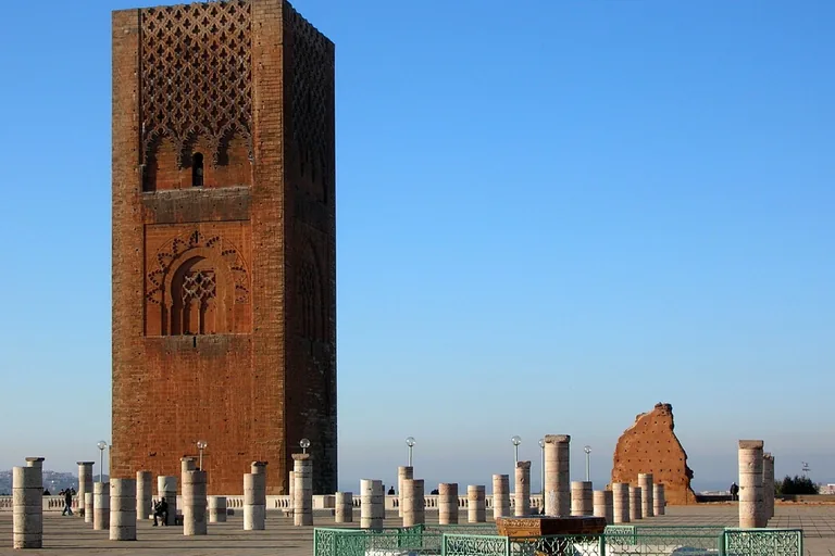
Photo: Bernard Gagnon · Wikimedia Commons source · CC BY-SA 3.0 · Cropped to the recorded 3:2 source rectangle and resized from the exact hash-bound source input. Hassan Tower and Mosque
Hassan Tower and the surviving forest of mosque columns belong to Ya'qub al-Mansur's vast, unfinished building campaign begun in 1191. The route reaches this monumental ruin to show how the medieval project of making a capital stopped with the ruler's death. The esplanade is broad and generally accessible but exposed, with little shade and varied paving.
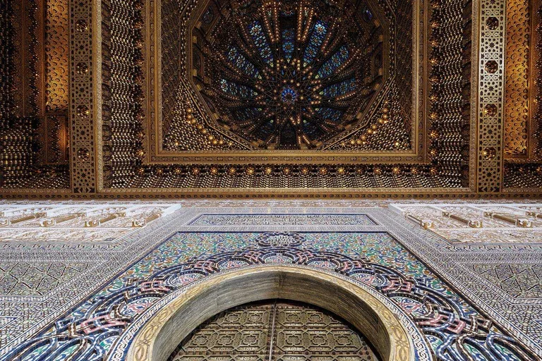
Photo: Petar Milošević · Wikimedia Commons source · CC BY-SA 4.0 · Cropped to the recorded 3:2 source rectangle and resized from the exact hash-bound source input. Mausoleum of Mohammed V
The Mausoleum of Mohammed V is a twentieth-century royal memorial completed in 1971 beside the unfinished Almohad mosque. Its modern structure and Moroccan craft programme provide the route's second, deliberately completed vision of national capital. The portico and esplanade are public, while steps, security and controlled interior access can affect a visit.


.jpg)
.jpg)

.jpg)
Local context
Before you go
The published route starts at Gare Rabat Ville, Avenue Mohammed V, 10000 Rabat, Maroc. It begins at Rabat-Ville Station and Avenue Mohammed V and ends at Mausoleum of Mohammed V.
On the ground
Access and surfaces
The modern-city section has broad sidewalks but busy road crossings. Medina and kasbah lanes are narrow, uneven, crowded and sometimes steep, with thresholds and steps around the Udayas complex. The riverfront and Hassan esplanade are more open and exposed, and the leg from the Bouregreg to Hassan Tower is long. Religious, museum and memorial access can change; every stop is written to remain complete from its public exterior stand-point, with no boat crossing required.
Frequently asked
Plan the walk
- How long is the Rabat audio walking tour?
- Allow about 165 minutes. The self-guided route covers 5.2 km (3.2 mi) in 11 stops, including walking and listening time.
- Where does the Rabat tour start and end?
- It starts at Gare Rabat Ville, Avenue Mohammed V, 10000 Rabat, Maroc. The published route begins at Rabat-Ville Station and Avenue Mohammed V and ends at Mausoleum of Mohammed V.
- Will the Rabat audio tour work offline?
- Yes, after download. Audio, stop text, images, and GPS triggering work without data; the live map background still needs a connection.