Porto · Porto, Portugal
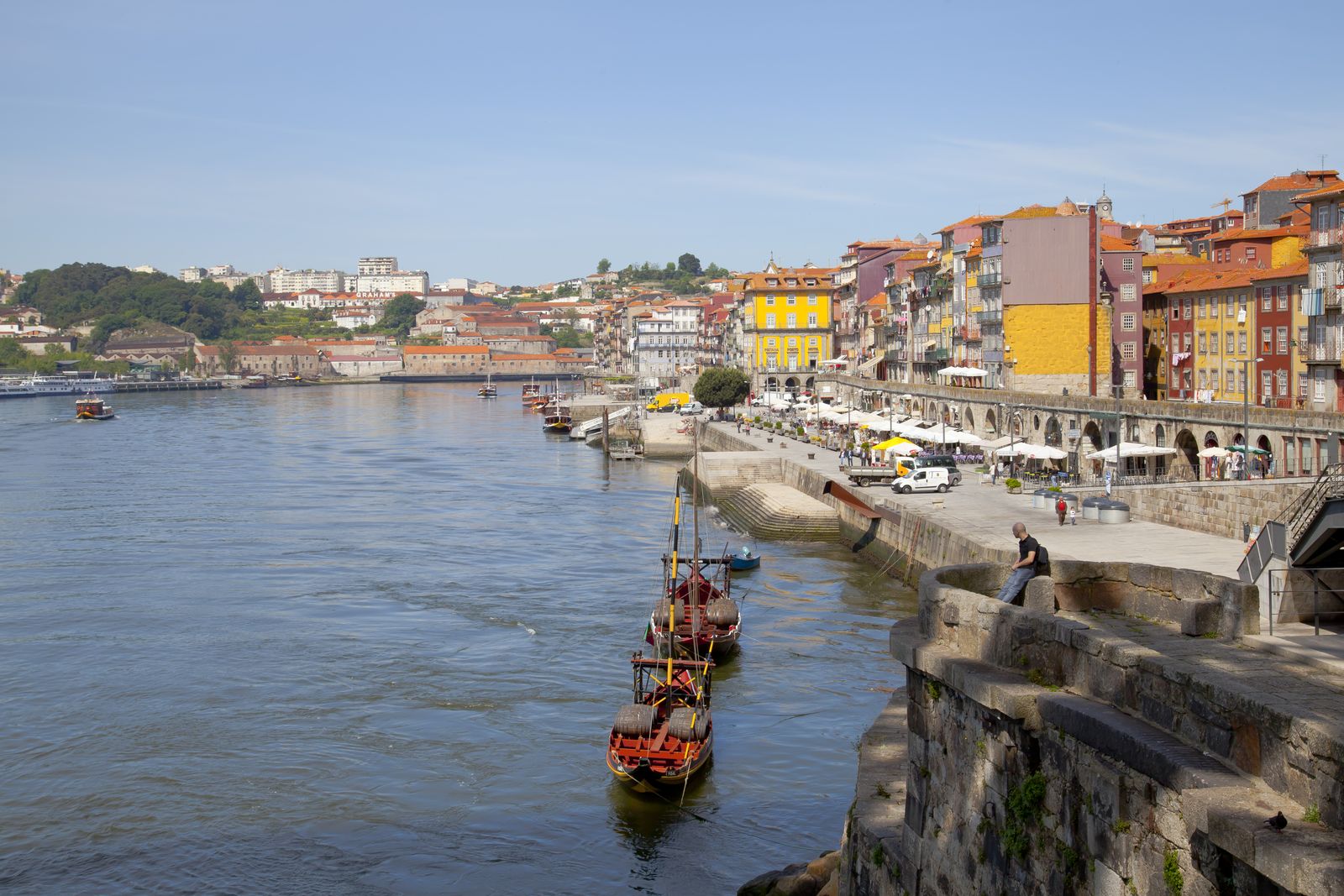
Porto — Ribeira, Down to the River
An audio walk through Porto's Ribeira, from the tiled hall of São Bento up to the bishop's cathedral, down the old wall to the Douro, and back up the goldsmiths' street.
Narration in English · Stop 1 is free
 Tour no. 31
- Stops
- 11
- Distance
- 2.2 km (1.4 mi)
- Time
- About 130 minutes
- Route
- Moderate walking route
Listen before you buy
Stop 1 · São Bento Station
Stop 1 is free. Listen before you buy.
The walk
An audio tour down to the Ribeira, at your own pace
Porto grew as two towns, the bishop's on the hill and the river's at the water, and for almost three centuries the bishop owned it. The walk starts under the twenty thousand or so painted tiles of São Bento Station, climbs to the fortress cathedral where King João the First married Philippa of Lancaster, and follows the wall King Fernando finished in the 1370s down a long stairway to the Douro, under the iron arch of the Dom Luís I Bridge.
On the quay a bronze panel marks the morning in March 1809 when a bridge of boats gave way under people fleeing a French army, and candles are still lit in front of it. Behind the quay climbs the Barredo, the crowded quarter an architect argued should be renewed with its people rather than cleared of them. Then come the square where a royal letter of 1389 ordered all fresh fish arriving in Porto to be brought first for sale, the king's customs house where Prince Henry is said to have been born, the Franciscan church gilded up to the ribs of its vault, and the merchants' palace raised on the ruins of the friars' burned convent. The walk ends on Rua das Flores, the goldsmiths' street cut through the bishop's gardens, which climbs back towards the station.
Route notes
The stops
About each stop · narration stays in the app
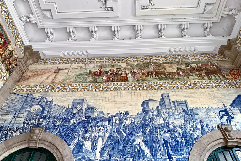
Photo: Vitor Oliveira from Torres Vedras, PORTUGAL · Wikimedia Commons source · CC BY-SA 2.0 · Cropped to the recorded 3:2 source rectangle and resized from the exact hash-bound source input. São Bento Station
São Bento Station stands on the site of a demolished Benedictine convent and opened in 1916 to a design by the Porto architect José Marques da Silva; its entrance hall is lined with around twenty thousand blue and white tiles by Jorge Colaço. It faces the square where the Porta de Carros, the old gate towards the north, once stood, a fitting start for a walk that runs down to the river and climbs back towards this point at the end. The hall is the station's public concourse, free to enter during station hours and busy with travellers, and the square outside carries heavy traffic.
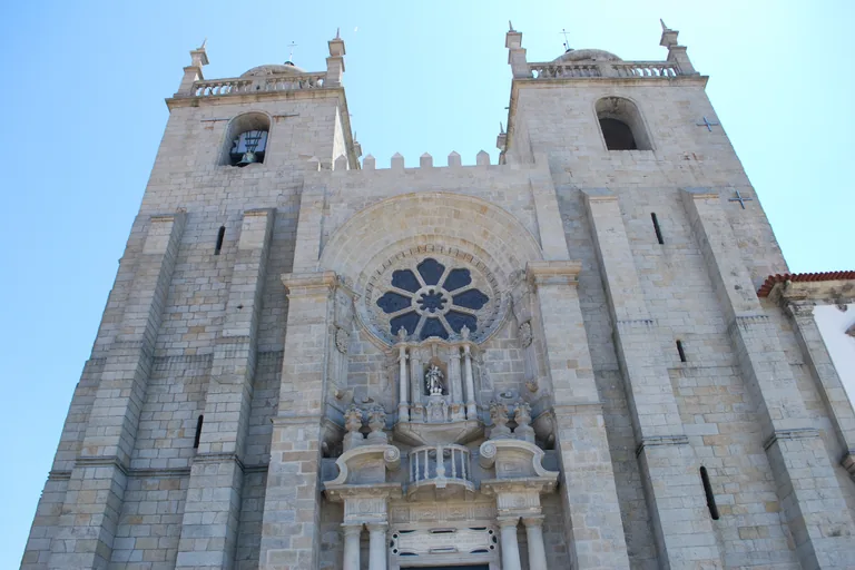
Photo: Concierge.2C · Wikimedia Commons source · CC BY-SA 3.0 · Cropped to the recorded 3:2 source rectangle and resized from the exact hash-bound source input. Porto Cathedral
Porto Cathedral is a Romanesque church begun under Bishop Hugo, with a Gothic rose window, a cloister of the late fourteenth century and a side loggia added by Nicolau Nasoni in 1736. The route climbs to it because the bishops were lords of Porto from a grant of 1120 until 1406, when an agreement with King João I passed the city to the crown, and the walk goes from their hilltop town down to the merchants' riverside. The stop is made on the open, level terrace in front; the cathedral is a working church with its own visiting hours, and the cloister is ticketed.
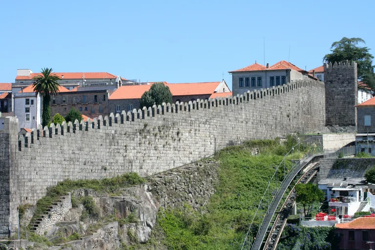
Photo: Alegna13 · Wikimedia Commons source · CC BY-SA 3.0 · Cropped to the recorded 3:2 source rectangle and resized from the exact hash-bound source input. Fernandine Walls
The Fernandine Walls were ordered by King Afonso IV in 1336 and finished in the 1370s under King Fernando, and much of the stretch seen today was restored between 1959 and 1962. The route meets them at the top of the Guindais, where the main surviving stretch, with its battlements and two square towers, runs down the escarpment and leads the walk from the old town to the river. The way down is the Escadas dos Guindais, a long, steep public stairway with no step free alternative on foot, and the Guindais funicular beside it links the top and the bottom when it is running.
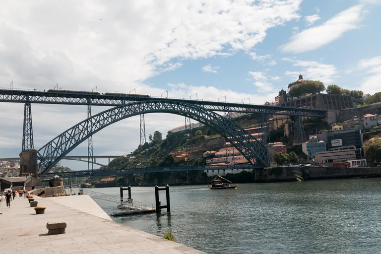
Photo: Daniel VILLAFRUELA · Wikimedia Commons source · CC BY-SA 4.0 · Cropped to the recorded 3:2 source rectangle and resized from the exact hash-bound source input. Dom Luís I Bridge
The Dom Luís I Bridge is a two deck iron arch over the Douro, built to a design by the engineer Théophile Seyrig, a former partner of Gustave Eiffel, and its upper deck opened in 1886. The walk reaches the river here, at a bridge built with two decks so that Porto's riverside and its upper town would each have a crossing to the matching level of Vila Nova de Gaia. The stop is on the pavement at the foot of the bridge beside a busy road; the lower deck can be crossed on foot along its walkways, while the upper deck, which carries the metro, is reached from the upper town.
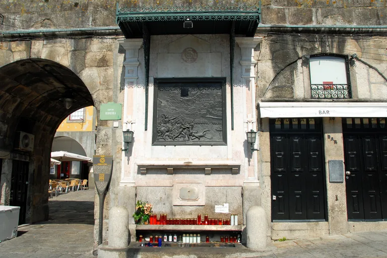
Photo: António Amen · Wikimedia Commons source · CC BY-SA 3.0 · Cropped to the recorded 3:2 source rectangle and resized from the exact hash-bound source input. Alminhas da Ponte
The Alminhas da Ponte is a shrine set into the Ribeira quay wall, with a bronze relief of 1897 by the sculptor Teixeira Lopes, the father, recalling the disaster on the bridge of boats on 29 March 1809, as French troops entered the city. The route includes it because it marks the place where the bridge of boats landed on the Porto side, and candles are still left on its ledge. It is on the level, pedestrian Cais da Ribeira and needs no entry, but the quay is crowded on summer evenings.
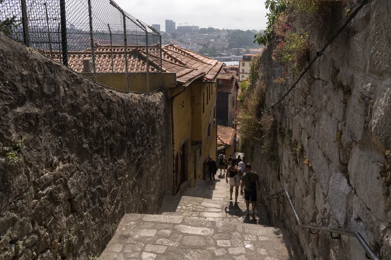
Photo: Alexkom000 · Wikimedia Commons source · CC BY 4.0 · Cropped to the recorded 3:2 source rectangle and resized from the exact hash-bound source input. Barredo
The Barredo is the residential quarter on the slope behind the Ribeira quay, reached by narrow stepped lanes such as the Escadas do Barredo, and the arches in front of it were opened in the old river wall in the first half of the nineteenth century. It is on the route as a lived in part of the historic centre that was long marked for demolition and, from the 1970s, was largely restored for the people living there rather than cleared. The stop is made from the level quay; the lanes and stairways behind are steep, narrow and residential, with no step free route, and they are people's homes rather than a sight to enter.
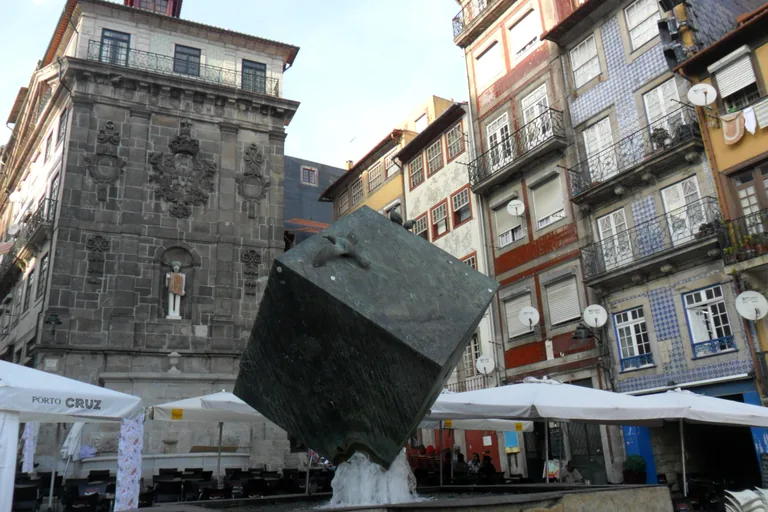
Photo: Dafema · Wikimedia Commons source · CC BY-SA 3.0 · Cropped to the recorded 3:2 source rectangle and resized from the exact hash-bound source input. Ribeira Square
Ribeira Square is the riverside square of the old port, rebuilt with arcaded houses after a fire in 1491 and opened to the Douro in 1821, when the stretch of medieval wall that closed it off was taken down. The route stops at the centre of the old river town, the square popularly called the praça do cubo after the cube by the sculptor José Rodrigues in its middle. The square is level and pedestrian, filled with café terraces, and very crowded on summer evenings and on the night of 23 June, when thousands go out for the Saint John festival.
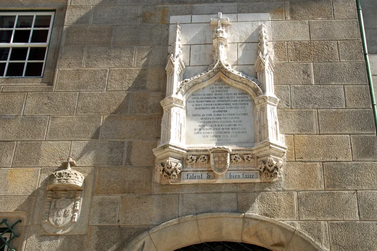
Photo: António Amen · Wikimedia Commons source · CC BY-SA 3.0 · Cropped to the recorded 3:2 source rectangle and resized from the exact hash-bound source input. Casa do Infante
The Casa do Infante was built in the fourteenth century as a royal customs house and mint, was largely rebuilt from 1677, and now houses the city's historical archive. It is on the route as the house where, by tradition, Prince Henry was born in 1394, a tradition supported by living quarters found in one of its towers; the same excavations uncovered late Roman mosaic floors. It stands on a narrow street with cars, and the museum and archive inside keep their own hours, so the stop is made outside by the entrance.
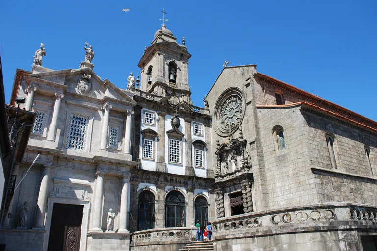
Photo: Concierge.2C · Wikimedia Commons source · CC BY-SA 3.0 · Cropped to the recorded 3:2 source rectangle and resized from the exact hash-bound source input. Church of São Francisco
The Church of São Francisco is a Gothic Franciscan church begun in 1383, with a rose window on its front and walls and vaults inside covered in gilded carved wood of the seventeenth and eighteenth centuries. The route includes it as one of the outstanding examples of gilded carving in Portugal, now shown as a museum together with the catacombs of the Third Order next door. The church is a ticketed museum with its own hours, entered through the Third Order's house beside it, and steps lead up to the terrace in front.
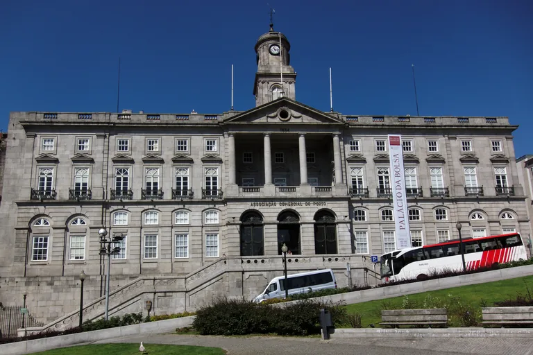
Photo: Barcex · Wikimedia Commons source · CC BY-SA 3.0 · Cropped to the recorded 3:2 source rectangle and resized from the exact hash-bound source input. Palácio da Bolsa
The Palácio da Bolsa is the palace of Porto's Commercial Association, designed in a Neopalladian manner, begun in 1842 on the ruins of the São Francisco convent and built over almost seventy years. The route includes it as a palace built by merchants rather than kings, with rooms such as the Arab Room, inspired by the Alhambra, and an Association board that still meets there every month. The palace can be visited only on a guided tour with its own times and tickets, so the stop is made from the garden across the road, with traffic between the two.
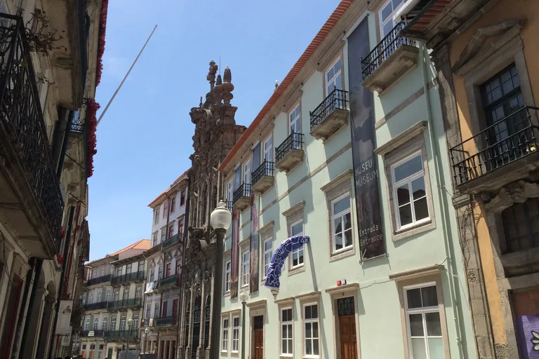
Photo: Gonzius de madrid · Wikimedia Commons source · CC BY-SA 4.0 · Cropped to the recorded 3:2 source rectangle and resized from the exact hash-bound source input. Rua das Flores
Rua das Flores was opened from 1521 through the bishop's gardens as a straight street, the first in the city built to rules that aligned the house fronts on both sides, and it was long known for its goldsmiths. The walk ends on it because it climbs from the river town back to the square in front of São Bento Station, where the Porta de Carros once stood, past the theatrical Baroque front of the Misericórdia church, dated 1750. It is a pedestrian street with granite paving that climbs gently towards the station; café terraces take part of its width, and the Misericórdia museum has its own hours and tickets.


.jpg)
.jpg)


.jpg)


Local context
Before you go
This is a line, not a loop. It starts in the tiled hall of São Bento Station on Praça de Almeida Garrett and ends on Rua das Flores, the street that runs back up to the station. From the cathedral on its hill the route drops to the river on the Escadas dos Guindais, a long and steep public stairway beside the old wall with no step free route; the Guindais funicular runs alongside the stairs when it is running. The quay and the Ribeira square are level, and the way back up to Rua das Flores is on steep streets, over granite cobbles that are slippery when wet.
On the ground
Access and surfaces
A line, not a loop, from the station down to the river and back up towards it. The cathedral sits on a hill; from there the route drops to the Douro on the Escadas dos Guindais, a long and steep public stairway beside the old wall, with no step free route on that stretch. The Guindais funicular runs alongside the stairs and, when it is running, is the alternative for anyone who cannot manage them. The quay and the Ribeira square are level; the climb back up to Rua das Flores is on steep streets. Paving is granite cobble and slippery when wet; the quay is crowded on summer evenings, and heavy traffic runs along the road at the foot of the bridge. Every stop works from the street and the audio is written that way. The cathedral, the Church of São Francisco, the Palácio da Bolsa and the Casa do Infante have their own opening hours and tickets; the Bolsa can only be visited on a guided tour. Working churches on the route expect quiet and covered shoulders.
Frequently asked
Plan the walk
- How long is the Porto Ribeira audio walking tour?
- Allow about 130 minutes. The route covers 2.2 km (1.4 mi) in 11 stops, including walking and listening time.
- Where does the Ribeira tour start and end?
- It starts in the tiled hall of São Bento Station on Praça de Almeida Garrett and ends on Rua das Flores, the street that leads back up to the station.
- Is there a way around the Guindais stairs?
- The stretch from the old wall down to the river is a long, steep public stairway with no step free route. The Guindais funicular runs alongside the stairs and, when it is running, is the alternative.
- Do I need to go inside the cathedral, São Francisco or the Palácio da Bolsa?
- No. Every stop works from the street. The cathedral, the Church of São Francisco, the Palácio da Bolsa and the Casa do Infante have their own opening hours and tickets, and the Bolsa can only be visited on a guided tour.
- Will the Porto audio tour work offline?
- Yes, after download. Audio, stop text, images, and GPS triggering work without data; the live map background still needs a connection.