Paphos · Paphos District, Cyprus
Paphos — The Town on the Bluff
An audio walk through the upper town of Paphos, from the market and a mosque that was once a church to the bishops' cathedral and the edge of the bluff.
Narration in English · Stop 1 is free
 Tour no. 49
- Stops
- 10
- Distance
- 2.8 km (1.7 mi)
- Time
- About 95 minutes
- Route
- Moderate walking route
Listen before you buy
Stop 1 · The Municipal Market
Stop 1 is free. Listen before you buy.
The walk
An audio walking tour of Paphos through Ktima, the upper town on its limestone bluff, from the Municipal Market past the mosque, the bath and the cathedral to the edge of the bluff and the square of the Town Hall, at your own pace
Paphos is two towns. Down by the sea lie the harbour and the ruins of Nea Paphos, the island's capital in Ptolemaic and Roman times; up on a limestone ridge back from the shore stands Ktima, the upper town, where in 1806 a traveller found the seat of the Ottoman governor and of the Greek bishop. This walk keeps to Ktima, a town that Greek Cypriots and Turkish Cypriots shared. It begins at the Municipal Market, where villagers bring in what they grow, and goes on to the Agia Sofia mosque in Mouttalos, a domed church estimated to date from the fifteenth century that became a mosque under Ottoman rule, then down to the Ottoman bath in its hollow and up to the Greek parish church of Agios Kendeas.
From there the route passes the Markideion theatre, named for Sotirakis Markides, whose satirical revue of 1918 raised money for the town's secondary school, and the Attikon, a cinema whose Greek and Turkish films drew audiences from both communities; the old police headquarters on Kennedy Square, which is becoming a museum of the history of Paphos; and Agios Theodoros, the cathedral of the Metropolis of Paphos, whose bishop Chrysanthos was beheaded in Nicosia on 9 July 1821. The walk then goes out to the edge of the bluff above the lower town, stops at the Ethnographic Museum, a collector's house full of village life, and ends in 28 October Square, between the Town Hall and the library the mayor Christodoulos Galatopoulos founded in 1946.
Route notes
Route and itinerary
About each stop · narration stays in the app
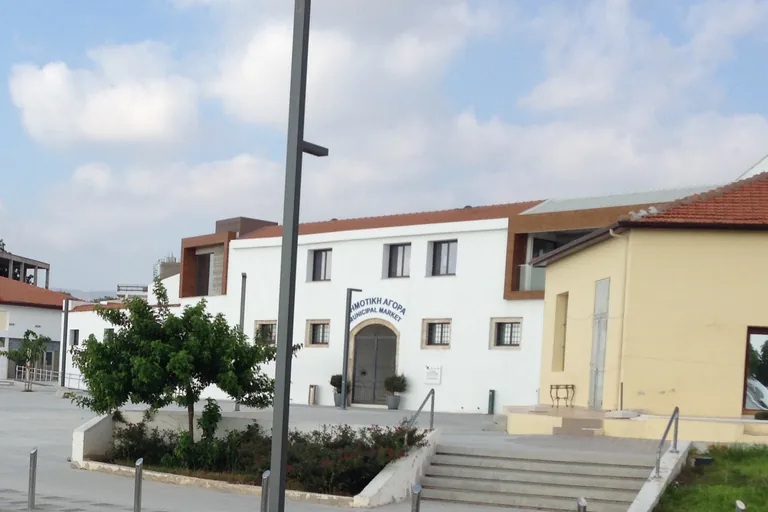
Photo: CAPTAIN RAJU · Wikimedia Commons source · CC BY-SA 4.0 · Cropped to the recorded 3:2 source rectangle and resized from the exact hash-bound source input. The Municipal Market
The Municipal Market of Paphos is the white market hall on the western edge of Ktima, the upper town, with produce and fish stalls set out around it. The route starts here because the municipality's renewal plans for the market, part funded by the EU Regional Development Fund, add to the new covered market a wide pedestrian path with benches, green areas and a viewing platform on the western brow of the ground, and a restaurant in the offices upstairs, reached by a new staircase and a lift. The sellers arrive early in the day and the market's hours change, so check locally; the walk begins on the paved square outside, beside the Market bus station.
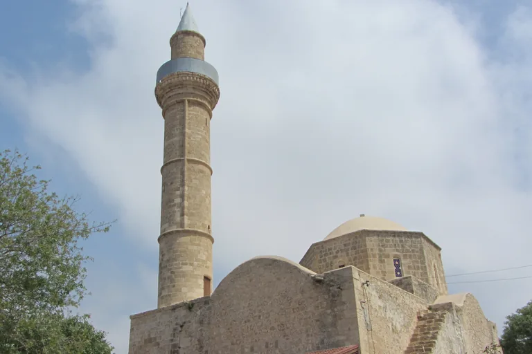
Photo: Stefan Bellini · Wikimedia Commons source · CC0 1.0 · Cropped to the recorded 3:2 source rectangle and resized from the exact hash-bound source input. Agia Sofia Mosque and Mouttalos
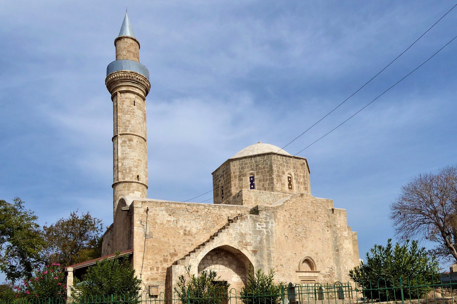
The Agia Sofia mosque, called Cami Kebir in Turkish, stands inside a railed enclosure in Mouttalos, on the north side of the upper town of Paphos. The route stops here for the building's long care: the heritage committee that looks after it describes a domed church on the cross in square plan, repaired after the earthquake of 1953 and conserved again from 2009 to 2012, and at the southern limits of the quarter the municipality has laid a path along the rock, with green walls and community plots, as what it calls a place of reconciliation. The walk stays outside the mosque and its railing, and the lanes of the quarter are narrow, with some traffic.
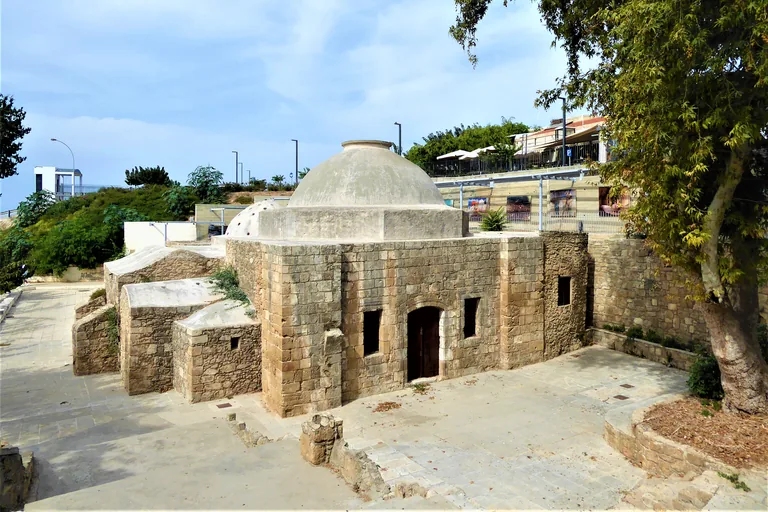
Photo: Chris06 · Wikimedia Commons source · CC BY-SA 4.0 · Cropped to the recorded 3:2 source rectangle and resized from the exact hash-bound source input. The Ottoman Baths
The Ottoman Baths are the hamam of the upper town of Paphos, near the old marketplace. The route stops here for what the sources add to its story: the tourism ministry says the building is believed to be of medieval heritage despite its typical Ottoman design and that its restoration was completed in 2015, and the archaeologist Anna Marangou said in 2003 that a fountain once stood at the centre of the building and that historians have used hamams to trace where Turkish communities lived on the island. The walk looks down on the bath from the street and stays outside; opening times and entrance fees change without notice, so check locally.
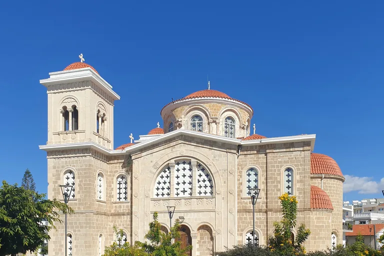
Photo: Chris06 · Wikimedia Commons source · CC BY-SA 4.0 · Cropped to the recorded 3:2 source rectangle and resized from the exact hash-bound source input. Agios Kendeas
Agios Kendeas is a domed church in the old town of Paphos, dedicated to a saint the Cypriot Church honours locally. The route stops here for its saint: the Handbook of Cyprus of 1907 named Kendeas among the local saints the Orthodox Church honours in particular villages, whose Lives, its authors thought, keep a tradition reaching far back, and the regional tourist board lists the church among the religious and historic monuments of the old town. The walk stays outside the church; if you go in, go outside the times of service, keep your voice down and cover your shoulders.
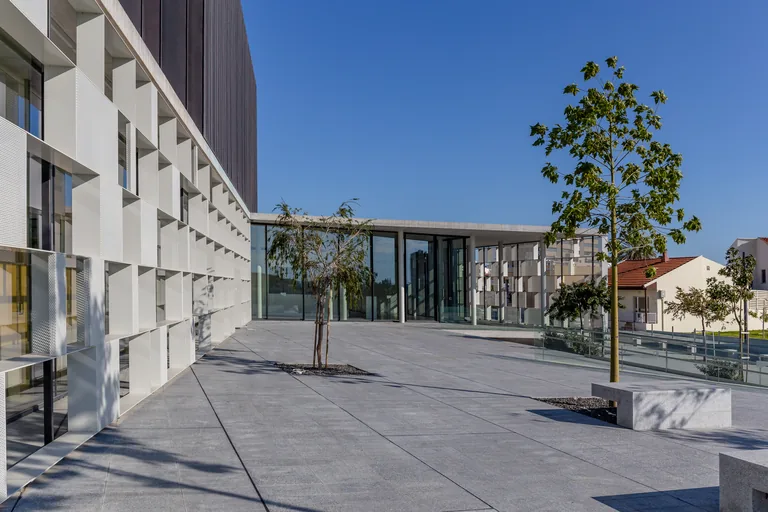
Photo: Michal Klajban · Wikimedia Commons source · CC BY-SA 4.0 · Cropped to the recorded 3:2 source rectangle and resized from the exact hash-bound source input. The Markideion and the Attikon
The Markideion Municipal Theatre is the town theatre of Paphos, named for Sotirakis Markides and built on the ruins of the old Markideion theatre, which was demolished for the project. The route stops here for the town's stage and screen: the letters Markides wrote from the Balkan wars and his articles in the Cypriot press have been gathered and published by the Paphian philologist George Hadjicosti, and down the road the Attikon cinema now serves as a hall for culture and conferences with an open air summer cinema beside it, near the old power station, where some of the old machinery is kept on show. The walk stays outside the theatre, the cinema and the power station, whose programmes change, so check locally; the terrace in front of the theatre is paved and level.
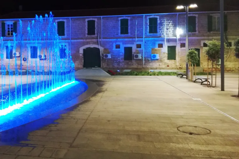
Photo: Viaggiamocela · Wikimedia Commons source · CC BY-SA 4.0 · Cropped to the recorded 3:2 source rectangle and resized from the exact hash-bound source input. Kennedy Square and the Old Police Station
Kennedy Square is a central square of the upper town of Paphos, with the town's former police headquarters on one side. The route stops here for a building in change: the former headquarters is being turned into the Paphos Historical Documentation Centre, with exhibits planned to cover the city's history from ancient times to now, and the square and the streets of the traditional shopping centre around it were redeveloped together, with new paving, lighting and planting. The centre is not yet open and works may fence parts of the building, so the stop works from the square; take care where the square meets the traffic at its edges.
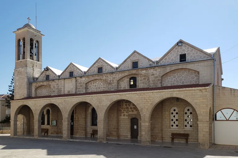
Photo: Chris06 · Wikimedia Commons source · CC BY-SA 4.0 · Cropped to the recorded 3:2 source rectangle and resized from the exact hash-bound source input. Agios Theodoros and the Bishops
Agios Theodoros is the cathedral of the Metropolis of Paphos, in the upper town beside the residence of its bishops. The route stops here for the see and its saints: the Metropolis of Paphos has its seat in the town, and one of its two patron saints, Saint Neophytos, founded in the twelfth century the monastery near Paphos that bears his name, whose rock cut cell and chapel the Handbook of Cyprus of 1907 placed near Tsada, about six miles from Ktema. The walk stays outside the cathedral; if you go in, go outside the times of service and cover your shoulders, and the forecourt is paved and level.
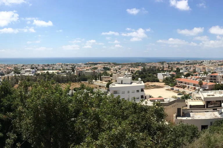
Photo: greglaskiewicz · Wikimedia Commons source · CC BY 3.0 · Cropped to the recorded 3:2 source rectangle and resized from the exact hash-bound source input. The Edge of the Bluff
The Edge of the Bluff is a cliff top on the western side of the upper town of Paphos, at a public car park where the ridge drops toward the lower town and the sea. The route stops here for the ancient city toward the sea: Nea Paphos was laid out on a rectangular street grid in the Hellenistic manner, with its agora below the acropolis, Polish and Cypriot archaeologists have excavated it since 1965 and uncovered villas with colonnades and floor mosaics, and with the Tombs of the Kings and Old Paphos at Kouklia it makes up the Paphos World Heritage Site. Keep to the level ground of the car park and away from the edge of the cliff, watch for cars and keep children close.
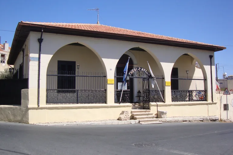
Photo: Роман Курносенко · Wikimedia Commons source · CC BY-SA 3.0 · Cropped to the recorded 3:2 source rectangle and resized from the exact hash-bound source input. The Ethnographic Museum
The Ethnographic Museum is a private museum of Cypriot folk life in the family house of its founder on Exo Vrisis, in the upper town of Paphos. The route stops here for its collector, George Eliades, who studied Greek literature and archaeology at the University of Athens, studied further in England, Scotland, Ireland and France on scholarships and was honorary curator of the district's archaeological museum, and for rooms the museum keeps as they were, a country kitchen, a bedroom and a barber's shop. Visits are ticketed and the museum's hours change, so check locally; the stop works from the street, where cars pass close to the front.
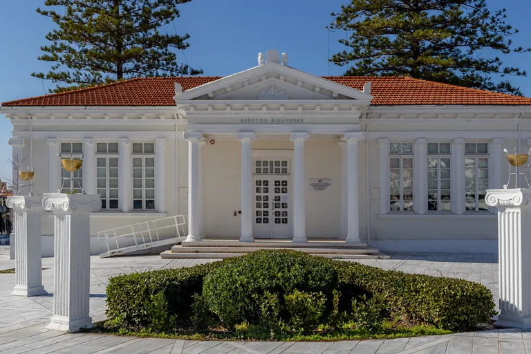
Photo: Michal Klajban · Wikimedia Commons source · CC BY-SA 4.0 · Cropped to the recorded 3:2 source rectangle and resized from the exact hash-bound source input. 28 October Square
28 October Square is the civic centre of Paphos, between the Municipal Library and the Town Hall, beside the public garden. The route ends here for the town's civic life: the municipality has joined the area between the 28 October and Kostis Palamas squares into one pedestrian space around the public garden, and the library, renovated and reopened after years of decline, holds about 26,000 volumes, among them rare editions and historical documents, with books given by writers such as the poet Odysseas Elytis. The library and the Town Hall keep their own hours, so check locally; Karavella, the main bus station, is a short walk north.


Local context
Before you go
The walk is a line of about 2.8 km on foot through the upper town of Paphos, from the Municipal Market, beside the Market bus station and about five minutes on foot from Karavella, the main bus station for intercity and many local buses, through Mouttalos and past the cathedral to 28 October Square, about seven minutes on foot south of Karavella. Driving into the old town is not recommended; there are public car parks near the market and near Kennedy Square.
On the ground
Access and surfaces
A line of about 2.8 km on foot through the upper town; allow an hour and a half or a little more with the audio. Ktima sits on a limestone ridge, so expect short climbs up from the bath, which lies low, and between the theatre, Agios Kendeas and the cathedral, plus a short walk out and back to the edge of the bluff. The old streets are narrow, some with uneven paving and narrow or missing pavements, and some carry traffic, so take care at crossings. At the edge of the bluff the stop is a car park on the cliff top above a drop: stay on the level ground, away from the edge, watch for cars and keep children close. The squares have little shade at midday and summers are hot, so bring water and a hat. The walk keeps to the streets outside the mosque and the churches; if you go into one, go outside the times of prayer or service, keep your voice down, cover your shoulders and do not photograph people at prayer. The Ethnographic Museum is visited with a ticket and its hours change, so check locally, and building works may fence parts of the old town.
Frequently asked
Plan the walk
- How long is the Paphos audio walking tour?
- Allow about 95 minutes. The route covers 2.8 km (1.7 mi) in 10 stops, including walking and listening time, with a few short climbs on the limestone ridge of the upper town.
- Where does the Paphos tour start and end?
- It starts at the Municipal Market, beside the Market bus station and about five minutes on foot from Karavella, the main bus station, and ends in 28 October Square by the Town Hall, about seven minutes on foot south of Karavella.
- Can I go inside the mosque, the churches and the museum?
- The walk stays outside, and each stop works from the street or square. If you go into the mosque or a church, go outside the times of prayer or service and cover your shoulders; the Ethnographic Museum is visited with a ticket and its hours change, so check locally.
- What should I bring for the walk?
- Water and a hat: the squares have little shade at midday and summers are hot. Wear shoes with a good grip for the uneven paving of the old streets, and at the cliff top car park keep well back from the edge.