Óbidos · Oeste, Portugal
Óbidos — The Queens' Town
An audio walk through Óbidos, from a queen's aqueduct through the town gate and up the main street to the castle, ending at a painter's grave.
Narration in English · Stop 1 is free
 Tour no. 35
- Stops
- 10
- Distance
- 1.4 km (0.9 mi)
- Time
- About 80 minutes
- Route
- Moderate walking route
Listen before you buy
Stop 1 · Óbidos Aqueduct
Stop 1 is free. Listen before you buy.
The walk
An audio tour through the walled town Portugal's queens held, at your own pace
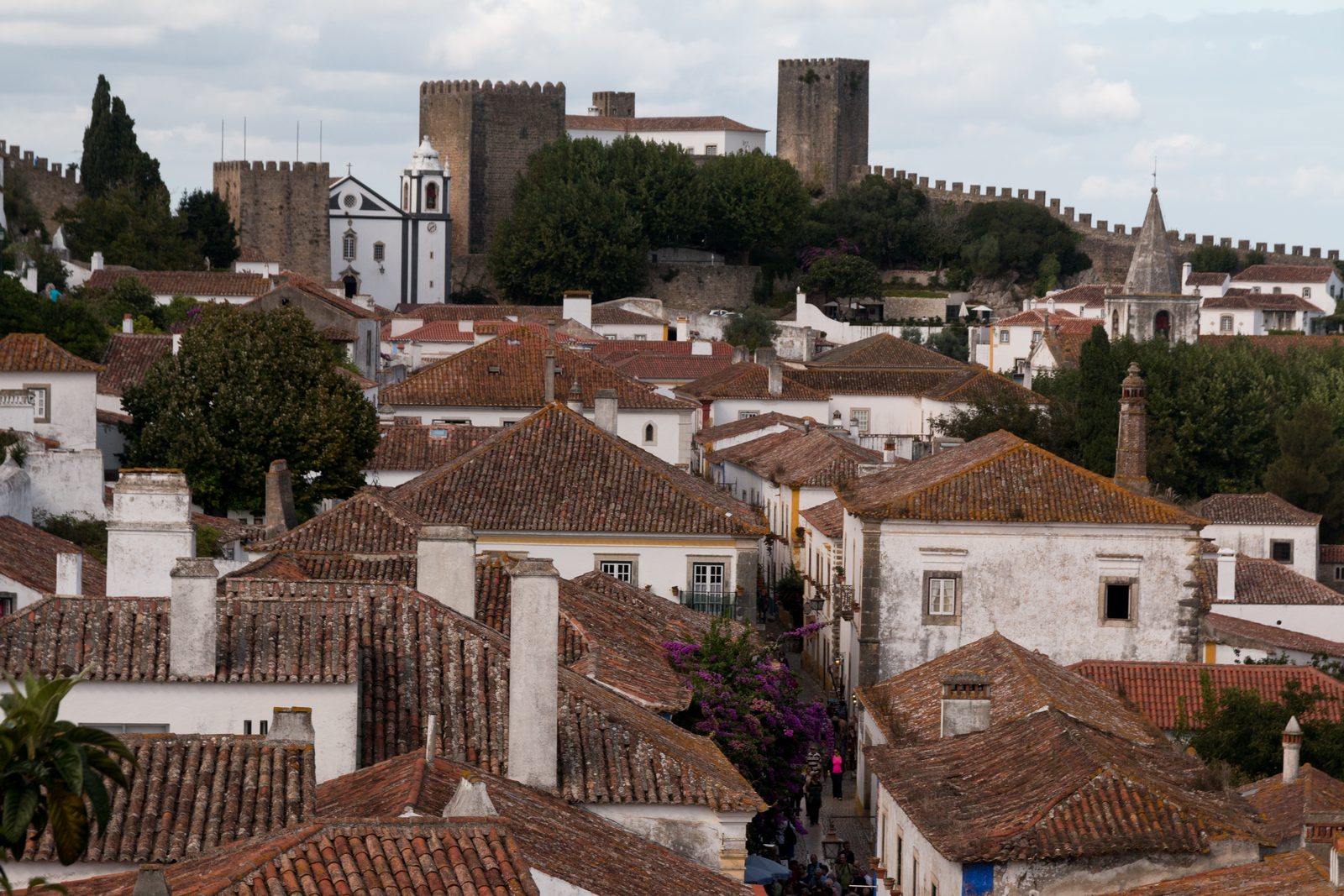
Óbidos was a wedding present. In 1281 King Dinis granted the town to his bride, Isabel of Aragon, in the settlement for their marriage, and from then until the queens' household was abolished in the nineteenth century it belonged, nearly all the time, to Portugal's queens. The walk starts below the walls at the arches of the aqueduct begun in 1573 and paid for by Queen Catarina, who received the low meadow below the town in return, and passes the white church that began as a chapel and a house for lepers, founded by tradition by Queen Isabel. It enters through the Porta da Vila, a gate built like an elbow in the time of King Fernando, with a tiled oratory inside its passage, and climbs the Rua Direita, the main street, where in the fourteenth century the town's richer Jewish families chose to live and where stalls now sell ginja, the cherry liqueur.
Halfway up, the Praça de Santa Maria keeps the pillory carved with the fishing net that was Queen Leonor's emblem, and the main church across the square saw the betrothal of two nine year old cousins, the young King Afonso V and Isabel, in 1441; inside, five canvases painted in 1661 by Josefa de Óbidos still hang at the altar they were made for. A lane drops to the older eastern gate, where the road runs straight through a chapel rebuilt in 1727, and another climbs to the church of Santiago, rebuilt after the earthquake of 1755 and now a bookshop, part of the town's literary project; in 2015 UNESCO named Óbidos a City of Literature. Beyond it rises the castle, long the seat of the town's governors, whose palace the state rebuilt as a hotel around 1950. The walk ends at the church of São Pedro, where Josefa, who in 1659 obtained her family's permission to live independently, is buried in a spot nobody can now identify.
Route notes
The stops
About each stop · narration stays in the app
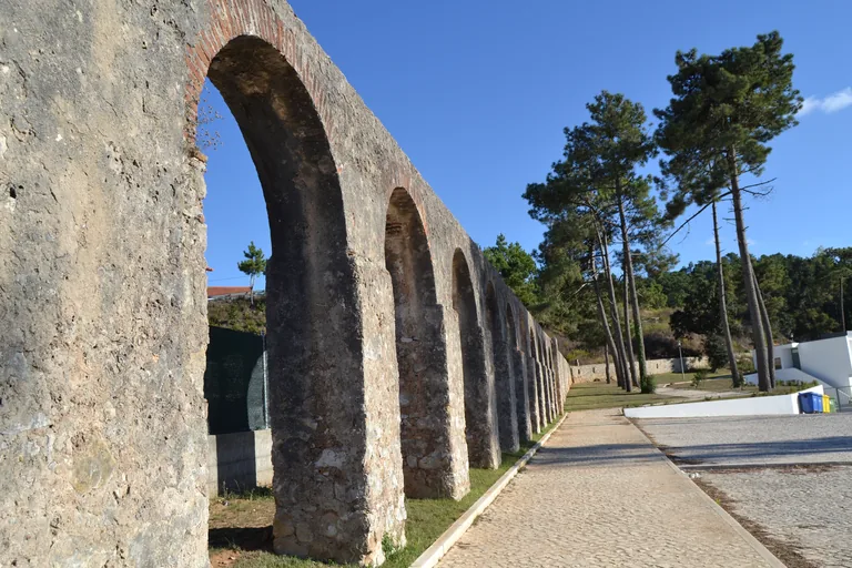
Photo: Anitsircana · Wikimedia Commons source · CC BY-SA 3.0 · Cropped to the recorded 3:2 source rectangle and resized from the exact hash-bound source input. Óbidos Aqueduct
The Óbidos Aqueduct was begun in 1573 on the order of Queen Catarina, wife of King João III, to bring water from Usseira, a village outside the town, to two fountains: one beside the town gate, destroyed in the twentieth century, and one in the Praça de Santa Maria. It opens the route because Catarina met the whole cost herself and took the low lying meadow land of the várzea in exchange, land which became known as the Várzea da Rainha, in a town that from the late thirteenth century belonged for most of the time to Portugal's queens. The stop is made from the car park on the west side of the arches; from here the route climbs into the walled town on a loop of about a kilometre and a half that ends a few minutes' walk from where it began.
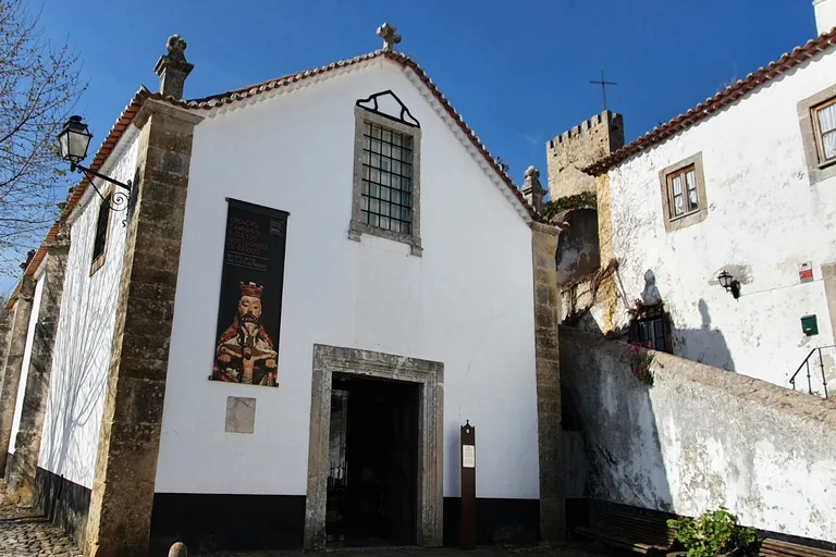
Photo: GualdimG · Wikimedia Commons source · CC BY-SA 4.0 · Cropped to the recorded 3:2 source rectangle and resized from the exact hash-bound source input. Church of São João Baptista
Tradition says this small church grew out of a chapel of Saint Vincent attached to a house for lepers, founded by Isabel of Aragon, queen of King Dinis, on ground then well away from the town. It is the last stop before the gate, and worth a look for how often its use has changed: the parish of São João Baptista moved its seat here from a church outside the walls in the mid seventeenth century, and since 2003 the building has served as the parish museum. It stands on a small cobbled square beside the road up to the town gate, and the parish museum inside has its own opening hours.
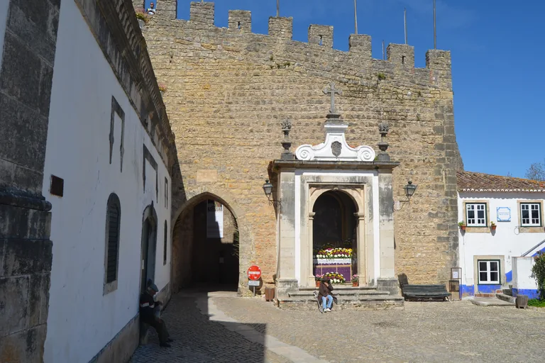
Photo: Pedro from Maia (Porto), Portugal · Wikimedia Commons source · CC BY 2.0 · Cropped to the recorded 3:2 source rectangle and resized from the exact hash-bound source input. Porta da Vila
The Porta da Vila is the town's main way in, a fourteenth century gate from King Fernando's reign whose double passage turns a sharp corner inside the walls, a layout meant to slow down and expose attackers. Before going through, look up: the panel above the entrance was put there by King João IV in thanks for Our Lady's protection at the Restoration of 1640, and inside, the chapel of Nossa Senhora da Piedade has a baroque balcony and eighteenth century blue and white tiles of Passion scenes. The passage is narrow, bent and busy, shared with occasional cars, and although stairs to the wall walk start near the gate, the top of the walls has no railing on its inner side, so the route keeps to the street.
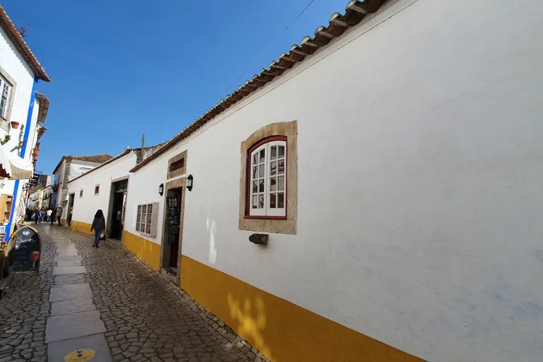
Photo: GualdimG · Wikimedia Commons source · CC BY-SA 4.0 · Cropped to the recorded 3:2 source rectangle and resized from the exact hash-bound source input. Rua Direita
The Rua Direita is the main street of the walled town, opened in the reign of King Dinis, already known by its name in the fourteenth century, and running from the Porta da Vila up to the governors' palace at the castle. The route walks up it because this was the street of the notaries, the merchants, the craftsmen the town most needed and an inn for travellers, and in the fourteenth century the richer Jewish families of Óbidos chose to live on it beside their Christian neighbours. It is a narrow cobbled street, crowded in season, rising gently from the gate, and its smooth stones are slippery when wet; the stalls along it sell ginja, the local sour cherry liqueur.
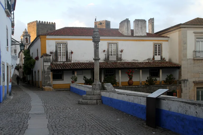
Photo: Gerd Eichmann · Wikimedia Commons source · CC BY-SA 4.0 · Cropped to the recorded 3:2 source rectangle and resized from the exact hash-bound source input. Praça de Santa Maria and the Pillory
The Praça de Santa Maria is the town's square, laid out beside the main street as a continuation of the forecourt of the church of Santa Maria, with a stone pillory at its head that carries the royal arms and the camaroeiro, the fishing net that was the emblem of Queen Leonor. The route stops here because from the late fourteenth century the square was where the townspeople gathered for assemblies, royal entries, processions and trade, with a covered market shed in the fifteenth century, and the fountain below the pillory was fed by Queen Catarina's aqueduct from the first stop. It is a small sloping cobbled square open off the main street, and the town museum on the square has its own opening hours.
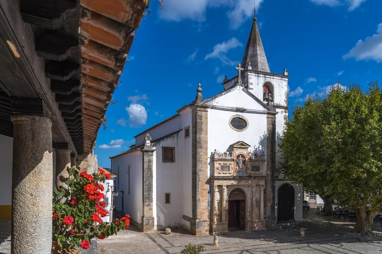
Photo: Alexkom000 · Wikimedia Commons source · CC BY 4.0 · Cropped to the recorded 3:2 source rectangle and resized from the exact hash-bound source input. Church of Santa Maria
The Church of Santa Maria is the main parish church of Óbidos; around 1570 it threatened to fall, and on 15 August 1571 the first stone of a complete rebuilding was laid, with the works continuing under the protection of Queen Catarina. The route stops here for the altarpiece of Saint Catherine of Alexandria, five canvases painted around 1661 by Josefa de Óbidos, whose grave is at the last stop, and for the tiles and painted ceiling of a baroque redecoration about a century after the rebuilding. The church faces the square, so the stop works from outside, and the interior keeps its own opening hours.
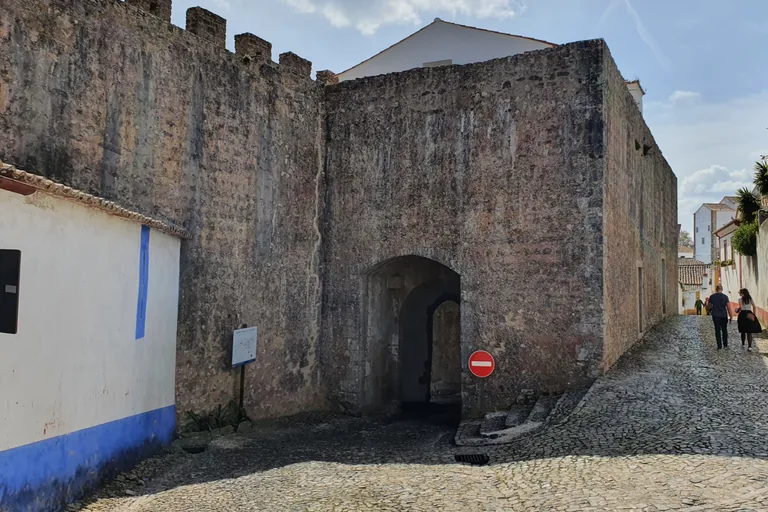
Photo: GualdimG · Wikimedia Commons source · CC BY-SA 4.0 · Cropped to the recorded 3:2 source rectangle and resized from the exact hash-bound source input. Porta da Senhora da Graça
The Porta da Senhora da Graça is the gate on the eastern side of the walls, the main way into the town until, from the late fourteenth century, the Rua Direita and King Fernando's longer walls moved the main entrance to the Porta da Vila. The route comes down to it for the chapel inside the gate: tradition links it to an image given in thanks after a siege of the 1240s, when Sancho II was fighting the brother who became King Afonso III, and in 1727 Bernardo de Palma, a magistrate in India, rebuilt it to keep a promise made by his daughter, who had died of thwarted love for a young man of Óbidos. The street runs straight through the chapel, whose nave is simply the passage of the road, and the lane through the gate is narrow and partly stepped, with occasional cars.
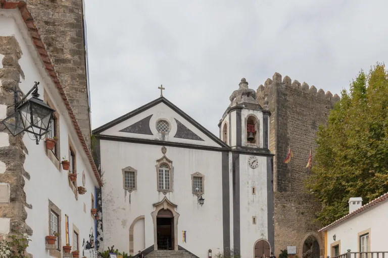
Photo: Diego Delso · Wikimedia Commons source · CC BY-SA 4.0 · Cropped to the recorded 3:2 source rectangle and resized from the exact hash-bound source input. Livraria de Santiago
The Livraria de Santiago is a bookshop opened in 2013 inside the old church of Santiago, which stands at the far end of the Rua Direita, below the castle. Óbidos has been a UNESCO City of Literature since 2015, and the route stops here for the town's literary project, Óbidos Vila Literária, run by the town council with the bookshop Ler Devagar, under which eleven bookshops opened after 2011 in unlikely buildings such as an old wine cellar, an organic market, a disused primary school and this church. Steps lead up to the church door, and the bookshop inside keeps its own opening hours.
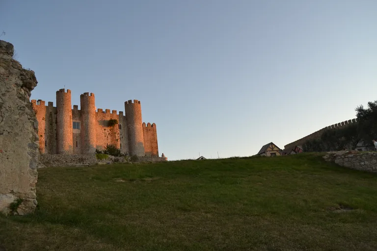
Photo: Anitsircana · Wikimedia Commons source · CC BY-SA 3.0 · Cropped to the recorded 3:2 source rectangle and resized from the exact hash-bound source input. Castle of Óbidos
The Castle of Óbidos closes the top of the town; Óbidos passed to the Christians in 1148, and the story that the knight Gonçalo Mendes da Maia slipped into the castle through its back gate, the Porta da Traição, is a tradition that historians treat with reserve. The route climbs here because the castle was the seat of the alcaides, the officers who held the town for the Crown, and in the reign of King Manuel I one of them built the palace inside it, whose Manueline windows open onto the courtyard and whose portal carries the royal arms and those of the Noronha family. Damaged by the earthquake of 1755 and in total ruin by the twentieth century, the palace was restored as a state hotel, a pousada, opened in the early 1950s, so its courtyard and rooms are for guests and the stop is made from the cobbled square before the gate.
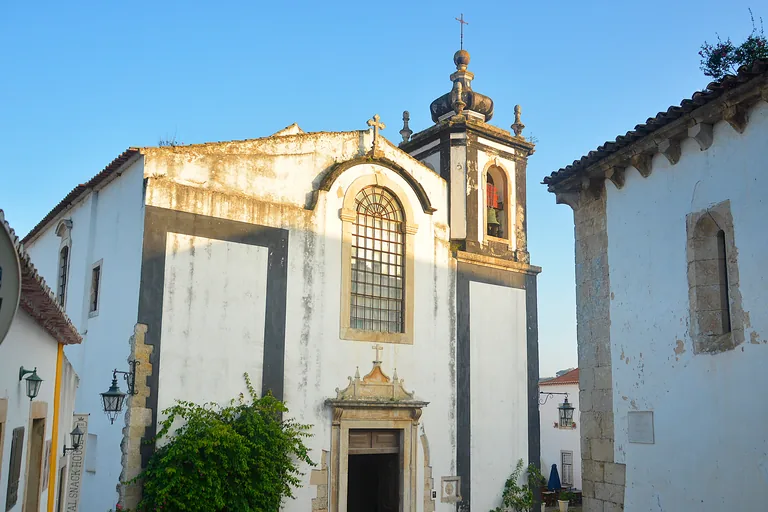
Photo: Miguel Ángel García. from Ólvega., España · Wikimedia Commons source · CC BY 2.0 · Cropped to the recorded 3:2 source rectangle and resized from the exact hash-bound source input. Largo de São Pedro
The Largo de São Pedro is a small sloping square below the castle, with the church of São Pedro, a medieval foundation reduced to rubble by the earthquake of 1755 and rebuilt; its single nave holds a gilded baroque altarpiece. The walk ends here because this church holds the grave of the painter Josefa de Óbidos, who was born in Seville, trained in her father's workshop and in 1659 obtained her family's permission to live independently; the exact place of her grave in the floor has never been identified with certainty. The square is reached by stepped lanes or by the main street, the church keeps its own opening hours, and the town gate is a few minutes' walk below, close to the aqueduct where the loop began.


.jpg)

.jpg)


.jpg)
.jpg)
Local context
Before you go
The walk is a loop of about a kilometre and a half. It starts below the main gate, by the aqueduct and the car park on Rua da Praça, and ends at the Largo de São Pedro inside the walls, a few minutes' walk from where it began. Inside the walls the streets are steep in places, narrow and paved with smooth stones that are slippery when wet, and some side lanes, including the lane through the Porta da Senhora da Graça, are stepped. The main street is crowded in season and during the town's festivals, and the gate passages are shared with occasional cars. The walk stays on the ground: the top of the walls is narrow, uneven and has no railing on the inner side.
On the ground
Access and surfaces
A loop of about a kilometre and a half that starts below the main gate, by the aqueduct and the car park, and ends a few minutes' walk from where it began. Inside the walls the streets are steep in places, narrow and paved with smooth stones that are slippery when wet, and some side lanes are stepped. The main street is crowded in season and during the town's festivals. The walk stays on the ground: the top of the walls is narrow, uneven and has no railing on the inner side, and the audio never sends you up there. Every stop works from the street; the churches and the museums have their own opening hours, and the castle is a hotel whose courtyard and rooms are for guests.
Frequently asked
Plan the walk
- How long is the Óbidos audio walking tour?
- Allow about 80 minutes. The route covers 1.4 km (0.9 mi) in 10 stops, including walking and listening time.
- Where does the Óbidos tour start and end?
- It starts at the Óbidos Aqueduct, by the car park on Rua da Praça below the main gate, and ends at the Largo de São Pedro inside the walls, a few minutes' walk from the start.
- Does the walk go up onto the town walls?
- No. The top of the walls is narrow, uneven and has no railing on the inner side, so the walk stays on the ground and the audio never sends you up there.
- Do I need to go inside the churches or the castle?
- No. Every stop works from the street. The churches, the parish museum, the town museum and the bookshop in the church of Santiago keep their own opening hours, and the castle is a hotel whose courtyard and rooms are for guests.
- Will the Óbidos audio tour work offline?
- Yes, after download. Audio, stop text, images, and GPS triggering work without data; the live map background still needs a connection.