Meknes · Fès-Meknès, Morocco
Meknes — A Capital Built to Command
Meknes is two cities pressed together: an older trading medina and the immense royal capital Moulay Ismail drove into its southern edge.
Narration in English · Stop 1 is free
 Tour no. 14
- Stops
- 10
- Distance
- 3.2 km (2 mi)
- Time
- About 150 minutes
- Route
- Moderate walking route
Listen before you buy
Stop 1 · Bab Berdaine
Stop 1 is free. Listen before you buy.
The walk
A self-guided audio tour of Meknes
Meknes is two cities pressed together: an older trading medina and the immense royal capital Moulay Ismail drove into its southern edge. This walk moves from neighborhood gates, markets and schools through the theatrical hinge of el-Hedim, then into the audience halls, tombs, waterworks and granaries that made absolutist rule physical.
Route notes
The stops
About each stop · narration stays in the app
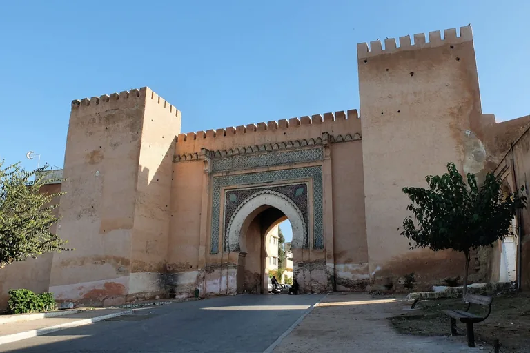
Photo: Robert Prazeres · Wikimedia Commons source · CC BY-SA 4.0 · Cropped to the recorded 3:2 source rectangle and resized from the exact hash-bound source input. Bab Berdaine
Bab Berdaine is the monumental northern gate of Meknes's medina, built under Moulay Ismail beside a long-established market and mosque quarter. It gives the route a neighbourhood-scale threshold before the imperial city's larger acts of display. The public approach is free but uneven, and the adjacent mosque remains an active religious site.
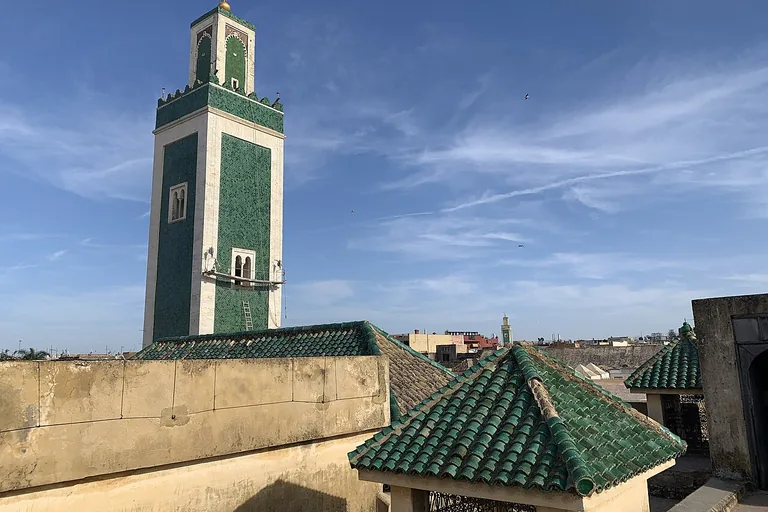
Photo: Heraclitus2000 · Wikimedia Commons source · CC BY-SA 4.0 · Cropped to the recorded 3:2 source rectangle and resized from the exact hash-bound source input. Great Mosque of Meknes
The Great Mosque anchors the old medina's religious and commercial core, with foundations and rebuilds attributed to several ruling periods. The route includes it to show an institution repeatedly adapted and used, rather than a city made only by Moulay Ismail. This is an exterior stop in narrow, crowded lanes; no mosque entry is assumed.
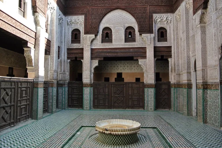
Photo: Ben Bender · Wikimedia Commons source · CC BY-SA 3.0 · Cropped to the recorded 3:2 source rectangle and resized from the exact hash-bound source input. Bou Inania Madrasa
Meknes's Bou Inania Madrasa is a fourteenth-century Marinid school arranged around a richly worked courtyard of wood, stucco and tile. It provides the route's principal Marinid interior and a measured counterpoint to the later Alawi royal city. Interior and roof access may close for restoration, while the public entrance remains the required stop.
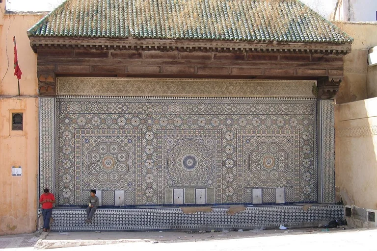
Photo: Matteo Martinello from Milan, Italy · Wikimedia Commons source · CC BY 2.0 · Cropped to the recorded 3:2 source rectangle and resized from the exact hash-bound source input. Dar Jamaï Museum
Dar Jamaï was built in 1882 for grand vizier Mokhtar ben Arbi el Jamaï and later served as a hospital, military court and museum. Its changing uses bring elite domestic rooms, political reversal and present craft collections into the same stop. The exterior and fountain are accessible from Place el-Hedim; upper rooms may have separate access limits.
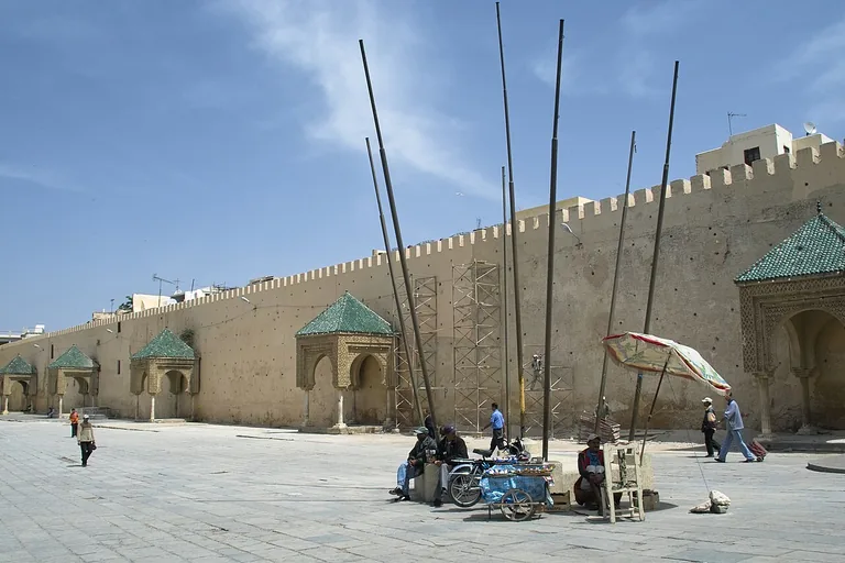
Photo: ArishG · Wikimedia Commons source · CC BY-SA 3.0 · Cropped to the recorded 3:2 source rectangle and resized from the exact hash-bound source input. Place el-Hedim
Place el-Hedim is the broad cleared square between the old medina and Moulay Ismail's imperial enclosure. The route uses this hinge to set royal planning against the storytellers, musicians, sellers and evening crowds that occupy it now. The square is free and mostly level, but temporary stalls and dense evening activity can narrow routes.
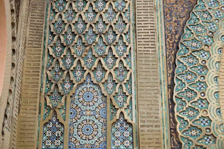
Photo: Robert Prazeres · Wikimedia Commons source · CC BY-SA 4.0 · Cropped to the recorded 3:2 source rectangle and resized from the exact hash-bound source input. Bab Mansour
Bab Mansour is Meknes's great ceremonial gate, completed under Moulay Abdallah in the early 1730s with zellij, carved patterns and reused ancient columns. Its carefully staged façade is the visual climax at the boundary between public square and royal court. The full composition is visible free from Place el-Hedim; passage through the gate is not required and may be closed.
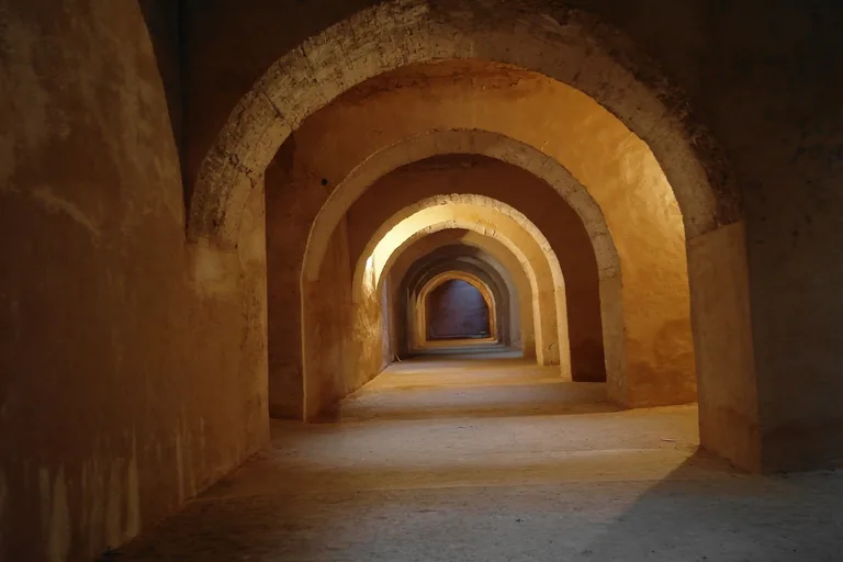
Photo: Jklamo · Wikimedia Commons source · CC BY-SA 4.0 · Cropped to the recorded 3:2 source rectangle and resized from the exact hash-bound source input. Qubbat al-Khayyatin and Habs Qara
Qubbat al-Khayyatin is an ambassadors' pavilion above extensive vaulted chambers now commonly called Habs Qara. The stop separates the popular underground-prison story from evidence that the chambers chiefly served storage and palace logistics. Underground entry involves steps and can close, so the complete stop remains available from the public forecourt.
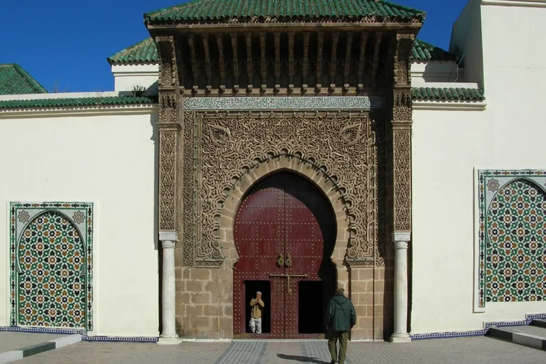
Photo: Bernard Gagnon · Wikimedia Commons source · CC BY-SA 3.0 · Cropped to the recorded 3:2 source rectangle and resized from the exact hash-bound source input. Mausoleum of Moulay Ismail
The Mausoleum of Moulay Ismail is the ruler's burial complex, built around a controlled sequence of courtyards and later modified in the eighteenth century. It places the person commemorated by the imperial city inside the ceremonial landscape he created. Entry rules, dress expectations and thresholds vary at this active religious complex; the southern approach is sufficient.
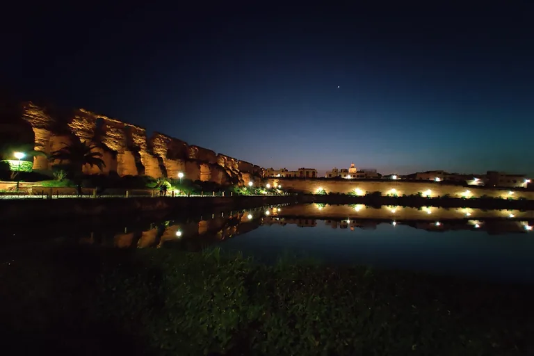
Photo: Mohamed Moustach · Wikimedia Commons source · CC BY-SA 4.0 · Cropped to the recorded 3:2 source rectangle and resized from the exact hash-bound source input. Sahrij Souani
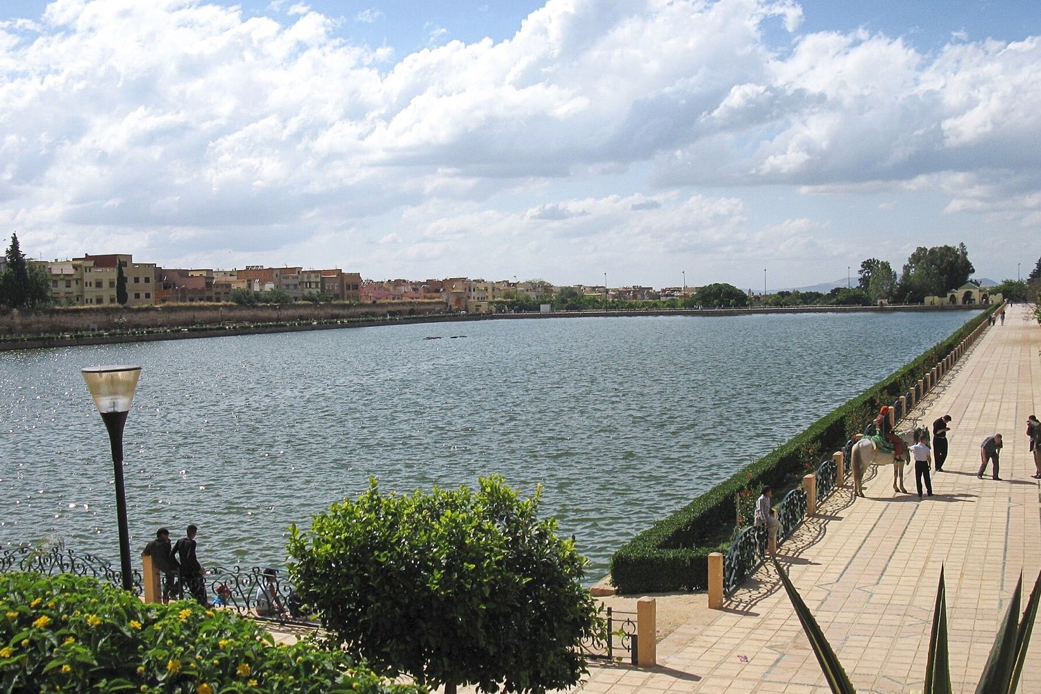
Sahrij Souani is a large open reservoir within the imperial city's linked system of wells, water lifting, pipes, gardens and service buildings. Its scale shifts the route from court ceremony to the infrastructure required to sustain a palace city. The exposed public edge is mostly level, but the walk from the mausoleum is long and offers limited shade.
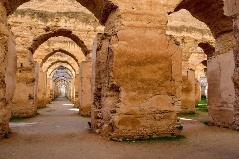
Photo: Andrew Brehmer · Wikimedia Commons source · CC BY 2.0 · Cropped to the recorded 3:2 source rectangle and resized from the exact hash-bound source input. Heri es-Souani
Heri es-Souani combines monumental granary vaults with adjoining water-lifting chambers that supplied Moulay Ismail's royal complex. The route ends here because grain storage, temperature control and water distribution reveal the logistics behind imperial spectacle. Interior passages can be uneven, roofless or temporarily closed; the buildings remain legible from the public entrance.


.jpg)
.jpg)


.jpg)
Local context
Before you go
The published route starts at Bab Berdaine, Rue 57, 50000 Meknès, Maroc. It begins at Bab Berdaine and ends at Heri es-Souani.
On the ground
Access and surfaces
The northern medina has narrow, crowded lanes, uneven paving and occasional steps. The imperial-city section is more open but includes a long exposed walk of roughly one kilometre from the mausoleum area to Sahrij Souani. Interiors may close for restoration, prayer or security; every stop is written to remain complete from its public exterior stand-point.
Frequently asked
Plan the walk
- How long is the Meknes audio walking tour?
- Allow about 150 minutes. The self-guided route covers 3.2 km (2 mi) in 10 stops, including walking and listening time.
- Where does the Meknes tour start and end?
- It starts at Bab Berdaine, Rue 57, 50000 Meknès, Maroc. The published route begins at Bab Berdaine and ends at Heri es-Souani.
- Will the Meknes audio tour work offline?
- Yes, after download. Audio, stop text, images, and GPS triggering work without data; the live map background still needs a connection.