Matera · Basilicata, Italy
Matera — The Sassi
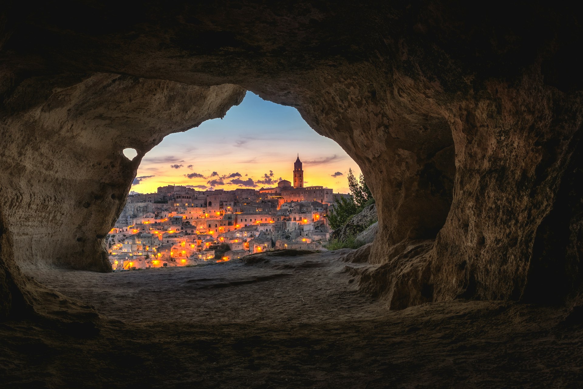
Matera's Sassi are two hollows of cave-houses carved into a ravine wall, inhabited from prehistory, emptied by law in the 1950s, and now the first UNESCO World Heritage site in southern Italy.
Narration in English · Stop 1 is free
 Tour no. 04
- Stops
- 9
- Distance
- 2.3 km (1.4 mi)
- Time
- About 120 minutes
- Route
- Moderate walking route
Listen before you buy
Stop 1 · Piazza Vittorio Veneto
Stop 1 is free. Listen before you buy.
The walk
A self-guided audio tour of Matera
Matera's Sassi are two hollows of cave-houses carved into a ravine wall, inhabited from prehistory, emptied by law in the 1950s, and now the first UNESCO World Heritage site in southern Italy. This walk descends one Sasso, crosses the cathedral rock between them, and climbs out of the other — from an upper piazza to a one-room cave home and back. One city, two levels, and the strangest comeback in Italy.
Route notes
The stops
About each stop · narration stays in the app
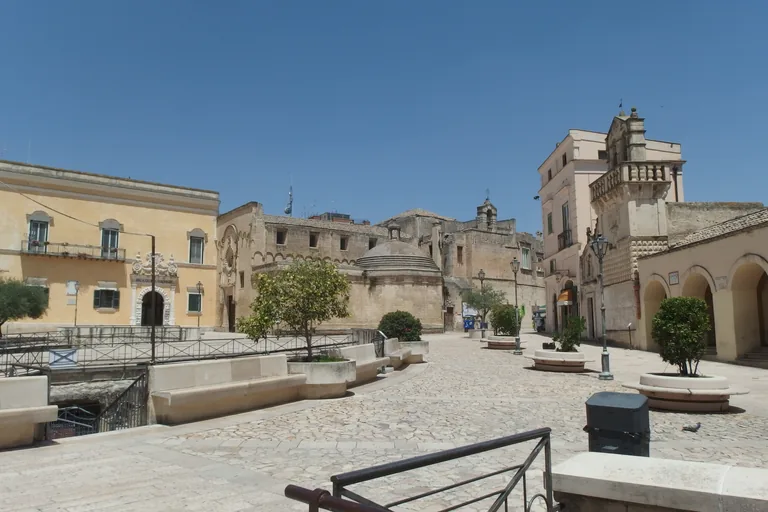
Photo: Palickap · Wikimedia Commons source · CC BY-SA 4.0 · Cropped to the recorded 3:2 source rectangle and resized from the original. Piazza Vittorio Veneto
Piazza Vittorio Veneto is Matera's modern civic centre, laid over cisterns and passages at the upper edge of the Sassi. The route starts here because the square hides the water infrastructure and abrupt change of level that made the cave districts possible below. The piazza is free and broadly accessible; underground spaces such as the Palombaro Lungo require separate admission and involve steps.
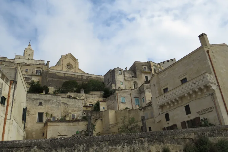
Photo: Enric · Wikimedia Commons source · CC BY-SA 4.0 · Cropped to the recorded 3:2 source rectangle and resized from the original. Sasso Barisano
Sasso Barisano is the northern cave district where built façades, roofs, lanes and excavated rooms stack along the ravine side. The route descends through it to show that the Sassi are a layered urban system, not a row of isolated caves. Expect steep ramps, stairs and polished stone; use signed public lanes and avoid treating private homes or hospitality spaces as exhibits.
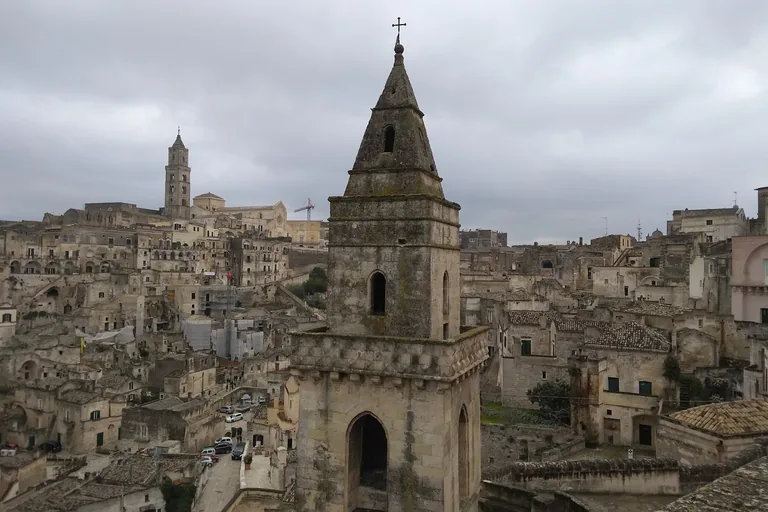
Photo: Hollowayvideo · Wikimedia Commons source · CC0 · Cropped to the recorded 3:2 source rectangle and resized from the original. Church of San Pietro Barisano
San Pietro Barisano is Matera's largest rock-cut church, expanded over centuries behind a masonry façade with chambers and burial spaces carved below. It is included because the contrast between the street front and excavated interior makes the Sassi's additive building process easy to read. The façade is visible without a ticket; the interior has admission, stairs and uneven floors, and opening hours can change.
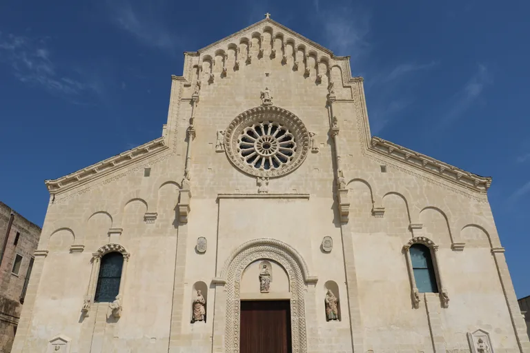
Photo: Diego Baglieri · Wikimedia Commons source · CC BY-SA 4.0 · Cropped to the recorded 3:2 source rectangle and resized from the original. Matera Cathedral
Matera Cathedral is the thirteenth-century church built on the Civita ridge, with a Romanesque exterior and later interior decoration overlooking both Sassi. The route climbs here because the ridge explains the civic and religious centre positioned between the two cave districts. The piazza and views are free, while church access follows worship hours and the climb involves sustained gradients and steps.
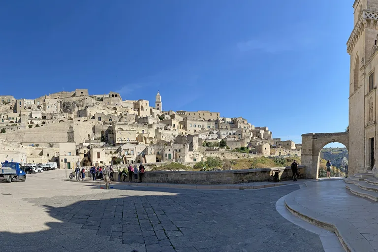
Photo: Bernard Gagnon · Wikimedia Commons source · CC BY 4.0 · Cropped to the recorded 3:2 source rectangle and resized from the original. Piazza San Pietro Caveoso
Piazza San Pietro Caveoso is the open terrace around the church of Saints Peter and Paul, facing the Gravina and the cave churches across the gorge. The route pauses here because the square gives the clearest ground-level view of how settlement, cliff and ravine fit together. The piazza is free and exposed, with strong sun and little shade; edges and connecting lanes include uneven drops and steps.
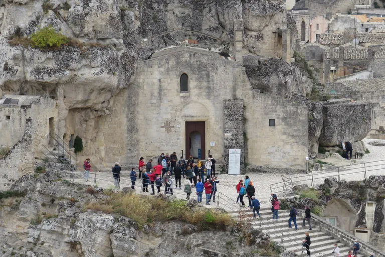
Photo: Enric · Wikimedia Commons source · CC BY-SA 4.0 · Cropped to the recorded 3:2 source rectangle and resized from the original. Santa Maria de Idris
Santa Maria de Idris is a rock-cut church embedded in the Monterrone outcrop above Sasso Caveoso, its masonry front attached directly to the stone mass. The route includes it because the church makes Matera's fusion of excavated and constructed architecture visible from across the district. The exterior view requires a steep approach; interior access is ticketed, confined and reached by steps.
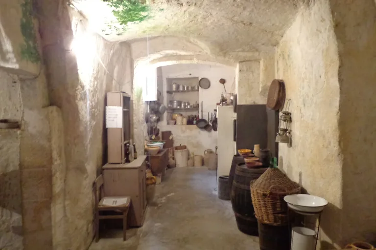
Photo: Superchilum · Wikimedia Commons source · CC BY-SA 4.0 · Cropped to the recorded 3:2 source rectangle and resized from the original. Casa Grotta of Vico Solitario
Casa Grotta of Vico Solitario is a furnished cave dwelling used to interpret the domestic arrangement of a Sassi household before the mid-twentieth-century clearances. It follows the rock church to shift attention from monumental excavation to the compressed living, storage and animal spaces of an ordinary home. The museum is ticketed and small, with steps and crowding at busy times; the display is an interpretation rather than an untouched household.
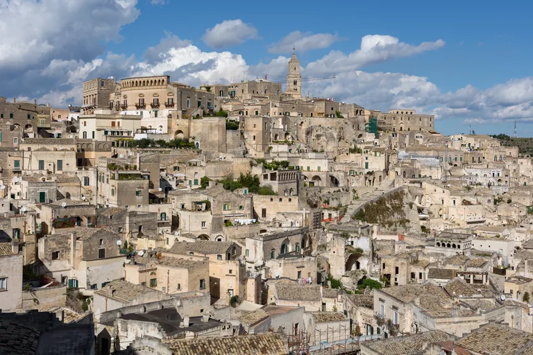
Photo: Isiwal · Wikimedia Commons source · CC BY-SA 4.0 · Cropped to the recorded 3:2 source rectangle and resized from the original. Piazzetta Pascoli
Piazzetta Pascoli is a Belvedere on the Piano, opening from the later town toward Sasso Caveoso, the Monterrone and the Gravina. The route uses it to look back across the ground already covered and compare the planned upper city with the irregular cave landscape. The viewpoint is free and relatively level, but it is exposed to sun and can become crowded around sunset.
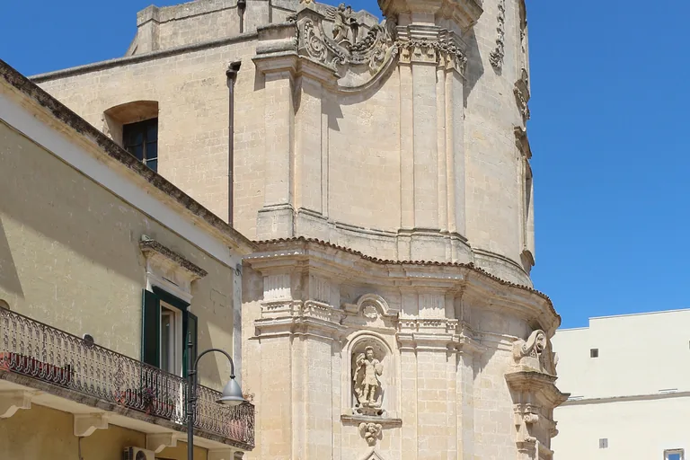
Photo: Bernard Gagnon · Wikimedia Commons source · CC BY 4.0 · Cropped to the recorded 3:2 source rectangle and resized from the original. Church of the Purgatorio
The Church of the Purgatorio is an eighteenth-century Baroque church whose façade uses skulls, bones and souls in flames to make prayers for the dead visible in stone. It closes the route by returning from the Sassi to the later city and ending on a building whose decoration explains its religious purpose directly. The façade is free to inspect from the street; interior access depends on worship and current opening arrangements.


.jpg)


,_des_de_Via_Muro.jpg)


_01.jpg)
Local context
Before you go
The published route starts at Piazza Vittorio Veneto, 75100 Matera MT, Italia. It begins at Piazza Vittorio Veneto and ends at Church of the Purgatorio.
On the ground
Access and surfaces
Stair-heavy throughout: the walk descends and climbs the Sassi on stone steps and uneven basoli paving. Not wheelchair-accessible as a full loop; stops 1, 4, 8 and 9 are reachable on street level. The Monterrone stair (stop 6) is the steepest single climb. Several church interiors are ticketed and optional — the narration works from outside throughout. Summer: minimal shade between stops 5 and 8; carry water.
Frequently asked
Plan the walk
- How long is the Matera audio walking tour?
- Allow about 120 minutes. The self-guided route covers 2.3 km (1.4 mi) in 9 stops, including walking and listening time.
- Where does the Matera tour start and end?
- It starts at Piazza Vittorio Veneto, 75100 Matera MT, Italia. The published route begins at Piazza Vittorio Veneto and ends at Church of the Purgatorio.
- Will the Matera audio tour work offline?
- Yes, after download. Audio, stop text, images, and GPS triggering work without data; the live map background still needs a connection.