Málaga · Andalusia, Spain
Málaga — What the City Chose to Keep
Málaga's centre is full of structures that survived by changing jobs.
Narration in English · Stop 1 is free
 Tour no. 09
- Stops
- 10
- Distance
- 2.3 km (1.4 mi)
- Time
- About 125 minutes
- Route
- Easy city route
Listen before you buy
Stop 1 · Atarazanas Market
Stop 1 is free. Listen before you buy.
The walk
A self-guided audio tour of Málaga
Málaga's centre is full of structures that survived by changing jobs. A Nasrid shipyard gate became the entrance to an iron market, Roman industry remained below a Renaissance palace, and a modern cultural building gave way when an ancient theatre reappeared beneath it. This walk follows the people who demolished, reused, excavated and campaigned to decide what the city would carry forward.
Route notes
The stops
About each stop · narration stays in the app
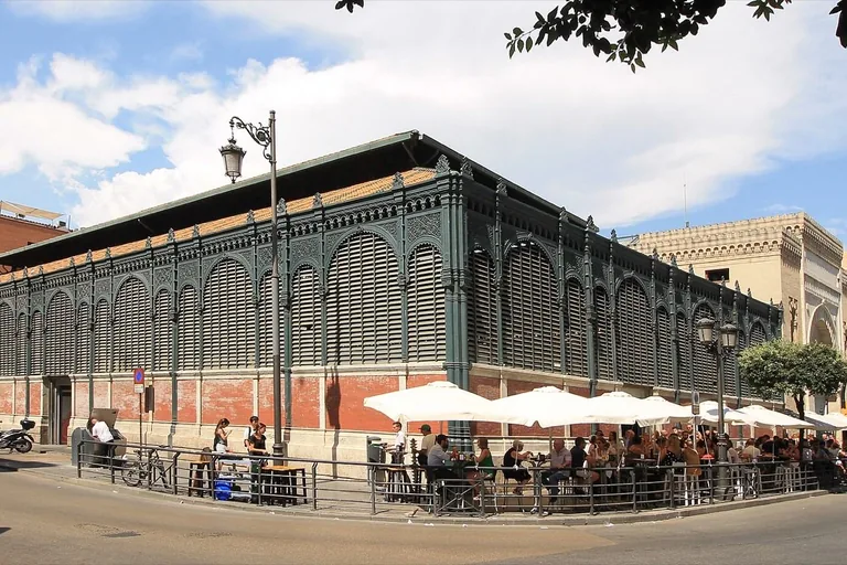
Photo: Luis García ( Zaqarbal ) · Wikimedia Commons source · CC BY-SA 4.0 · Cropped to the recorded 3:2 source rectangle and resized from the exact hash-bound source input. Atarazanas Market
Atarazanas Market incorporates the stone gateway of Málaga's Nasrid shipyards into a nineteenth-century iron market hall. The route opens here because one displaced medieval fragment still frames the daily work of a modern food market. The public pavement is level, while deliveries, crowds and opening hours affect access to the hall.
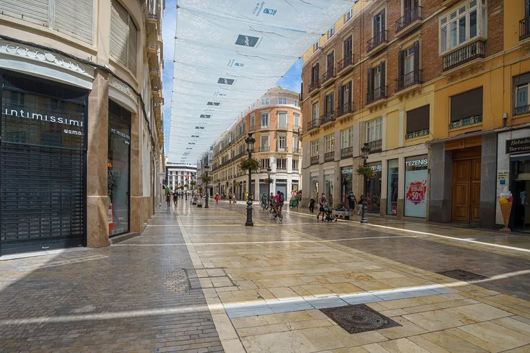
Photo: Pedro J Pacheco · Wikimedia Commons source · CC BY-SA 4.0 · Cropped to the recorded 3:2 source rectangle and resized from the exact hash-bound source input. Marqués de Larios Street
Marqués de Larios Street was cut through the centre between 1887 and 1891 as a project of movement, sanitation, property and commercial display. Its coordinated façades and rounded corners expand the route's theme from a reused gateway to deliberate urban remaking. The broad pedestrian street is level, though events and seasonal installations can make it very crowded.
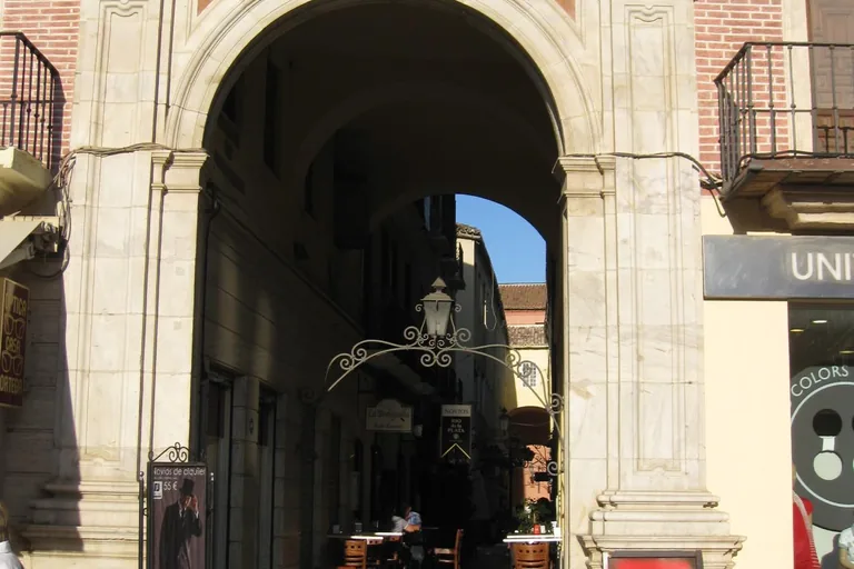
Photo: alf.melin · Wikimedia Commons source · CC BY-SA 2.0 · Cropped to the recorded 3:2 source rectangle and resized from the exact hash-bound source input. Constitution Square and Chinitas Passage
Constitution Square is Málaga's long-standing civic centre, while narrow Chinitas Passage behind it once held a celebrated café and performance venue. The contrast lets the route place formal public space beside a compressed world of sociability that left few physical traces. Paving is level, but terraces, events and crowds can constrict the passage entrance.
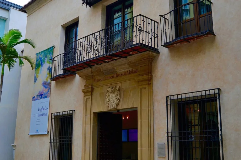
Photo: Emilio J. Rodríguez Posada · Wikimedia Commons source · CC BY-SA 2.0 · Cropped to the recorded 3:2 source rectangle and resized from the exact hash-bound source input. Villalón Palace
Villalón Palace is a Renaissance residence adapted as a museum above excavated Roman rooms, fish-processing installations and a nymphaeum. The stop shifts the route from visible redesign to urban continuity discovered below ground. The exterior is on level public paving; museum and archaeological access depend on admission and lift availability.
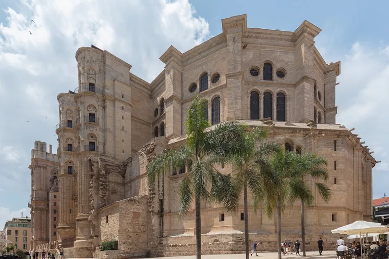
Photo: Diego Delso · Wikimedia Commons source · CC BY-SA 4.0 · Cropped to the recorded 3:2 source rectangle and resized from the exact hash-bound source input. Málaga Cathedral
Málaga Cathedral was begun after the 1487 conquest on the site of the main mosque and developed through several architectural campaigns without full completion. Its long building history is the route's largest visible act of religious and political replacement. The exterior square is level and free; interior, service and roof access have separate schedules and tickets.
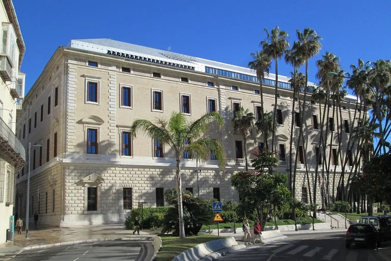
Photo: Tyk · Wikimedia Commons source · CC BY-SA 3.0 · Cropped to the recorded 3:2 source rectangle and resized from the exact hash-bound source input. Customs Palace
The Customs Palace was planned in 1787 and completed in the nineteenth century before serving customs, tobacco, government and eventually the Museo de Málaga. Its reuse, damaging roof fire and conversion to a museum bring the route into institutional memory. The exterior approach is broad and level; museum entry and security are separate.
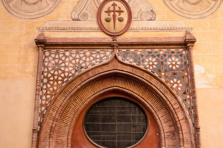
Photo: Rafa Esteve · Wikimedia Commons source · CC BY-SA 4.0 · Cropped to the recorded 3:2 source rectangle and resized from the exact hash-bound source input. Church of Santiago
The Church of Santiago is an early post-conquest parish retaining Gothic-Mudéjar fabric and the documented baptismal record of Pablo Picasso. The route narrows from state institutions to a working parish and the ordinary paperwork of one famous life. The Calle Granada frontage is level but narrow; entry depends on worship and opening hours.
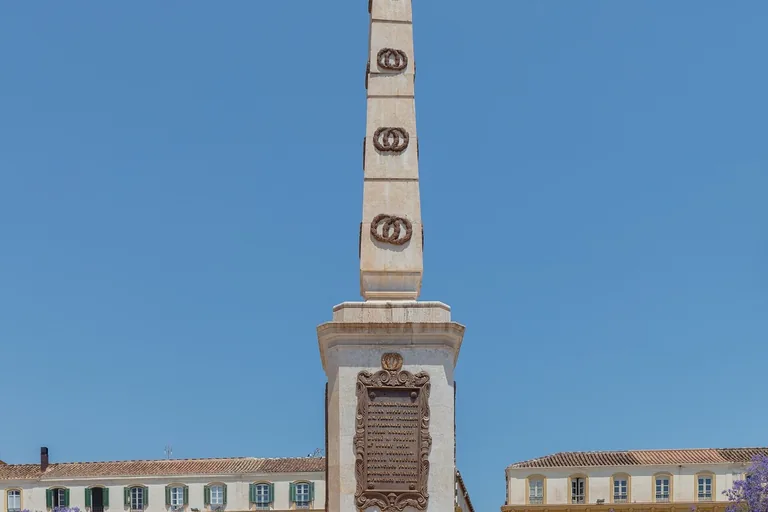
Photo: Diego Delso · Wikimedia Commons source · CC BY-SA 4.0 · Cropped to the recorded 3:2 source rectangle and resized from the exact hash-bound source input. Merced Square and Torrijos Monument
Merced Square contains the 1842 monument to General Torrijos and his executed companions near the building where Picasso spent part of his childhood. The stop compares two forms of public memory with the square's present cafés, events and daily use. The large paved space is mostly level but exposed to sun and frequently crowded.
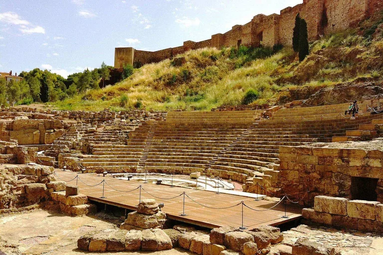
Photo: andynash · Wikimedia Commons source · CC BY-SA 2.0 · Cropped to the recorded 3:2 source rectangle and resized from the exact hash-bound source input. Roman Theatre
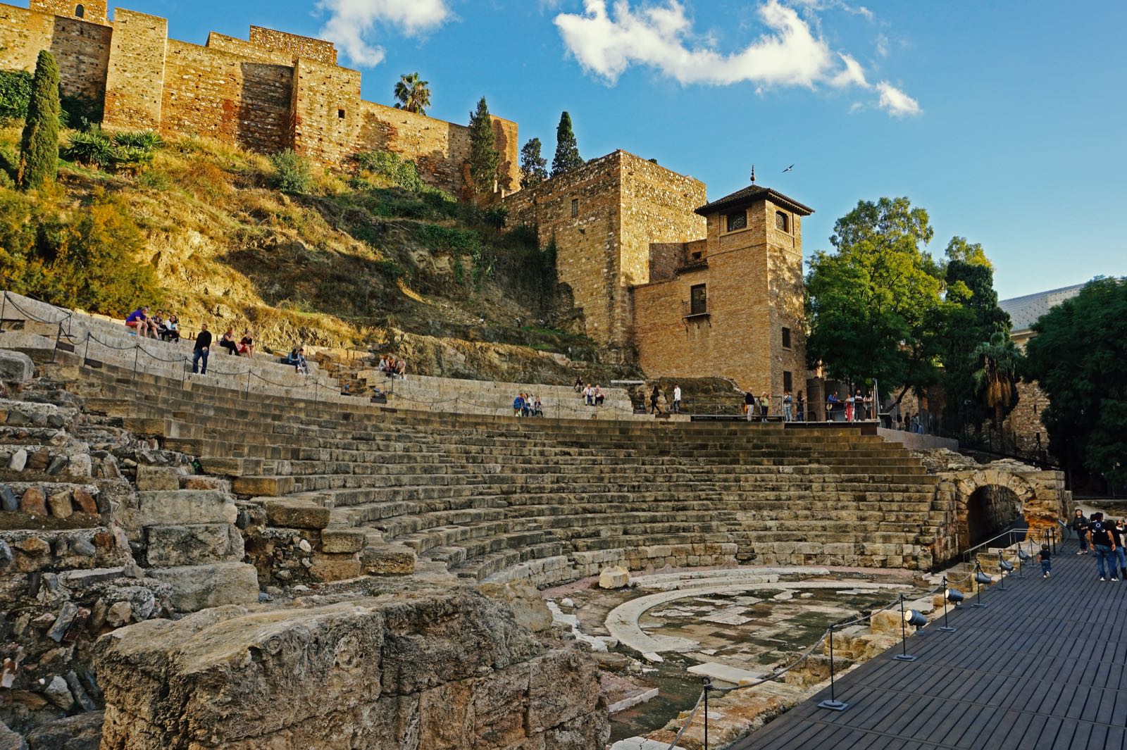
Málaga's Roman theatre re-emerged during work on a twentieth-century cultural building, which was later removed after decades of debate. The stop provides the route's sharpest example of one preservation era choosing which layer should remain visible. The theatre can be read free from broad public paving; the visitor centre follows separate hours.
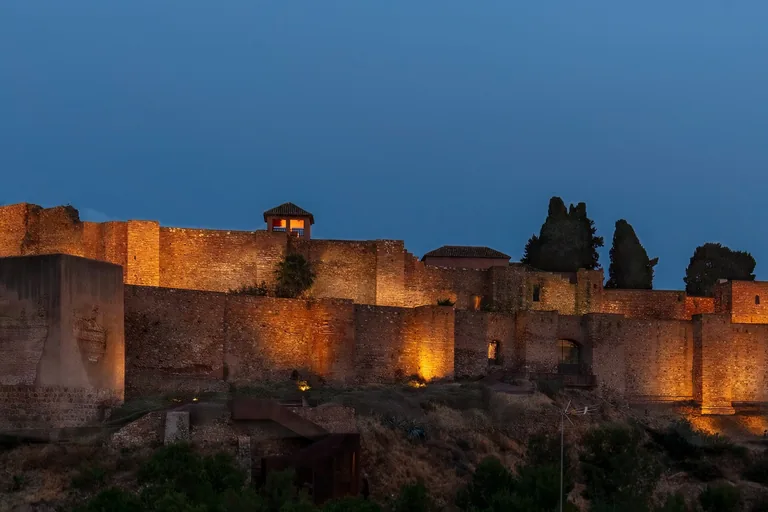
Photo: Diego Delso · Wikimedia Commons source · CC BY-SA 4.0 · Cropped to the recorded 3:2 source rectangle and resized from the exact hash-bound source input. Alcazaba of Málaga
The Alcazaba is an eleventh-century palatial fortress that reused Roman materials and later passed through military, residential, abandoned and restored phases. The route ends here because the complex gathers Málaga's cycles of adaptation into its largest surviving architectural palimpsest. The exterior approach is level and complete; the ticketed interior has sustained slopes, steps and uneven paving.


_01.jpg)


Local context
Before you go
The published route starts at Calle Atarazanas, 10, 29005 Málaga, España. It begins at Atarazanas Market and ends at Alcazaba of Málaga.
On the ground
Access and surfaces
The route stays in the mostly level, pedestrianised historic centre. The market and Calle Larios can be crowded, and several crossings have busy delivery or traffic periods. Every narration works from a public exterior stand-point; interiors keep changing hours and are optional. The Alcazaba interior has steep ramps, steps and uneven surfaces, but the final stop is complete from Calle Alcazabilla outside the ticketed entrance.
Frequently asked
Plan the walk
- How long is the Málaga audio walking tour?
- Allow about 125 minutes. The self-guided route covers 2.3 km (1.4 mi) in 10 stops, including walking and listening time.
- Where does the Málaga tour start and end?
- It starts at Calle Atarazanas, 10, 29005 Málaga, España. The published route begins at Atarazanas Market and ends at Alcazaba of Málaga.
- Will the Málaga audio tour work offline?
- Yes, after download. Audio, stop text, images, and GPS triggering work without data; the live map background still needs a connection.