Luang Prabang · Luang Prabang Province, Laos
Luang Prabang — The Town Between Two Rivers
An audio walk up the main street of Luang Prabang, past its monasteries, the royal palace and the sacred hill, to the point where its two rivers meet.
Narration in English · Stop 1 is free
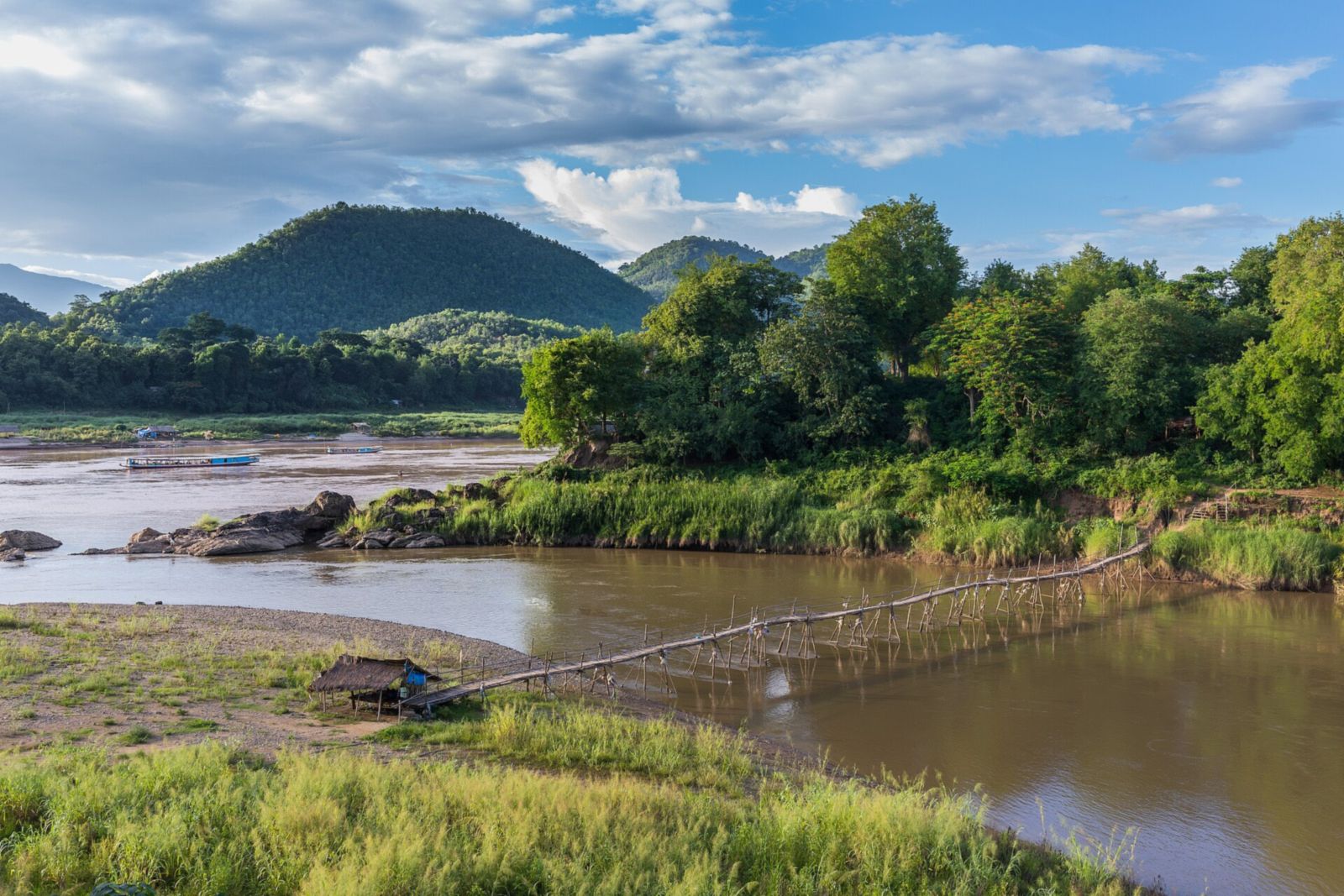 Tour no. 50
- Stops
- 9
- Distance
- 2.4 km (1.5 mi)
- Time
- About 90 minutes
- Route
- Easy city route
Listen before you buy
Stop 1 · The Market Street
Stop 1 is free. Listen before you buy.
Read Stop 1Hide Stop 1 text
Transcript · Stop 1
This is a royal town built on a tongue of land between two rivers, kept by its monks and its neighbours. You are standing at the south west end of the main street of Luang Prabang, on a peninsula between the Mekong and the smaller Nam Khan, with mountains all round. Temples, wooden houses and brick houses of the French period stand along one long street. The town has been a World Heritage site since 1995.
Up the street the tuk tuks — the local three-wheeled taxis — wait in a row; along the left side, when they are up, are the awnings and clothes rails of the market stalls; above the trees ahead and to the right rises a wooded hill with a gilded spire. At this end of the main street the stalls of a night market fill the road in the evening. By the usual account, Hmong and other sellers bring needlework and textiles from the town and the villages round it. You may see Hmong story cloths — embroideries that tell stories in pictures — stitched onto aprons, bags and pillows. In 2009 a scholar found them numerous in the market here; they are a newer form of Hmong needlework adapted for functional textiles.
In 1867, when the French Mekong expedition arrived, a daily market crowded under sheds at the far end of the peninsula, and its open-air stalls ran for more than a kilometre down a long street parallel to the river — the first real market, one of the expedition wrote, since Phnom Penh. Another member wrote that one must go to the market to judge the variety of costumes and types. The sellers crouched on mats or banana leaves under the low houses on both sides of the street, waiting without crying their wares, the whole going on gravely, almost in silence. The only money then was little white shells on strings, twenty five strings to a single silver coin.
In the 1880s a surveyor in the Siamese service found the market rather crowded in the mornings, men and women bartering and chaffering in their different jargons. Rupees were melted down for the Lao silversmiths' boxes, betel sets and dagger handles. More than twenty Burmese traders lived in the town. The old Lao towns were royal compounds with their temples; the villages round them, not the town itself, were the centres of trade.
A short way up the street, on the left, a long temple roof sweeps down in tiers of dark red tile.
The walk
An audio walking tour of Luang Prabang up the main street of its peninsula, from the night market past Wat Mai, the royal palace and a quiet temple lane, under Phousi and along Sakkaline Road to the Nam Khan, Wat Xieng Thong and the meeting of the rivers, at your own pace
Luang Prabang stands on a peninsula where the Nam Khan runs into the Mekong, ringed by green mountains, and UNESCO listed the town in 1995 for the way its Lao temples and wooden houses sit beside the brick buildings of the colonial era. This walk follows the main street up the length of the old town. It begins at the market end, where stalls set up in the road each evening for the night market, and passes Wat Mai, where the Phra Bang, the Buddha image that gives the town its name, is brought each Lao New Year and bathed by the people, and the gate of the royal palace begun for King Sisavang Vong in 1904, now a museum.
From there it turns down a quiet lane to Wat Xieng Muan, to hear how the town's monks pass on to young monks the skills to restore their temples, stops below Phousi, the sacred hill at the heart of the town, and walks Sakkaline Road, the street of temples and colonial houses where the monks receive alms at first light. It then goes down to the Nam Khan, the river the French naturalist Henri Mouhot followed upstream in 1861 on his last journey, stands below Wat Xieng Thong, whose name means the temple of the Golden City and where kings were crowned, and ends at the tip of the peninsula, where the two rivers meet.
Route notes
Route and itinerary
About each stop · narration stays in the app
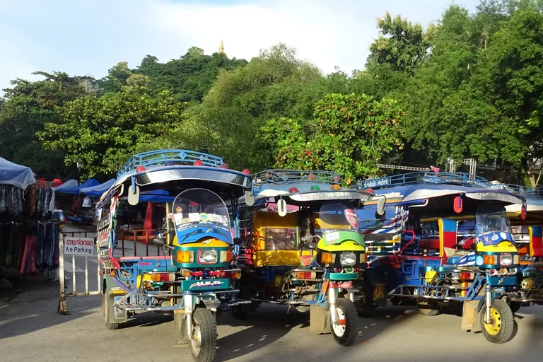
Photo: Christophe95 · Wikimedia Commons source · CC BY-SA 4.0 · Cropped to the recorded 3:2 source rectangle and resized from the exact hash-bound source input. The Market Street
The Market Street is the south west end of Sisavangvong Road, the old town's main street in Luang Prabang, beside the Tourist Information Centre, where in the evening a night market sets up stalls selling shirts, bracelets and other souvenirs. The route starts here for the textiles on the stalls: a scholar of Hmong paj ntaub, or flower cloth, worked by embroidery, appliqué, reverse appliqué and indigo batik, came to Laos at the end of 2009 partly to see how these textiles are made and sold for visitors, and to look for the roots of their move from abstract geometric patterns to pictures. The stalls stand in the road only in the evening and their times change, so check locally; at other times the walk starts on the pavement by the Tourist Information Centre, where tuk tuks wait.
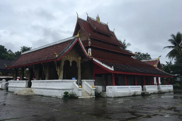
Photo: Christophe95 · Wikimedia Commons source · CC BY-SA 4.0 · Cropped to the recorded 3:2 source rectangle and resized from the exact hash-bound source input. Wat Mai
Wat Mai Suwannaphummaram, as the national news agency names it, is a working monastery on the main street of Luang Prabang, a short walk up from the market end. The route stops here for the New Year procession: the provincial tourism office lists its order, from young people carrying the national and religious flags and traditional music to the conch blowers and bells, the monks, the carriage of the Phra Bang and young people in white holding candles, and the national news agency reports that the image's return to its hall is followed by a performance of the Phalak Phalam theatre, the Lao telling of the Ramayana. The walk stays outside the gate; the monastery is a working place of worship, so if you go in, cover your shoulders and knees, take off your shoes before entering the hall and keep your voice down.
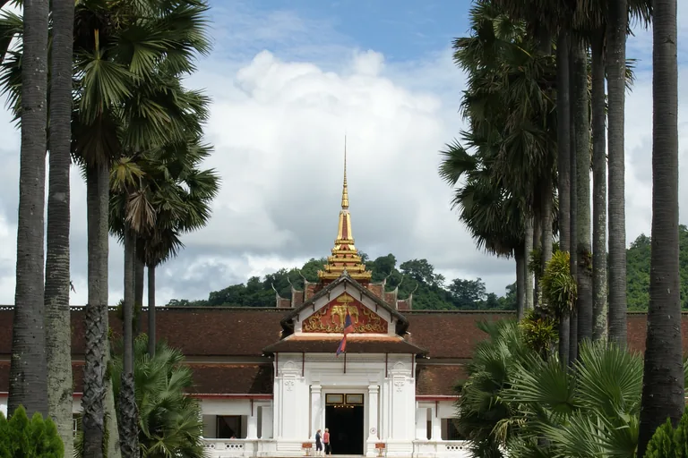
Photo: Allie Caulfield · Wikimedia Commons source · CC BY 2.0 · Cropped to the recorded 3:2 source rectangle and resized from the exact hash-bound source input. The Royal Palace
The Royal Palace of Luang Prabang, now the National Museum of Luang Prabang, stands at the end of a drive of palms behind its gate on the main street. The route stops here for how the palace was made: the provincial tourism office says it was built between 1904 and 1909 to the design of a French architect remembered in Lao as Thone, mostly from local materials, and reads in the carving of its pediment the fifteen tribes of naga around the three headed elephant under its white parasol. The palace museum is visited with a ticket and its hours change, so check locally; the stop works from the gate on the street.
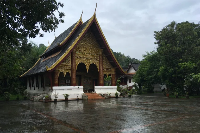
Photo: Christophe95 · Wikimedia Commons source · CC BY-SA 4.0 · Cropped to the recorded 3:2 source rectangle and resized from the exact hash-bound source input. Wat Xieng Muan and the Heuan Chan House
Wat Xieng Muan is a working monastery at the end of a quiet residential lane off the main street of Luang Prabang, with the wooden Heuan Chan house some fifty metres down the lane toward the main street. The route stops here for the upkeep of the town's temples: the ICOMOS evaluation of 1995 records that the monuments had always been maintained according to local traditions and had been the subject of international restoration projects since 1991, and UNESCO says measures for the use of traditional wood, brick, tile and local ceramic will be strengthened. The lane is a residential street, so keep your voice down; the walk stays at the edge of the temple court and goes into neither the hall nor the house.
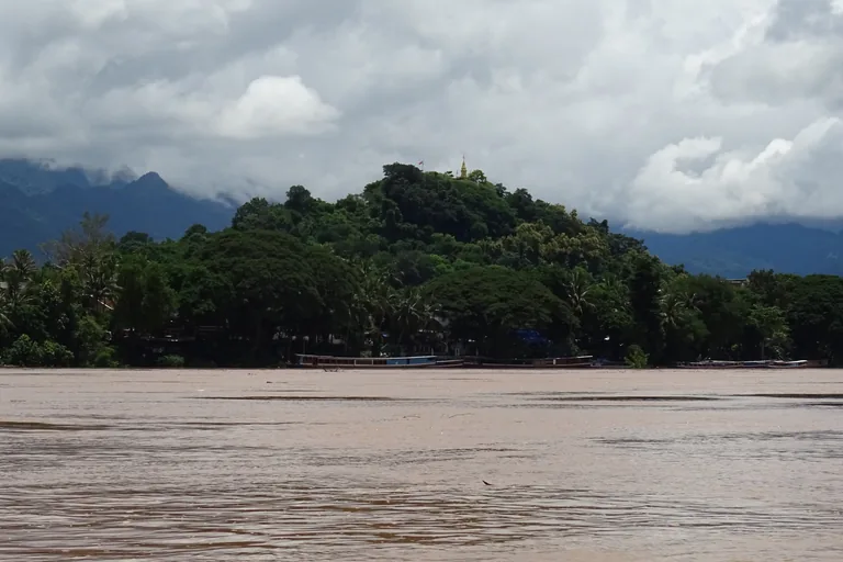
Photo: Christophe95 · Wikimedia Commons source · CC BY-SA 4.0 · Cropped to the recorded 3:2 source rectangle and resized from the exact hash-bound source input. The Foot of Phousi
Phousi is the wooded hill at the centre of the peninsula of Luang Prabang, and this stop stands at its north east foot, on Soukkhaseum Road, a few metres off the main street. The route stops here for the lie of the land: the ICOMOS evaluation describes the town on a peninsula formed by the Mekong and its tributaries the Nam Khan and the Huai Hop, in a clay basin among limestone hills, UNESCO names the Phou Thao and Phou Nang ranges among the mountains that ring the town, and from its summit the hill looks out over the town and its rivers. The walk stays at the foot of the hill and does not climb it; the short road here carries some traffic.
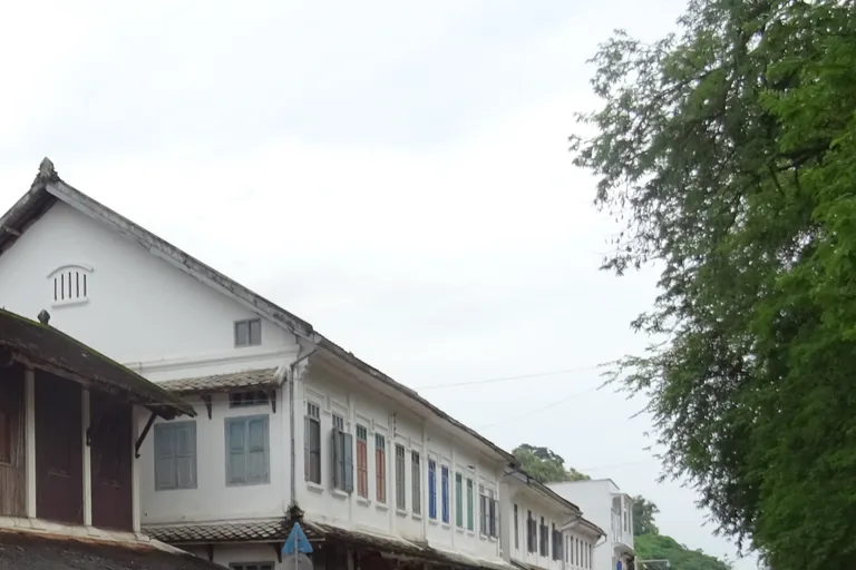
Photo: Christophe95 · Wikimedia Commons source · CC BY-SA 4.0 · Cropped to the recorded 3:2 source rectangle and resized from the exact hash-bound source input. Sakkaline Road
Sakkaline Road is the north eastern stretch of the old town's main street in Luang Prabang, running on from Sisavangvong Road toward the tip of the peninsula. The route stops here for the meeting of building traditions: the nomination of 1994 says that between 1915 and 1925 a new idea of urban planning entered the Lao town, which bears witness to exchanges between the Lao, the Vietnamese and the French, and its inventory traced a progression from Lao wooden building to colonial styles from France, Vietnam and China. At first light the monks walk this street to receive alms, and the town asks visitors who are out then to watch in silence from a distance, without flash, and never to stand higher than the monks; by day the street carries scooters, cars and tuk tuks.
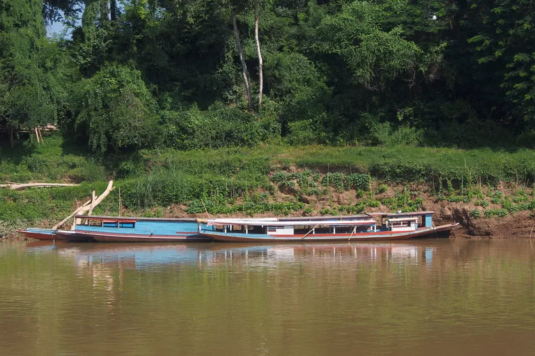
Photo: Clay Gilliland · Wikimedia Commons source · CC BY-SA 2.0 · Cropped to the recorded 3:2 source rectangle and resized from the exact hash-bound source input. The Nam Khan
The Nam Khan is the lesser river of the two that bound the peninsula of Luang Prabang, and this stop is on Kingkitsarath Road above its town bank, where steps go down to the water. The route stops here for Henri Mouhot, born in Montbéliard in 1826, who taught French in Russia and worked as a photographer with his brother before he sailed from London in April 1858 and made four journeys from Bangkok, and whose notes, the archives of his home town add, were published after his death, in 1863, in the magazine Le Tour du monde. Keep to the road at the top of the bank: the steps and the bank below are uneven and loose, and the walk does not go down to the water.
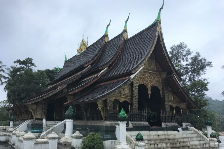
Photo: Christophe95 · Wikimedia Commons source · CC BY-SA 4.0 · Cropped to the recorded 3:2 source rectangle and resized from the exact hash-bound source input. Wat Xieng Thong
Wat Xieng Thong is a royal monastery on the northern tip of the peninsula of Luang Prabang, and this stop stands on the Mekong road at the head of the river stairs, outside its compound wall. The route stops here for the temple's later history: a library for the scriptures was added in 1880 and a drum tower in 1961, a reclining Buddha went to Paris for the exhibition of 1931 and came back from Vientiane in 1964, and renovations in 2012 and 2013 cleaned the building and repainted its gold stencils. The walk stays on the road outside the temple wall; if you go into the compound, cover your shoulders and knees, take off your shoes before entering a hall, and check entry and hours locally.
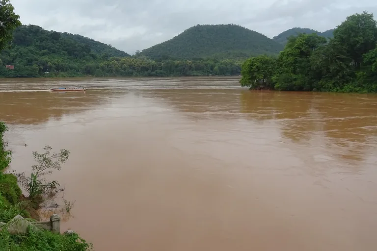
Photo: Christophe95 · Wikimedia Commons source · CC BY-SA 4.0 · Cropped to the recorded 3:2 source rectangle and resized from the exact hash-bound source input. The Meeting of the Rivers
The Meeting of the Rivers is the viewpoint at the tip of the peninsula of Luang Prabang, at the end of the Mekong road, where the Nam Khan runs into the Mekong. The route ends here for the rivers' wider story: the French Mekong expedition, which had left Saigon in June 1866, set out again from this town on 25 May 1867 with its passports for China, and the Mekong giant catfish, which can grow to about three metres and, once grown, has no teeth and feeds on algae, may not legally be fished in the wild in Laos. Stay on the viewpoint above the water, since the steps and the bank below are steep and loose; the Mekong road leads back toward the main street, where tuk tuks wait for the way back.


Local context
Before you go
The walk is a line of about 2.4 km on foot along the old town's main street, Sisavangvong Road and then Sakkaline Road, from the pavement by the Tourist Information Centre at its south west end to the viewpoint at the tip of the peninsula, with short detours into a temple lane and down to the riverside roads on the Nam Khan and the Mekong. The end is about a kilometre and a half from the start, and tuk tuks wait at the start and along the main street for the way back.
On the ground
Access and surfaces
A line of about 2.4 km on foot; allow an hour and a half with the audio. The main street is flat, with short slopes down to the riverside roads and a short residential lane to Wat Xieng Muan. Pavements are narrow and uneven in places, with kerbs and drains, and scooters, cars and tuk tuks use the streets, so take care at crossings. At the Nam Khan and at the tip the banks have steps and loose ground: keep to the road and do not go down to the water. The town is hot and sunny through much of the year, with heavy rain in the wet season, roughly May to October, so bring water, a hat and something for the rain. The temples are working places of worship and the walk stays outside them; if you go in, cover your shoulders and knees, take off your shoes before entering a temple hall, keep your voice down and do not photograph monks or people at prayer close up. Some temples and the palace museum ask a fee to enter and their hours change, so check locally. If you are out at first light, when the monks walk the main street to receive alms, the town asks visitors to watch quietly from a distance, without flash, and never to stand higher than the monks.
Frequently asked
Plan the walk
- How long is the Luang Prabang audio walking tour?
- Allow about 90 minutes. The route covers 2.4 km (1.5 mi) in 9 stops, including walking and listening time, flat along the main street with short slopes down to the two rivers.
- Where does the Luang Prabang tour start and end?
- It starts by the Tourist Information Centre on Sisavangvong Road, where the main street begins and the night market sets up, and ends at the viewpoint at the tip of the peninsula, about a kilometre and a half from the start; tuk tuks wait along the main street for the way back.
- Can I go inside the temples and the palace?
- The walk stays outside, and each stop works from the street, a gate or the riverside road. If you go into a temple, cover your shoulders and knees and take off your shoes before entering a hall; some temples and the palace museum ask a fee and their hours change, so check locally.
- What should I bring for the walk?
- Water and a hat for the sun, and something for the rain in the wet season, roughly May to October. Wear shoes with a good grip for the narrow, uneven pavements, and keep to the road above the steps on the riverbanks.