Granada · Andalusia, Spain
Granada — The City Before the Palace
Everyone climbs the Albaicín to look at the Alhambra.
Narration in English · Stop 1 is free
 Tour no. 16
- Stops
- 12
- Distance
- 2.9 km (1.8 mi)
- Time
- About 150 minutes
- Route
- Moderate walking route
Listen before you buy
Stop 1 · Plaza Nueva and the Church of Santa Ana
Stop 1 is free. Listen before you buy.
The walk
A self-guided audio tour of Granada
Everyone climbs the Albaicín to look at the Alhambra. This walk is about the hill itself: Granada's first capital, walled by the Zirid kings a good two centuries before the palace across the valley was begun, and the quarter where Muslim Spain lasted longest — through a bathhouse nearly a thousand years old, the street along the river, a church grown over the quarter's Great Mosque, the market gate where confiscated false weights were left, the palace of the last sultan's mother, and the famous viewpoint where a brand-new mosque now shares the hilltop. It ends downhill, through the street of the tea houses.
Route notes
The stops
About each stop · narration stays in the app
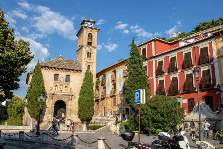
Photo: Rumomo · Wikimedia Commons source · CC BY-SA 4.0 · Cropped to the recorded 3:2 source rectangle and resized from the original. Plaza Nueva and the Church of Santa Ana
Plaza Nueva is the broad civic terrace laid over the Darro beside the sixteenth-century Church of San Gil y Santa Ana, whose brick tower recalls a minaret. The route starts here because the square is the hinge between the lower city, the Alhambra road and the Albaicín river corridor. The plaza and church exterior are free to see; the paving and riverward route become narrower and less even from here.
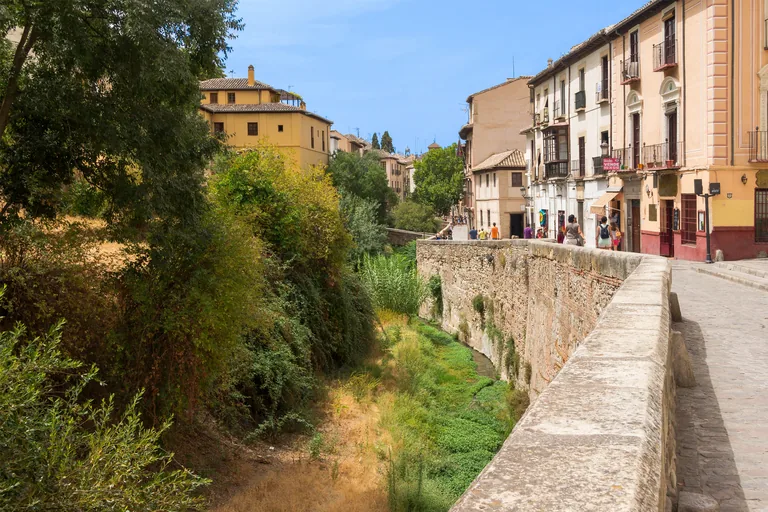
Photo: Jebulon · Wikimedia Commons source · CC0 · Cropped to the recorded 3:2 source rectangle and resized from the original. Carrera del Darro
Carrera del Darro is the narrow riverside street running beneath the Alhambra along bridges, surviving historic houses and the edge of the Albaicín. The route follows it to keep the Darro valley visible as the physical divide and connection between palace hill and neighbourhood. The lane is public but confined, cobbled and shared with local traffic, so step aside at wider points rather than blocking doorways.
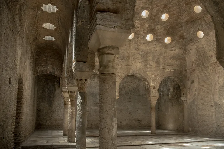
Photo: Antonio Martínez · Wikimedia Commons source · CC BY-SA 4.0 · Cropped to the recorded 3:2 source rectangle and resized from the original. El Bañuelo
El Bañuelo is an exceptionally well-preserved Andalusi bathhouse, probably dating from the eleventh century, with vaulted rooms lit by star- and octagon-shaped openings. It is the route's first interior because the sequence of cold, warm and hot rooms makes everyday urban infrastructure tangible. Admission and opening arrangements can change, and the historic thresholds and floor levels make parts of the interior difficult to access.
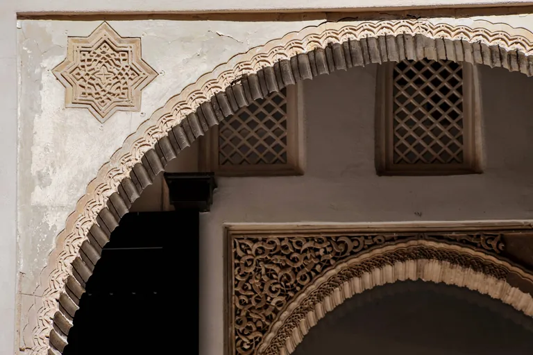
Photo: Junta Granada Informa from Granada, España · Wikimedia Commons source · CC BY-SA 2.0 · Cropped to the recorded 3:2 source rectangle and resized from the original. Casa de Zafra
Casa de Zafra is a Nasrid courtyard house later adapted after the Christian conquest, preserving domestic rooms, arches and a garden behind an unassuming lane façade. The route includes it to shift the story from public monuments to the private architecture that organised family life in the Albaicín. The exterior is easy to miss; interior access is ticketed or combined with other Andalusi monuments and should be checked in advance.
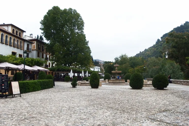
Photo: Palickap · Wikimedia Commons source · CC BY-SA 4.0 · Cropped to the recorded 3:2 source rectangle and resized from the original. Paseo de los Tristes
Paseo de los Tristes is the riverside esplanade below the Alhambra, formally named Paseo del Padre Manjón and centred on a seventeenth-century fountain. The route pauses here because the open view explains the steep relationship between the Darro settlement and the palace walls above. The promenade is free and has places to rest, but summer sun and busy restaurant terraces can make midday uncomfortable.
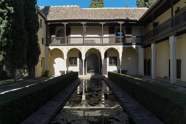
Photo: José Luis Filpo Cabana · Wikimedia Commons source · CC BY-SA 4.0 · Cropped to the recorded 3:2 source rectangle and resized from the original. Casa del Chapiz
Casa del Chapiz combines two sixteenth-century Morisco houses that reused Nasrid forms around courtyards, pools and hillside gardens. It marks the climb into the upper Albaicín and shows how elite domestic building continued across the political break after 1492. The entrance is ticketed and the site includes slopes, steps and garden surfaces; the street approach itself is steep.
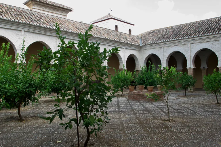
Photo: José Luis Filpo Cabana · Wikimedia Commons source · CC BY 4.0 · Cropped to the recorded 3:2 source rectangle and resized from the original. Colegiata del Salvador
The Colegiata del Salvador was built on the Albaicín's former congregational mosque and preserves the mosque courtyard beside its Christian church fabric. The route includes it because the surviving courtyard makes religious conversion and architectural continuity readable in one place. The exterior and surrounding plaza are public; church access follows worship and visitor hours that may change.
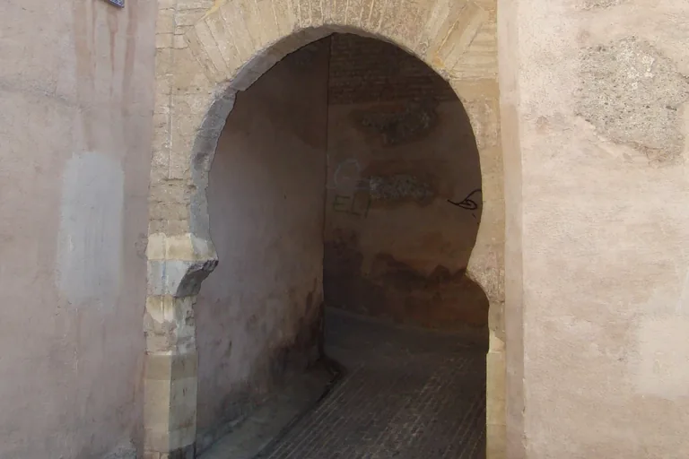
Photo: Arco de las Pesas.JPG : Pepepitos derivative work: Stegop · Wikimedia Commons source · Public domain · Cropped to the recorded 3:2 source rectangle and resized from the original. Plaza Larga and the Arco de las Pesas
Plaza Larga is the upper Albaicín's market square beside the Arco de las Pesas, a fortified gate surviving from the neighbourhood's medieval walls. The route pairs them to show how a defensive threshold became part of an everyday commercial centre rather than an isolated monument. Both are open-air, but the ascent is steep and market activity can constrict the square and gate passage.
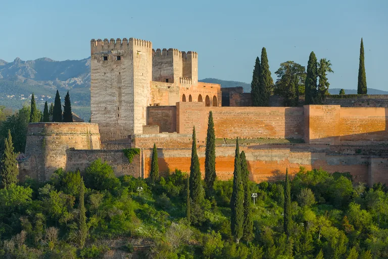
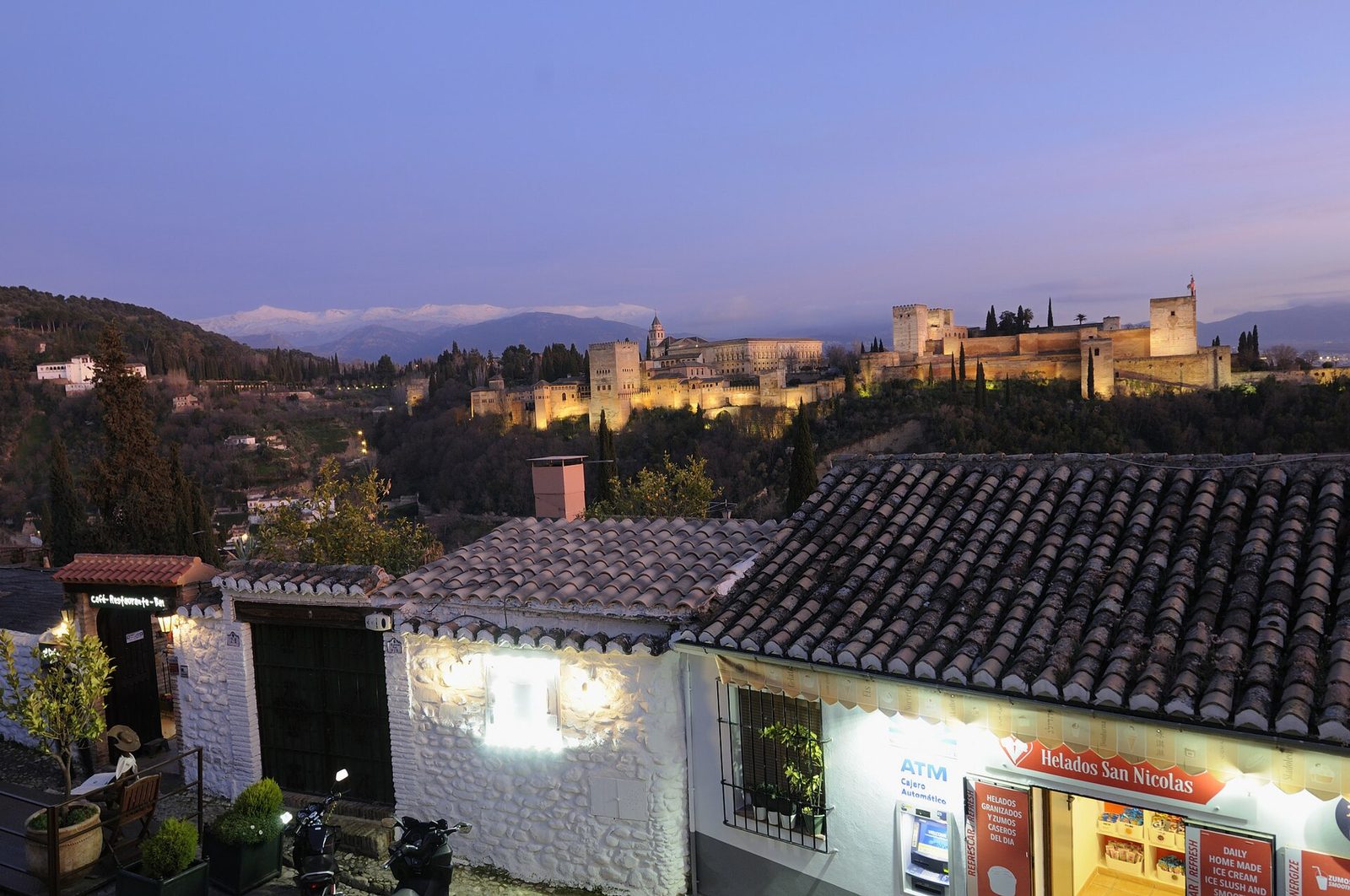
Photo: Benjamin Smith · Wikimedia Commons source · CC BY-SA 4.0 · Cropped to the recorded 3:2 source rectangle and resized from the original. Mirador de San Nicolas
Mirador de San Nicolas is the Albaicín terrace facing the Alhambra across the Darro valley with the Sierra Nevada beyond. The route stops here because the panorama gathers the geography of the entire walk into one view after the long climb. The viewpoint is free and step-free from parts of the plaza, but it is busiest around sunset and offers little shelter.
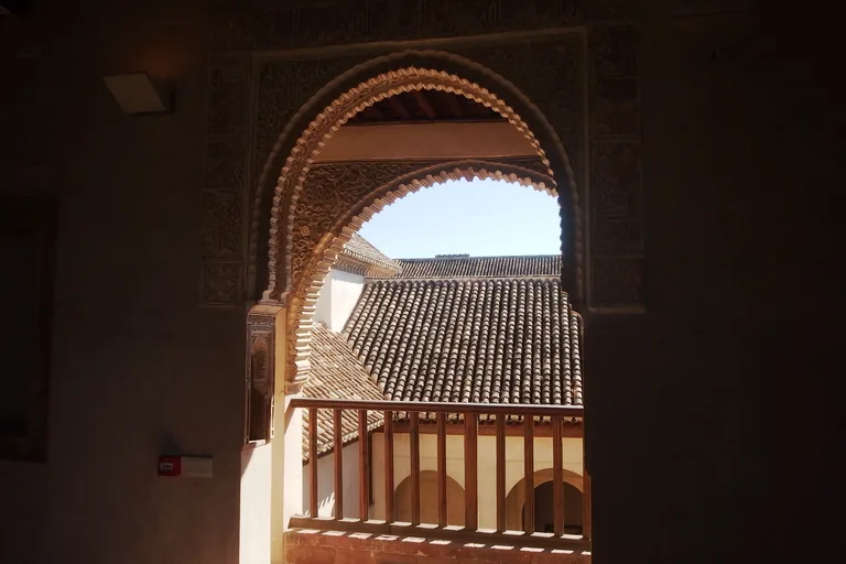
Photo: Palickap · Wikimedia Commons source · CC BY-SA 4.0 · Cropped to the recorded 3:2 source rectangle and resized from the original. Dar al-Horra
Dar al-Horra is a fifteenth-century Nasrid residence traditionally associated with Aixa, mother of the last Nasrid ruler, built around an intimate courtyard. It follows the public viewpoint to return the route to a secluded palace whose restrained scale contrasts with the Alhambra across the valley. Entry is ticketed and the approach uses steep, uneven lanes; check the monument's current opening window before climbing to it.
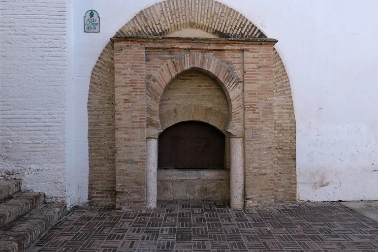
Photo: Jl FilpoC · Wikimedia Commons source · CC BY 4.0 · Cropped to the recorded 3:2 source rectangle and resized from the original. Plaza de San Miguel Bajo
Plaza de San Miguel Bajo is a neighbourhood square anchored by a sixteenth-century church and surrounded by the domestic fabric of the lower Albaicín. The route includes it as a resting point where post-conquest parish life and present-day social use occupy the same open space. The square is free and has seating and cafés, though terraces and local events can reduce clear space.
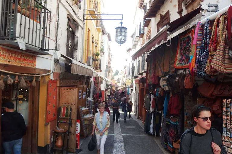
Photo: Palickap · Wikimedia Commons source · CC BY-SA 4.0 · Cropped to the recorded 3:2 source rectangle and resized from the original. Caldereria Nueva
Caldereria Nueva is the steep market lane descending from the Albaicín toward the cathedral quarter, its modern tea houses and shops occupying an old commercial connection. It closes the route by returning from hillside houses and viewpoints to the trading movement of central Granada. The lane is public but narrow, crowded and stepped in places, so it is not a quiet or barrier-free finish.


.jpg)

.jpg)
.jpg)


.jpg)

.jpg)
Local context
Before you go
The published route starts at Calle Santa Ana, 1, 18010 Granada, España. It begins at Plaza Nueva and the Church of Santa Ana and ends at Caldereria Nueva.
On the ground
Access and surfaces
A hill walk: the route climbs ~100 m from the river to the upper quarter on stepped, cobbled lanes, with one sustained climb (Cuesta del Chapiz) and a steep stepped descent at the end. Between climbs the stops sit on level squares and the riverside promenade. All stops are written to work from free public positions; the Bañuelo, Casa de Zafra, Casa del Chapiz, the Salvador and Dar al-Horra are ticketed and optional. The mirador stretch is heavily crowded at sunset.
Frequently asked
Plan the walk
- How long is the Granada audio walking tour?
- Allow about 150 minutes. The self-guided route covers 2.9 km (1.8 mi) in 12 stops, including walking and listening time.
- Where does the Granada tour start and end?
- It starts at Calle Santa Ana, 1, 18010 Granada, España. The published route begins at Plaza Nueva and the Church of Santa Ana and ends at Caldereria Nueva.
- Will the Granada audio tour work offline?
- Yes, after download. Audio, stop text, images, and GPS triggering work without data; the live map background still needs a connection.