Fez · Fès-Meknès, Morocco
Fez — The City Within
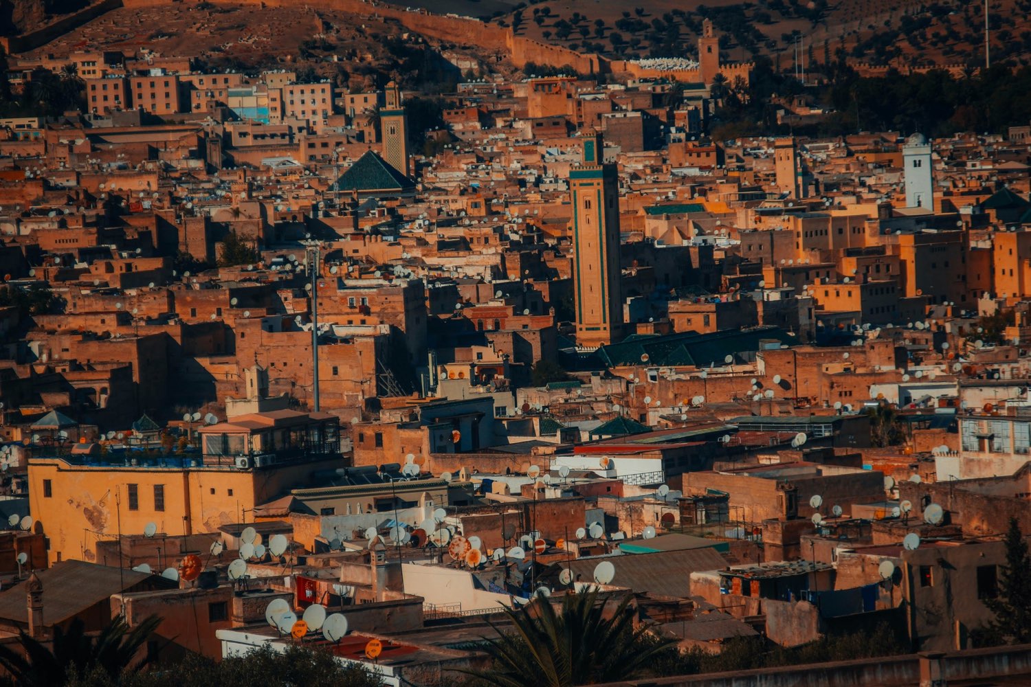
Fez el-Bali is not a museum quarter but a living city folded into a steep river valley.
Narration in English · Stop 1 is free
 Tour no. 07
- Stops
- 10
- Distance
- 2.4 km (1.5 mi)
- Time
- About 135 minutes
- Route
- Moderate walking route
Listen before you buy
Stop 1 · Bab Bou Jeloud
Stop 1 is free. Listen before you buy.
The walk
A self-guided audio tour of Fez
Fez el-Bali is not a museum quarter but a living city folded into a steep river valley. This walk follows its main commercial slope from the Blue Gate to Marinid madrasas, merchant inns, a founder's shrine, the Qarawiyyin, coppersmiths and the Chouara tanneries. It ends at R'cif, where the covered lanes open back into a civic square at the lower edge of the medina.
Route notes
The stops
About each stop · narration stays in the app
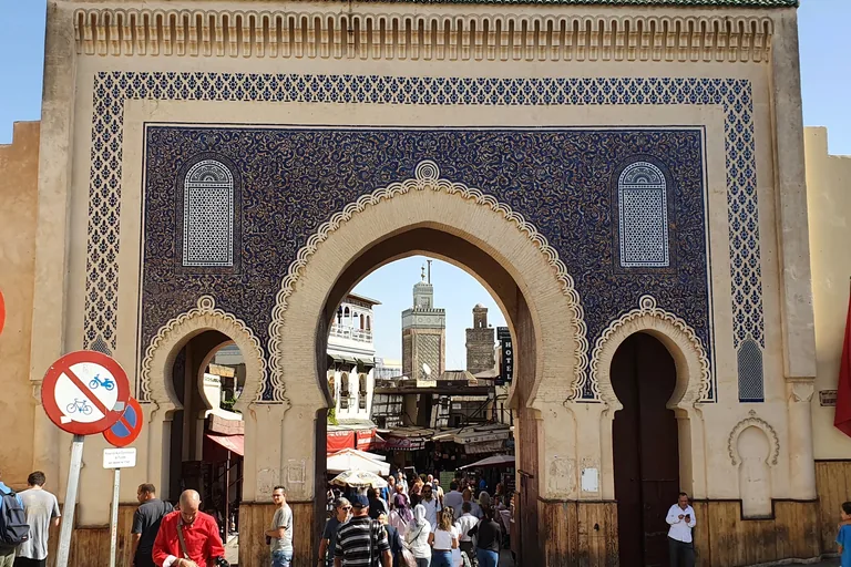
Photo: Yair Haklai · Wikimedia Commons source · CC BY-SA 4.0 · Cropped to the recorded 3:2 source rectangle and resized from the original. Bab Bou Jeloud
Bab Bou Jeloud is the blue-and-green triple gateway built in 1913 beside Fez's smaller, older western entrance. The route starts here because the two gates make the difference between a modern ceremonial image and the medina's older fabric immediately visible. The gateway is open-air and marks the point where vehicle access gives way to a steep, busy walking route.
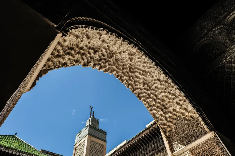
Photo: Petar Milošević · Wikimedia Commons source · CC BY-SA 4.0 · Cropped to the recorded 3:2 source rectangle and resized from the original. Bou Inania Madrasa
Bou Inania Madrasa is a Marinid school and Friday mosque built between 1350 and 1355, with a minaret, student rooms, carved cedar, stucco, zellij and a water channel gathered around one courtyard. It is the route's first major interior because it shows religious teaching, public worship and royal display operating in the same compact complex. The entrance works as an exterior stop, while interior access may require a ticket and can close without notice.
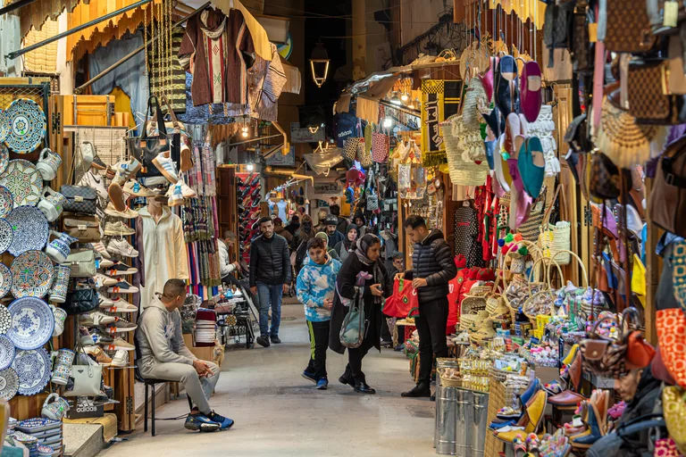
Photo: Jorge Franganillo · Wikimedia Commons source · CC BY 2.0 · Cropped to the recorded 3:2 source rectangle and resized from the original. Tala'a Kebira
Tala'a Kebira, the Great Slope, is one of the medina's main market streets, linking Bab Bou Jeloud with the Qarawiyyin quarter through shops, funduqs and residential side lanes. The route follows it to make Fez legible as a working commercial city rather than a collection of isolated monuments. Expect a steep, crowded lane with uneven paving and shared handcart or pack-animal traffic.
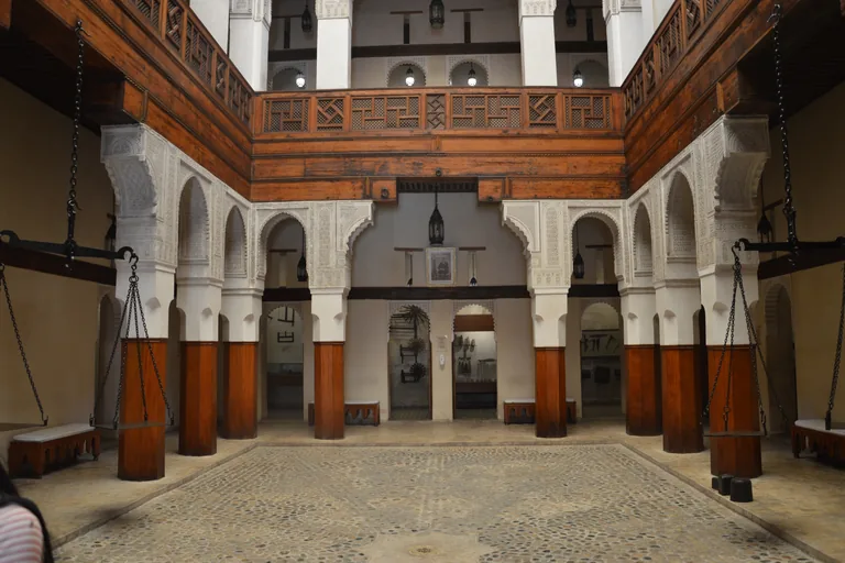
Photo: Oumaima Loudini · Wikimedia Commons source · CC BY-SA 4.0 · Cropped to the recorded 3:2 source rectangle and resized from the original. Funduq al-Najjarin
Funduq al-Najjarin is an early-eighteenth-century merchant inn where goods and animals occupied the lower level and travelling traders lodged above. The route includes it because its restored courtyard turns the medina's trading infrastructure into an architectural set-piece, now used as a museum of wooden arts and crafts. The square and façade are freely visible; the museum, upper galleries and roof require admission and stairs.
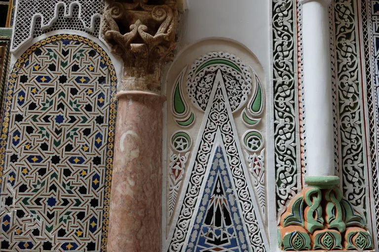
Photo: R Prazeres · Wikimedia Commons source · CC BY-SA 4.0 · Cropped to the recorded 3:2 source rectangle and resized from the original. Zawiya of Moulay Idris II
The Zawiya of Moulay Idris II is the sanctuary built around the tomb traditionally attributed to the ruler associated with Fez's early growth. This stop sits at the route's sacred and civic hinge, where a narrow market approach opens onto a place central to the city's devotional identity. The tour remains at the public exterior threshold; non-Muslim visitors should not enter the restricted sanctuary or photograph worshippers.
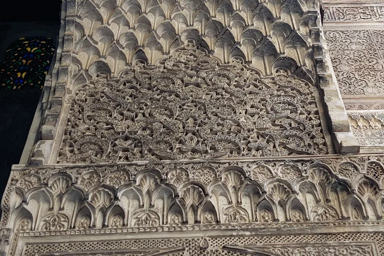
Photo: SanaaSSAF · Wikimedia Commons source · CC BY-SA 4.0 · Cropped to the recorded 3:2 source rectangle and resized from the original. Al-Attarine Madrasa
Al-Attarine Madrasa is a compact Marinid school built in 1323–1325 beside the spice and perfume market, with student rooms arranged around an exceptionally dense decorated courtyard. It follows the shrine to show how teaching, craft and the Qarawiyyin institution were fitted into a much tighter urban plot than Bou Inania. The narrow approach and raised threshold are visible without entry; interior access may require a ticket and includes stairs.
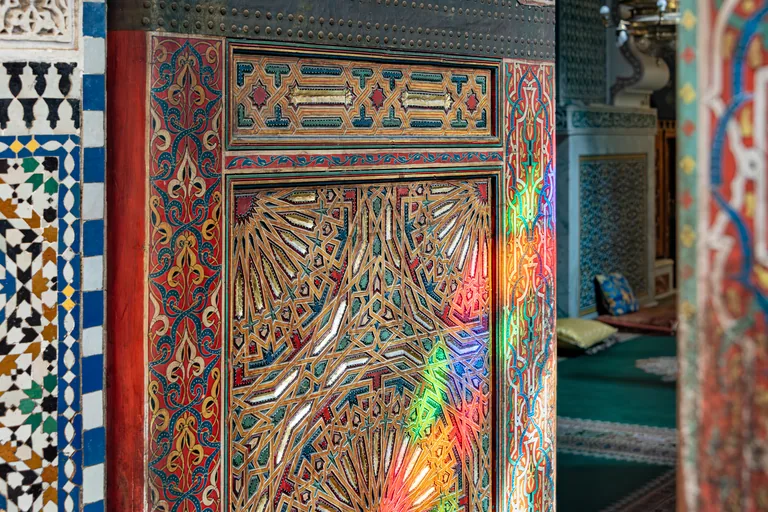
Photo: Jorge Franganillo · Wikimedia Commons source · CC BY 2.0 · Cropped to the recorded 3:2 source rectangle and resized from the original. Al-Qarawiyyin Mosque
Al-Qarawiyyin began as a mosque in the ninth century and grew through successive enlargements into Fez's principal centre of religious learning; the modern state university dates from 1963. The route reaches it as the intellectual and spatial centre of the medina, without relying on the disputed shorthand that it is simply the world's oldest university. This is an exterior-only stop at a busy public threshold because non-Muslim access to the mosque is generally restricted.
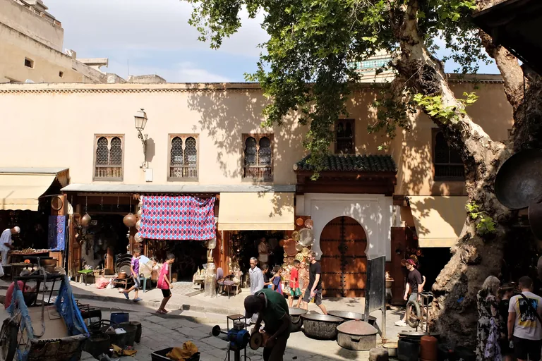
Photo: R Prazeres · Wikimedia Commons source · CC BY-SA 4.0 · Cropped to the recorded 3:2 source rectangle and resized from the original. Place Seffarine
Place Seffarine is the small working square long associated with Fez's coppersmiths, beside the Qarawiyyin library, a madrasa, a hammam and the river corridor. The route pauses here because visible metalwork and the sound of hammering reveal a craft district still doing practical work. Activity varies by time of day, so do not count on workshops operating; keep clear of work areas and delivery paths.
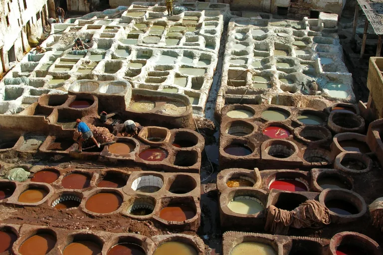
Photo: Bernard Gagnon · Wikimedia Commons source · CC BY-SA 3.0 · Cropped to the recorded 3:2 source rectangle and resized from the original. Chouara Tanneries
Chouara is Fez's largest surviving historic tannery complex, where hides move through soaking, softening, dyeing and drying before reaching leatherworkers. It is the working-city climax of the route, included for the organisation of labour, water and surrounding workshops rather than for a guaranteed terrace view. The required stop is on public Rue Smmat Laadoul; private shop terraces are optional, involve stairs and sales pressure, and are not part of the route.
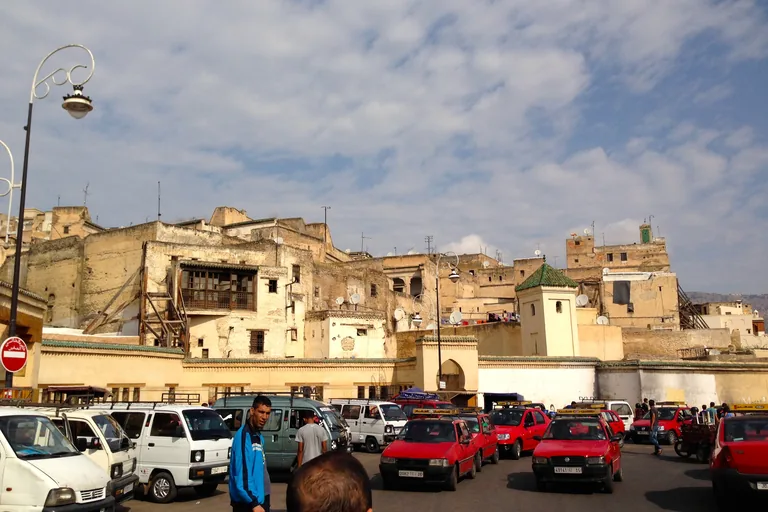
Photo: Andrew Nash from Vienna, Austria · Wikimedia Commons source · CC BY-SA 2.0 · Cropped to the recorded 3:2 source rectangle and resized from the original. Place R'cif
Place R'cif is a twentieth-century civic opening beside R'cif Mosque at the lower edge of the medina, where narrow lanes meet a broader transport threshold. The route ends here because the square shows how historic Fez connects to the contemporary city without confusing the square, mosque and Bab R'cif gate. The square is open-air, but the approach remains uneven and traffic increases sharply at its outer edge.


.jpg)
.jpg)


.jpg)


.jpg)
Local context
Before you go
The published route starts at Bab Bou Jeloud, Place Boujloud, Fès, Maroc. It begins at Bab Bou Jeloud and ends at Place R'cif.
On the ground
Access and surfaces
The medina route uses steep, narrow and often crowded lanes with uneven paving, thresholds and occasional steps; it is not reliably wheelchair-accessible. Motor traffic is limited inside the old city, but handcarts, pack animals and delivery traffic share the lanes. Religious interiors may be closed to non-Muslims, and museums or madrasas may change hours or close for prayer and restoration; every stop is written to work from a respectful public exterior position. Chouara is narrated from a public approach lane; optional private terrace visits can involve sales pressure and stairs and are not required.
Frequently asked
Plan the walk
- How long is the Fez audio walking tour?
- Allow about 135 minutes. The self-guided route covers 2.4 km (1.5 mi) in 10 stops, including walking and listening time.
- Where does the Fez tour start and end?
- It starts at Bab Bou Jeloud, Place Boujloud, Fès, Maroc. The published route begins at Bab Bou Jeloud and ends at Place R'cif.
- Will the Fez audio tour work offline?
- Yes, after download. Audio, stop text, images, and GPS triggering work without data; the live map background still needs a connection.