Essaouira · Marrakech-Safi, Morocco
Essaouira — The Sultan's Port
An audio walk through Essaouira, from the fishing harbour and the sea gate through the merchants' Kasbah and the Jewish quarter to the caravan gate.
Narration in English · Stop 1 is free
 Tour no. 37
- Stops
- 10
- Distance
- 2.5 km (1.6 mi)
- Time
- About 100 minutes
- Route
- Easy city route
Listen before you buy
Stop 1 · Port of Essaouira
Stop 1 is free. Listen before you buy.
The walk
An audio tour from the fishing harbour through the sea gate, the merchants' Kasbah and the Mellah to the caravan gate, at your own pace
Essaouira was drawn before it was built: in the 1760s the sultan Sidi Mohammed ben Abdallah chose a windswept shore beside an island and a ruined Portuguese castle for a new royal port to trade with the world, and its older name, Mogador, gave way to Essaouira at independence. The walk starts on the quay of the fishing harbour that still works, where traditional boats are built and repaired by the old methods and the stone platform of the Skala du Port was built with stones from the Portuguese castle. It goes through Bab el Marsa, the sea gate that an Englishman who had become a Muslim built in 1769 to 1770, across Place Moulay Hassan, the stop for the Gnawa, whose music UNESCO inscribed in 2019, and through the clock tower gate into the Kasbah, where the sultan set up about ten Jewish merchant families as royal merchants beside the European consuls.
Bayt Dakira, the House of Memory, keeps the synagogue of Simon Attias, built in 1882 with woodwork carved in London, and tells the story of a community that at some periods made up a large share of the town; by the end of the twentieth century almost none of it remained. On the sea rampart, woodworkers inlay thuya wood in rooms that were built to store gunpowder beneath the cannons. The route then enters the Mellah, the Jewish quarter that a later sultan, Moulay Slimane, ordered early in the nineteenth century, and stops at Slat Lkahal, the synagogue its people built from 1850 with money collected at funerals, reopened at the end of 2017. It stops at Bab Doukkala, the way out to the seaside cemetery where pilgrims come every year to the grave of Rabbi Haim Pinto, crosses the market streets of Souk Jdid, and ends at Bab Marrakech, the caravan gate of a town once nicknamed the port of Timbuktu.
Route notes
The stops
About each stop · narration stays in the app
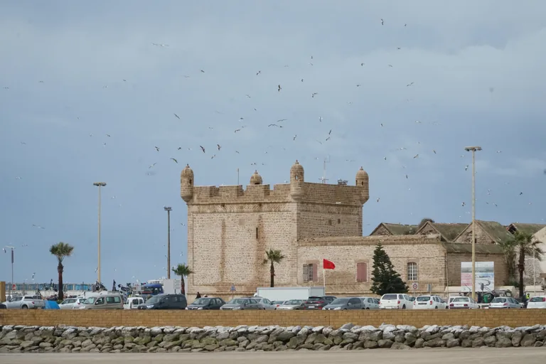
Photo: Adam Harangozó · Wikimedia Commons source · CC BY-SA 4.0 · Cropped to the recorded 3:2 source rectangle and resized from the exact hash-bound source input. Port of Essaouira
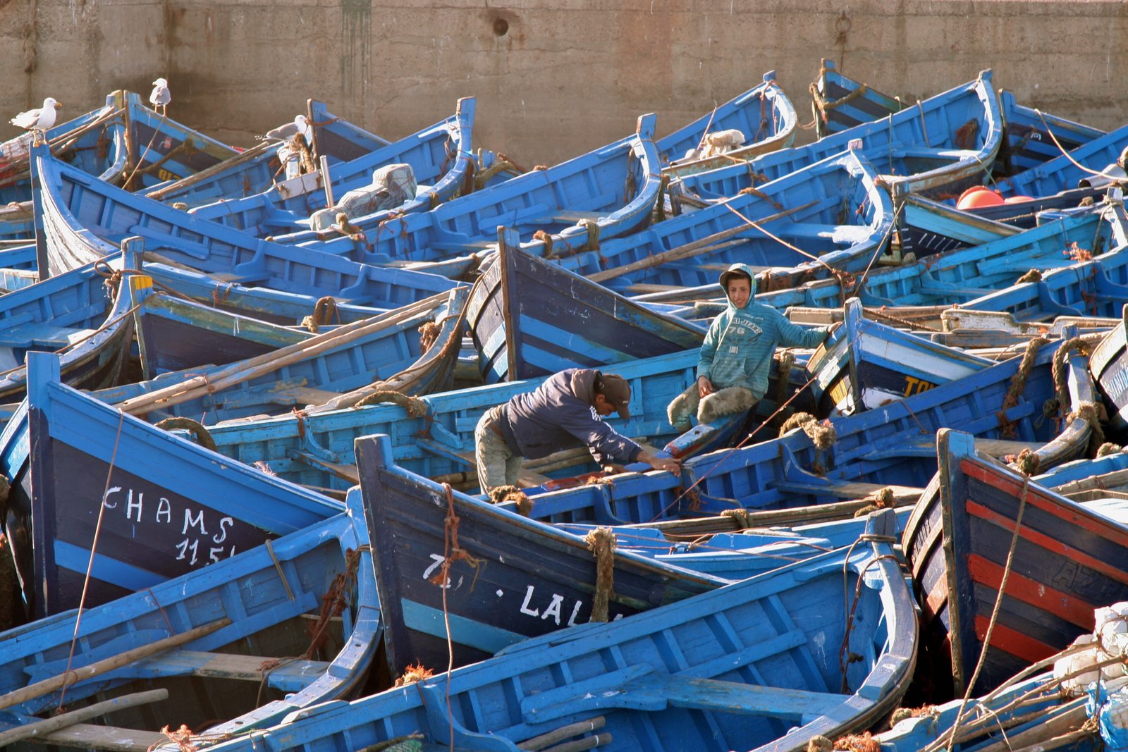
The Port of Essaouira is the town's fishing harbour, guarded on its seaward side by the Skala du Port, an artillery platform of two fortified wings, each about 200 metres long, that has been a listed historic monument since 1924. The walk begins on the quay because the town was laid out as a port to control the maritime trade of the south: the sultan made the European consuls at Safi, Agadir and Rabat move here, and the island about one and a half kilometres offshore was later used, from 1866, as a quarantine station for pilgrims coming home from the Hajj. It is a working port where forklifts, carts and fish crates cross the quay and the ground near the fish stalls is wet and slippery, and the Skala du Port platform charges a small entry fee and keeps its own hours.
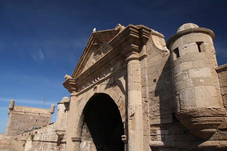
Photo: yeowatzup · Wikimedia Commons source · CC BY 2.0 · Cropped to the recorded 3:2 source rectangle and resized from the exact hash-bound source input. Bab el-Marsa
Bab el Marsa, the Sea Gate, is the stone gate that leads from the harbour into the town; it is about 10.6 metres wide, and like the port platform it has been a listed historic monument since 1924. The route passes through it because it stands at the middle of the harbour front, a group of batteries, customs house and dock that ends in a square tower at each side, and nearby a stone bridge of five arches, its central keystone carved with an inscription in the gate's own style, joins the port platform to the rest of the sea walls. The gate opens on a road junction with port traffic and parked vehicles, so cross with care.
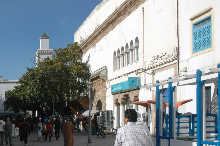
Photo: DimiTalen · Wikimedia Commons source · CC0 1.0 · Cropped to the recorded 3:2 source rectangle and resized from the exact hash-bound source input. Place Moulay Hassan
Place Moulay Hassan is the long open square between the harbour gate and the Kasbah, lined with cafés and terraces, with the old mosque, Jama el Atiq, at its centre, known by its doorway of cut stone. The route crosses it as the place where the town meets and as the stop for the Gnawa, whose groups in towns and cities, by UNESCO's account, wear colourful embroidered costumes, and whose associations hold local, regional, national and international festivals through the year. It is an open paved square with café terraces, busy in the evening and very crowded during the June festival.
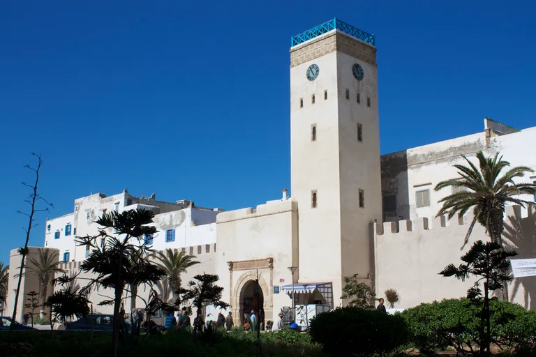
Photo: Patrick Nouhailler · Wikimedia Commons source · CC BY-SA 3.0 · Cropped to the recorded 3:2 source rectangle and resized from the exact hash-bound source input. Clock tower gate
The clock tower gate, also called Bab Mohamed Ou Messaoud or Bab al Magana, is the main gate of the old Kasbah and shares the open ground of the méchouar with Bab Sbaa, the Lion Gate. The route goes through it into the quarter of the consuls and the royal merchants, where the house of the Danish consulate, built from 1766 and one of the town's historic buildings, still stands near the former Dutch consulate, and where Jacob Guedalla, one of the first merchants to settle in the Kasbah, was the first Jew to receive a permit to build a house. The gate is a narrow passage shared with hand carts and scooters, and most of the merchants' great houses inside have since been turned into guesthouses and hotels.
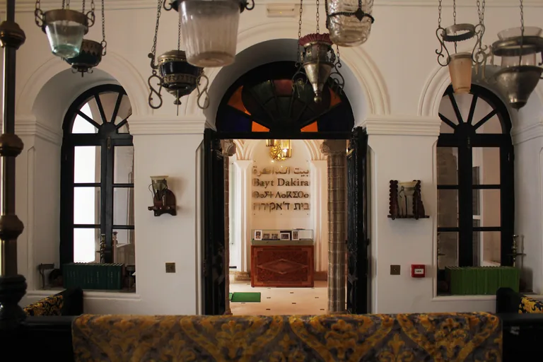
Photo: Nassima Chahboun · Wikimedia Commons source · CC BY-SA 4.0 · Cropped to the recorded 3:2 source rectangle and resized from the exact hash-bound source input. Bayt Dakira
Bayt Dakira, the House of Memory, is a museum of Jewish life in Essaouira built around the restored synagogue of Simon Attias, also called Slat Attia, which stands at the entrance to a broad covered street in the Kasbah. The route stops at its building: a single large door in a horseshoe arch leads into the courtyard house, where the prayer hall rises two storeys with large round arched windows and a women's gallery, and ICOMOS, in its 2001 evaluation of the medina, named this synagogue among the town's main features. Bayt Dakira keeps its own opening hours and days, so the stop is made from the lane outside the big blue door.
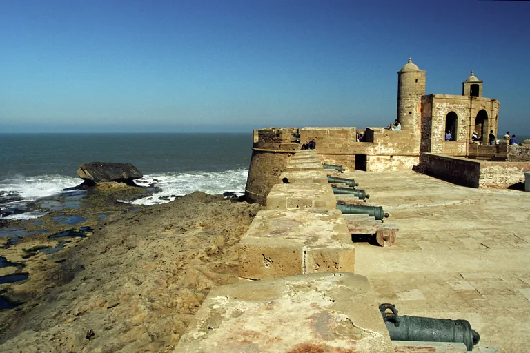
Photo: Jerzy Strzelecki · Wikimedia Commons source · CC BY 3.0 · Cropped to the recorded 3:2 source rectangle and resized from the exact hash-bound source input. Skala de la Ville
The Skala de la Ville, also called the Sqala de la Kasbah, is the town's rampart on the Atlantic, a platform of cut stone whose Spanish bronze cannons, each about 3.25 metres long, were made to fire ten pound balls about 1,500 metres. The route comes here for the woodworkers in the old stores beneath it, reached from the monumental gate called Bab al Jihad; a visitor in 2008 watched one family at work and noted that the few hand tools a woodworker showed the visitors appeared to be made from scrap metal, and that one craftsman could make four or five inlaid trays in a week. The platform is open to walk, but its edges have no railings in places and the cannons and steps are uneven; the workshops are small shops along the lane under the wall.
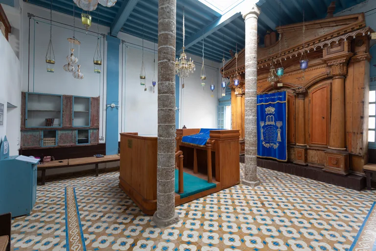
Photo: Elfathiamine · Wikimedia Commons source · CC BY-SA 4.0 · Cropped to the recorded 3:2 source rectangle and resized from the exact hash-bound source input. Slat Lkahal Synagogue
Slat Lkahal, the Synagogue of the Community, is a small synagogue at the entrance of a covered street in the Mellah, inaugurated in 1859. The route stops here for the quarter's own congregation: the building also served as a school where poor children learned Hebrew, its restoration had the support of UNESCO, and a reporter in 2018 found an exhibition of historic photographs of the town's Jewish life in the Rabbi Haim Pinto Synagogue close by. The Mellah's streets are narrow and some buildings are in ruins or propped up, so keep to the street; the synagogue opens irregularly.
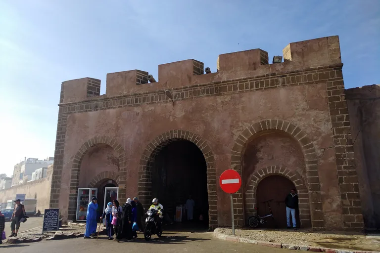
Photo: Jklamo · Wikimedia Commons source · CC BY-SA 3.0 · Cropped to the recorded 3:2 source rectangle and resized from the exact hash-bound source input. Bab Doukkala
Bab Doukkala, also called Bab Safi, is the plain gate of cut stone on the northeast side of the medina where the road to Safi leaves the town, a listed historic monument since 1924. The route comes here for what lies beyond it: the old Jewish cemetery by the sea, whose tombs, as far as they have been read, go back to 1775, and the newer cemetery opposite, officially founded on 21 December 1892, where, apart from three or four later burials, the last tombs date from 1963. Outside the gate is a busy road with a bus station and taxis; the Jewish cemeteries are a few minutes' walk beyond it along the coast road and keep their own hours.
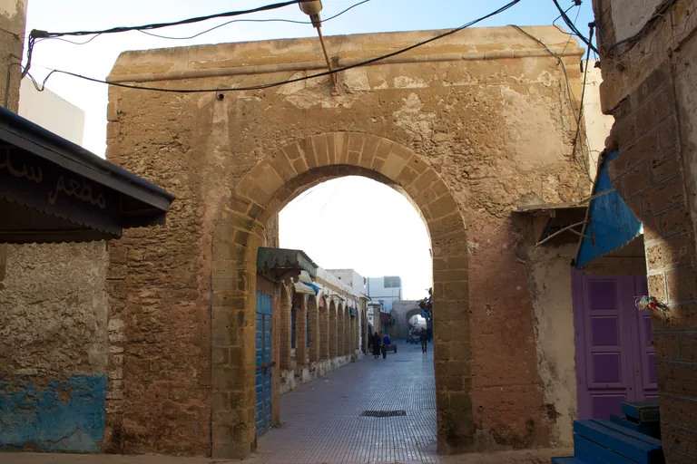
Photo: Patrick Nouhailler · Wikimedia Commons source · CC BY-SA 3.0 · Cropped to the recorded 3:2 source rectangle and resized from the exact hash-bound source input. Souk Jdid
Souk Jdid, the new market, is the crossing at the heart of the commercial street that the English traveller James Richardson called the Broadway of Morocco, where the medina's two main streets meet. The route stops here because the first town wall, drawn in 1767, ran along this market before it was moved out to its present line by Bab Marrakech, and because the trades around it included a flea market where, the town's heritage guide says, a sharp eye could once find a chased silver sabre, an English teapot or an Arabic or Hebrew manuscript. The market streets are busy with hand carts, and the covered sections are dim.
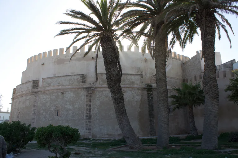
Photo: Patrick Nouhailler · Wikimedia Commons source · CC BY-SA 3.0 · Cropped to the recorded 3:2 source rectangle and resized from the exact hash-bound source input. Bab Marrakech
Bab Marrakech is the medina's land gate on its southeast side, a round arch set in a square frame of about 5.9 by 5.8 metres, with round batteries on either side, one of which, Borj Bab Marrakech, is now an art gallery. The route ends here because this was the caravan gate: in the 1840s the English traveller James Richardson found feather merchants from the Sous and the Wad Noun in town for the Jewish feasts, and Sudanic gum that Arabs brought from near Timbuktu among the goods leaving Mogador. The gate opens onto a busy road and car parks, and the bastion keeps its own hours as an exhibition space; the street back into town runs through Derb Ahl Agadir, where the square walled tomb of Sidi Abd Addaim stands on a street corner.


.jpg)

.jpg)


.jpg)
.jpg)
Local context
Before you go
The walk covers about two and a half kilometres through the medina, on the flat. It starts on the quay of the fishing harbour and ends at Bab Marrakech, the land gate on the southeast side of the medina. The streets are straight but narrow and shared with hand carts, scooters and bicycles, and the harbour is a working port with vehicles and wet ground near the fish stalls. The wind off the Atlantic is strong for much of the year, so bring a layer. Parts of the old Jewish quarter are in ruins or propped up; keep to the street.
On the ground
Access and surfaces
About two and a half kilometres on the flat, through straight but narrow streets shared with hand carts, scooters and bicycles; the harbour is a working port with vehicles and wet, slippery ground near the fish stalls. The wind off the Atlantic is strong for much of the year, so bring a layer. Every stop works from the street. The Skala du Port platform, Bayt Dakira, the synagogues and the cemeteries keep their own hours, and some charge for entry. The sea rampart has no railings in places, and parts of the old Jewish quarter are in ruins or propped up, so keep to the street.
Frequently asked
Plan the walk
- How long is the Essaouira audio walking tour?
- Allow about 100 minutes. The route covers 2.5 km (1.6 mi) in 10 stops, including walking and listening time.
- Where does the Essaouira tour start and end?
- It starts on the quay of the fishing harbour, beside the boat basin, and ends at Bab Marrakech, the land gate on the southeast side of the medina.
- Do I need to go inside the synagogues or museums?
- No. Every stop works from the street. Bayt Dakira, the synagogues, the Skala du Port platform and the cemeteries keep their own hours, and some charge for entry.
- Is the walk windy?
- Often. The wind off the Atlantic is strong for much of the year, so bring a layer.
- Will the Essaouira audio tour work offline?
- Yes, after download. Audio, stop text, images, and GPS triggering work without data; the live map background still needs a connection.