Ephesus · İzmir, Türkiye
Ephesus
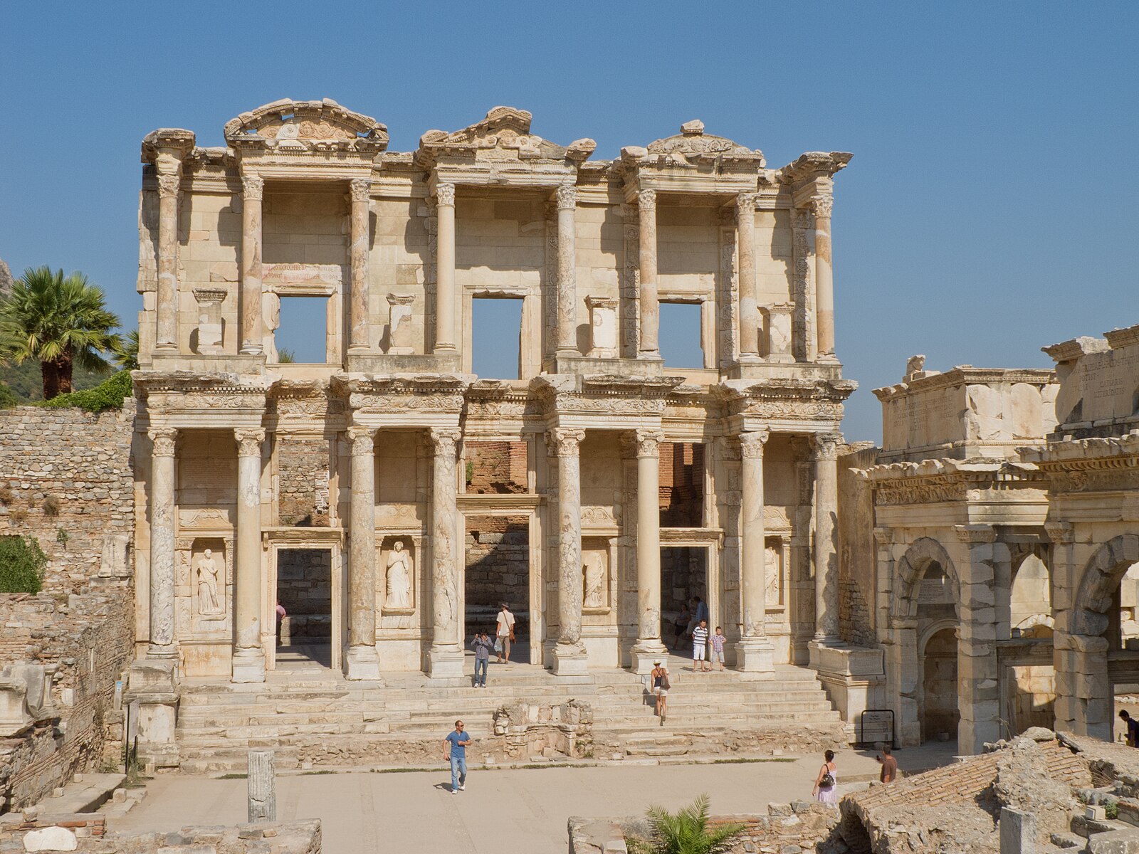
Ephesus was the Roman capital of Asia — a marble port city of temples, fountains, and a library built over its founder's tomb, home to perhaps the largest urban population on the Aegean's eastern shore.
Narration in English · Stop 1 is free
 Tour no. 23
- Stops
- 12
- Distance
- 2 km (1.2 mi)
- Time
- About 120 minutes
- Route
- Moderate walking route
Listen before you buy
Stop 1 · State Agora and Basilica Stoa
Stop 1 is free. Listen before you buy.
The walk
A self-guided audio tour of Ephesus
Ephesus was the Roman capital of Asia — a marble port city of temples, fountains, and a library built over its founder's tomb, home to perhaps the largest urban population on the Aegean's eastern shore. Its harbor silted into farmland and the city died of dry land; what the excavators uncovered is the most complete Roman streetscape in the eastern Mediterranean. Twelve stops, downhill from the state agora to the harbor avenue, ~2 km, ~2 hours.
Route notes
The stops
About each stop · narration stays in the app
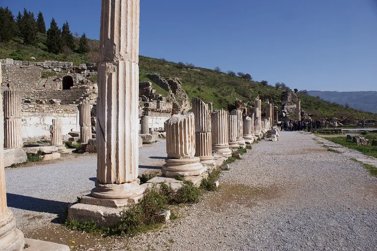
Photo: Yağmur Aydın · Wikimedia Commons source · CC BY-SA 3.0 · Cropped to the recorded 3:2 source rectangle and resized from the exact hash-bound source input. State Agora and Basilica Stoa
The State Agora was the upper city's formal civic square, bordered by stoas used for meetings, courts, teaching and public ceremony. It orients the route in Ephesus's governmental quarter before the walk descends toward commerce and the harbour. The open archaeological surface is exposed, uneven and included within the main site ticket.
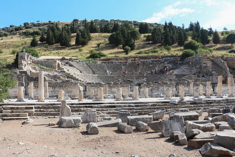
Photo: Bernard Gagnon · Wikimedia Commons source · CC BY-SA 3.0 · Cropped to the recorded 3:2 source rectangle and resized from the exact hash-bound source input. Odeon (Bouleuterion)
The Odeon was a roofed semicircular hall for roughly 1,400 people, serving both as council chamber and performance venue. Its double use makes the machinery of Ephesian self-government legible in a compact building. Stone steps and seating are uneven, and access follows the archaeological site's current route controls.
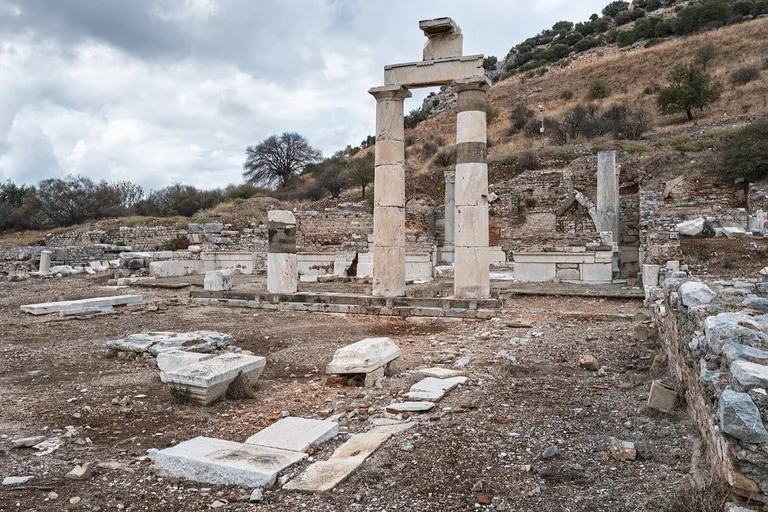
Photo: Giorgio Galeotti · Wikimedia Commons source · CC BY-SA 4.0 · Cropped to the recorded 3:2 source rectangle and resized from the exact hash-bound source input. Prytaneion
The Prytaneion housed Ephesus's civic hearth, where the sacred flame of Hestia was maintained by the city's governing and religious officials. The route includes it to place named office-holders and daily institutional practice behind the surviving columns. The remains are outdoors on uneven stone, with little shade and no interior room required.
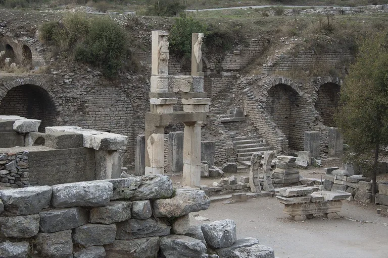
Photo: Dosseman · Wikimedia Commons source · CC BY-SA 4.0 · Cropped to the recorded 3:2 source rectangle and resized from the exact hash-bound source input. Domitian Square: Temple of Domitian and Memmius Monument
Domitian Square joins the terrace of the Flavian imperial-cult temple with the Memmius Monument, a family memorial tied to Sulla's legacy. The pairing lets the route examine imperial worship and political memory on the same urban stage. The monuments are viewed from the public archaeological path, where paving and level changes are irregular.
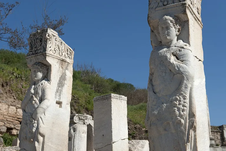
Photo: Dosseman · Wikimedia Commons source · CC BY-SA 4.0 · Cropped to the recorded 3:2 source rectangle and resized from the exact hash-bound source input. Hercules Gate
Hercules Gate narrowed Curetes Street with relief-bearing piers and later helped close the route to wheeled traffic. It provides a short threshold and the first long view down the street toward the Library of Celsus. The surviving gateway is viewed from the sloping main path and cannot be entered as a separate interior.
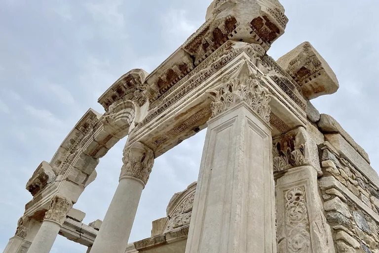
Photo: Warren LeMay from Chicago, IL, United States · Wikimedia Commons source · CC BY-SA 2.0 · Cropped to the recorded 3:2 source rectangle and resized from the exact hash-bound source input. Temple of Hadrian
The so-called Temple of Hadrian is a small, richly carved building dedicated by Publius Quintilius Valens Varius to Artemis, Hadrian and the Ephesian people. Its famous arch rewards close reading of a privately funded façade whose exact institutional role remains debated. The monument stands directly on Curetes Street and is seen from the uneven public path without entry.
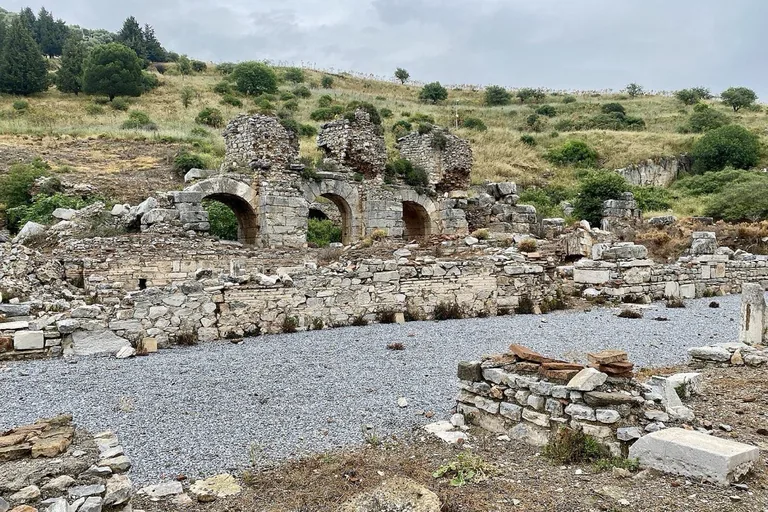
Photo: Warren LeMay from Chicago, IL, United States · Wikimedia Commons source · CC BY-SA 2.0 · Cropped to the recorded 3:2 source rectangle and resized from the exact hash-bound source input. Baths of Scholastica and the Public Latrines
The Baths of Scholastica preserve a large Roman bathing complex beside a communal latrine with dozens of closely spaced seats. This stop brings renovation, hygiene and ordinary social life into a route dominated by official monuments. Access involves ancient floors, thresholds and steps; some rooms may be closed while the street view remains available.
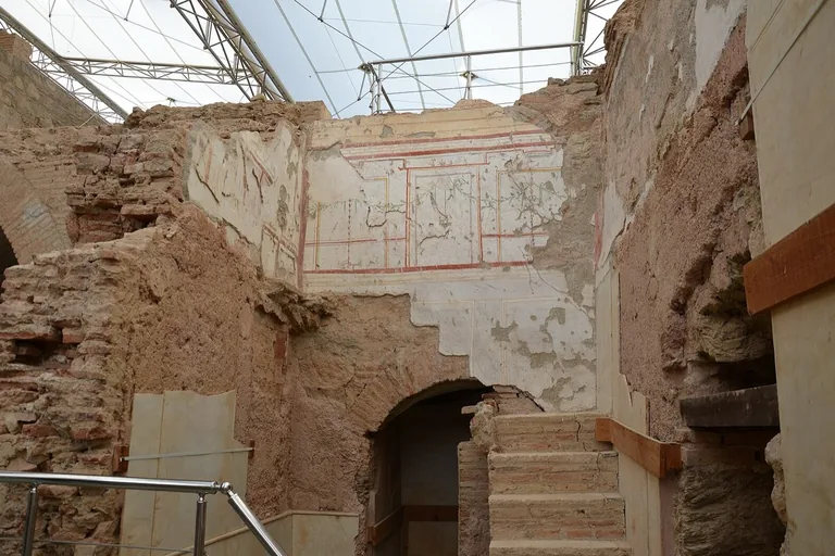
Photo: shankar s. from Dubai, united arab emirates · Wikimedia Commons source · CC BY 2.0 · Cropped to the recorded 3:2 source rectangle and resized from the exact hash-bound source input. Terrace Houses
The Terrace Houses preserve elite Roman homes with mosaics, frescoes, water systems and informal writing left on their walls. They offer the route's most intimate evidence for how wealthy Ephesians inhabited the city behind its public façades. The roofed complex requires a separate ticket and substantial stairs, but the stop remains complete from Curetes Street.
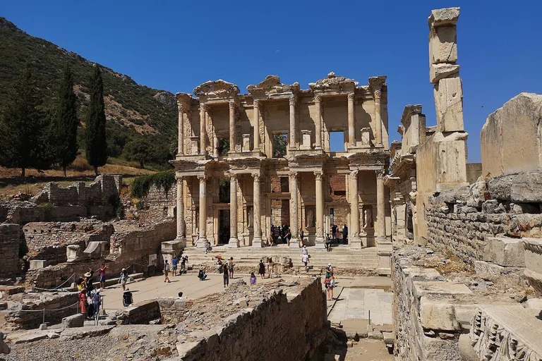
Photo: Gargarapalvin · Wikimedia Commons source · CC BY-SA 4.0 · Cropped to the recorded 3:2 source rectangle and resized from the exact hash-bound source input. Library of Celsus and the Gate of Mazaeus and Mithridates
The Library of Celsus was built by a son for his father, whose sarcophagus lies beneath the reading hall; the adjacent gate was dedicated by two imperial freedmen. Together they form the route's principal set-piece about education, burial and two different kinds of social memory. The square is open within the site, with uneven paving and crowding at the façade.
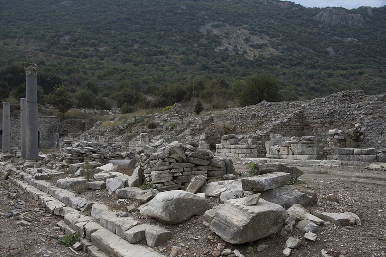
Photo: Dosseman · Wikimedia Commons source · CC BY-SA 4.0 · Cropped to the recorded 3:2 source rectangle and resized from the exact hash-bound source input. Tetragonos Agora and Marble Road
The Tetragonos Agora was Ephesus's commercial square, ringed by colonnades, shops, workshops, warehouses and guild rooms. It shifts the route from monumental benefactors to the trade and labour that kept the port city functioning. The agora interior is normally fenced, so the required view is from the Marble Road along its eastern edge.
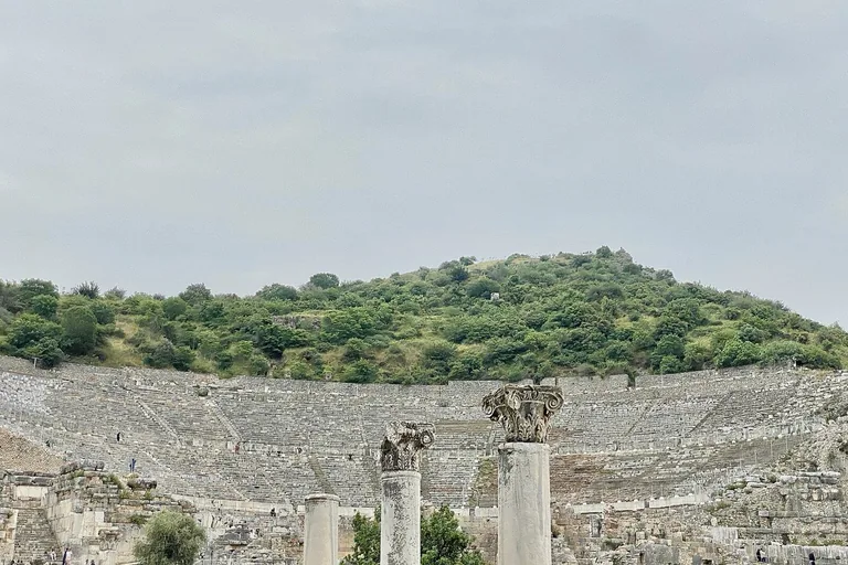
Photo: Warren LeMay from Chicago, IL, United States · Wikimedia Commons source · CC BY-SA 2.0 · Cropped to the recorded 3:2 source rectangle and resized from the exact hash-bound source input. Great Theatre
The Great Theatre grew from a Hellenistic venue into a Roman auditorium holding roughly twenty-four to twenty-five thousand people. Its scale makes performance and crowd politics visible, including the riot associated with the silversmiths in Acts. The theatre is exposed and steep; the stop works from the orchestra-level approach without climbing the seating.
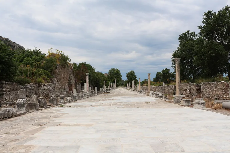
Photo: Bernard Gagnon · Wikimedia Commons source · CC BY-SA 3.0 · Cropped to the recorded 3:2 source rectangle and resized from the exact hash-bound source input. Arcadiane (Harbour Street)
The Arcadiane was the long colonnaded avenue linking the theatre to Ephesus's harbour, with shops, mosaics and rare night lighting. The route ends here because the silted harbour explains how a city built around maritime access ultimately lost it. Only the eastern stretch is open, and the former harbour end remains fenced across exposed, uneven ground.


_-_panoramio_-_Ya%C4%9Fmur_Ayd%C4%B1n_(7).jpg)


.jpg)
.jpg)
.jpg)


.jpg)

Local context
Before you go
The published route starts at Efes Örenyeri Üst Kapı, Efes Harabeleri, 35920 Selçuk/İzmir, Türkiye. It begins at State Agora and Basilica Stoa and ends at Arcadiane (Harbour Street).
On the ground
Access and surfaces
Ticketed outdoor archaeological site with two entrances; this tour runs one-way downhill from the upper (Magnesia Gate) entrance to the lower entrance, so arrange transport accordingly — the exits are ~2 km apart by road. Surfaces are original marble and flagstone, polished slippery in places and uneven throughout; almost no shade. Bring water and sun protection in warm months; mornings and late afternoons are cooler and quieter. Site opening hours vary by season; last entry is typically one hour before closing.
Frequently asked
Plan the walk
- How long is the Ephesus audio walking tour?
- Allow about 120 minutes. The self-guided route covers 2 km (1.2 mi) in 12 stops, including walking and listening time.
- Where does the Ephesus tour start and end?
- It starts at Efes Örenyeri Üst Kapı, Efes Harabeleri, 35920 Selçuk/İzmir, Türkiye. The published route begins at State Agora and Basilica Stoa and ends at Arcadiane (Harbour Street).
- Will the Ephesus audio tour work offline?
- Yes, after download. Audio, stop text, images, and GPS triggering work without data; the live map background still needs a connection.