Casablanca · Casablanca-Settat, Morocco
Casablanca — The City That Keeps Rewriting Itself
Casablanca is often treated as a twentieth-century city, but this walk tests that claim against what survives: a planned civic centre, a working market, a repeatedly altered medina, and religious buildings restored or rebuilt after rupture.
Narration in English · Stop 1 is free
 Tour no. 24
- Stops
- 9
- Distance
- 4.2 km (2.6 mi)
- Time
- About 145 minutes
- Route
- Moderate walking route
Listen before you buy
Stop 1 · Mohammed V Square and Civic Ensemble
Stop 1 is free. Listen before you buy.
The walk
A self-guided audio tour of Casablanca
Casablanca is often treated as a twentieth-century city, but this walk tests that claim against what survives: a planned civic centre, a working market, a repeatedly altered medina, and religious buildings restored or rebuilt after rupture. The route follows who planned the city, who worked inside it, and what later governments chose to preserve, clear, or remake. It ends at the Hassan II Mosque, where national scale meets the Atlantic.
Route notes
The stops
About each stop · narration stays in the app
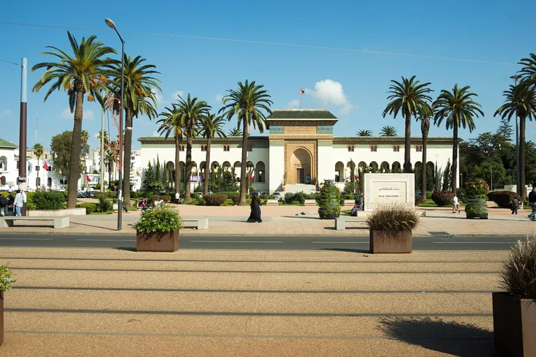
Photo: Rigelus · Wikimedia Commons source · CC BY-SA 4.0 · Cropped to the recorded 3:2 source rectangle and resized from the exact hash-bound source input. Mohammed V Square and Civic Ensemble
Mohammed V Square gathers Casablanca's Protectorate-era civic buildings around a planned administrative plaza. The route starts here to read authority in the square's geometry before testing that official image against markets, medina streets and later monuments. The plaza is broad and public, but approach roads carry fast traffic and should be crossed only at marked points.
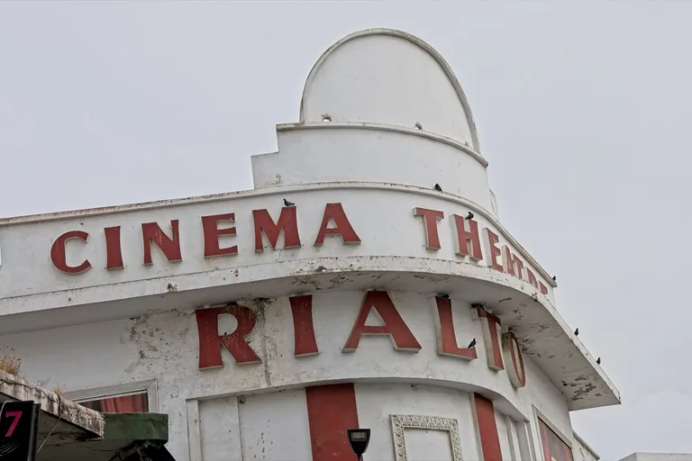
Photo: Bertrand SOUBEYRAND · Wikimedia Commons source · CC BY-SA 4.0 · Cropped to the recorded 3:2 source rectangle and resized from the exact hash-bound source input. Cinema Rialto
Cinema Rialto is a 1929 Art Deco picture palace designed by Pierre Jabin for an audience of roughly 1,350. It brings Casablanca's architectural modernity down to the popular scale of tickets, performances and crowds. View the façade from the public sidewalk and use marked crossings on the traffic-bearing boulevard.
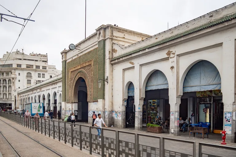
Photo: C messier · Wikimedia Commons source · CC BY-SA 4.0 · Cropped to the recorded 3:2 source rectangle and resized from the exact hash-bound source input. Casablanca Central Market
Casablanca Central Market was planned in the late 1910s as a regulated centre for food trading, sanitation and municipal revenue. The route includes it because the same planning system that composed civic squares also reorganised labour, property and daily supply. Deliveries, crowds and opening hours vary; the exterior boulevard point works when the interior is closed.
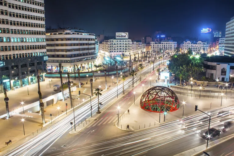
Photo: Achalhikarim · Wikimedia Commons source · CC BY-SA 4.0 · Cropped to the recorded 3:2 source rectangle and resized from the exact hash-bound source input. United Nations Square and Clock Tower
United Nations Square sits between the old medina and planned city, with a reconstructed clock tower and later canopy marking successive redesigns. Its changing names and structures make Casablanca's civic memory physically visible at the route's main hinge. Stay within the broad pedestrian paving and use signals at the surrounding tram and road crossings.
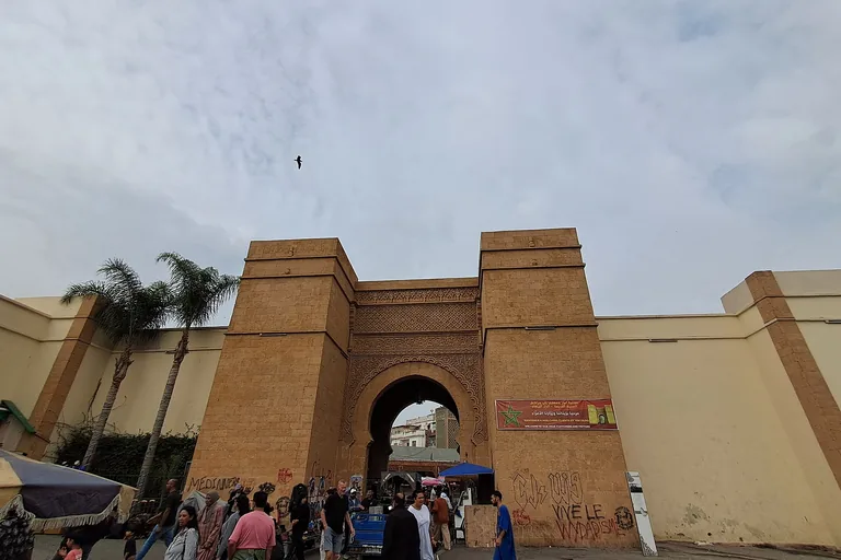
Photo: Ideophagous · Wikimedia Commons source · CC BY-SA 4.0 · Cropped to the recorded 3:2 source rectangle and resized from the exact hash-bound source input. Bab Marrakech and the Old Medina
Bab Marrakech opens into Casablanca's old medina, rebuilt after the 1755 earthquake and repeatedly reframed by later planning and heritage projects. Crossing the threshold lets the route compare the lived neighbourhood with the monumental city laid out beside it. The approach is crowded and uneven with delivery traffic, so the required stop remains outside the gate.
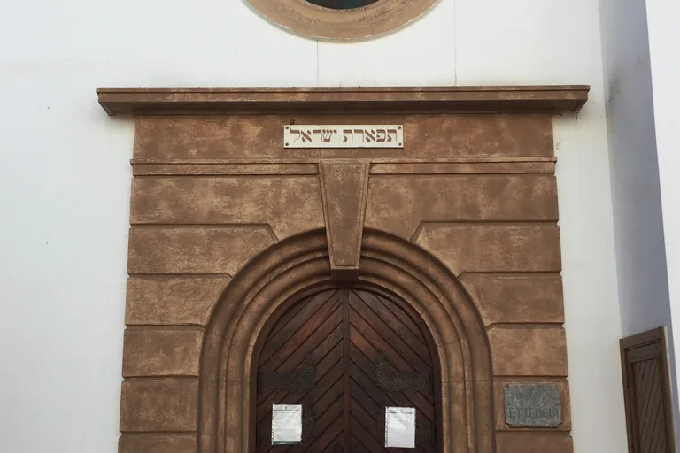
Photo: Sambasoccer27 · Wikimedia Commons source · CC BY-SA 4.0 · Cropped to the recorded 3:2 source rectangle and resized from the exact hash-bound source input. Ettedgui Synagogue and the Triangle of Tolerance
Ettedgui Synagogue is a restored old-medina synagogue damaged during the Allied bombing of Casablanca in November 1942. The nearby mosque and former church make religious proximity visible without turning a history of rupture and repair into a harmony slogan. The lane is narrow, and synagogue entry and hours are variable; the exterior is sufficient.
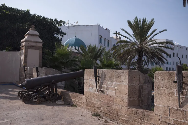
Photo: mustapha ennaimi · Wikimedia Commons source · CC BY 2.0 · Cropped to the recorded 3:2 source rectangle and resized from the exact hash-bound source input. Sqala Bastion
La Sqala is a surviving coastal bastion from the defensive works built as Casablanca was re-established in the eighteenth century. It gives the old medina a tangible seaward edge before the route turns to local sacred geography. The exterior point is public and level; restaurant use and opening hours do not form part of the required stop.
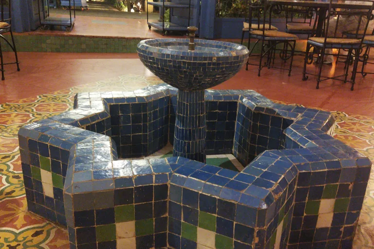
Photo: اترك أثرا · Wikimedia Commons source · CC BY-SA 3.0 · Cropped to the recorded 3:2 source rectangle and resized from the exact hash-bound source input. Mausoleum of Sidi Allal al-Qairawani
The mausoleum is associated with Sidi Allal al-Qairawani, honoured in local tradition as Casablanca's patron saint. The route treats the shrine as evidence of the city's sacred geography while keeping origin legends explicitly attributed. Remain on the medina-side pavement beside the port road; interior access is not required.
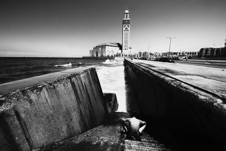
Photo: Nabil Elminaoui · Wikimedia Commons source · CC BY-SA 3.0 · Cropped to the recorded 3:2 source rectangle and resized from the exact hash-bound source input. Hassan II Mosque
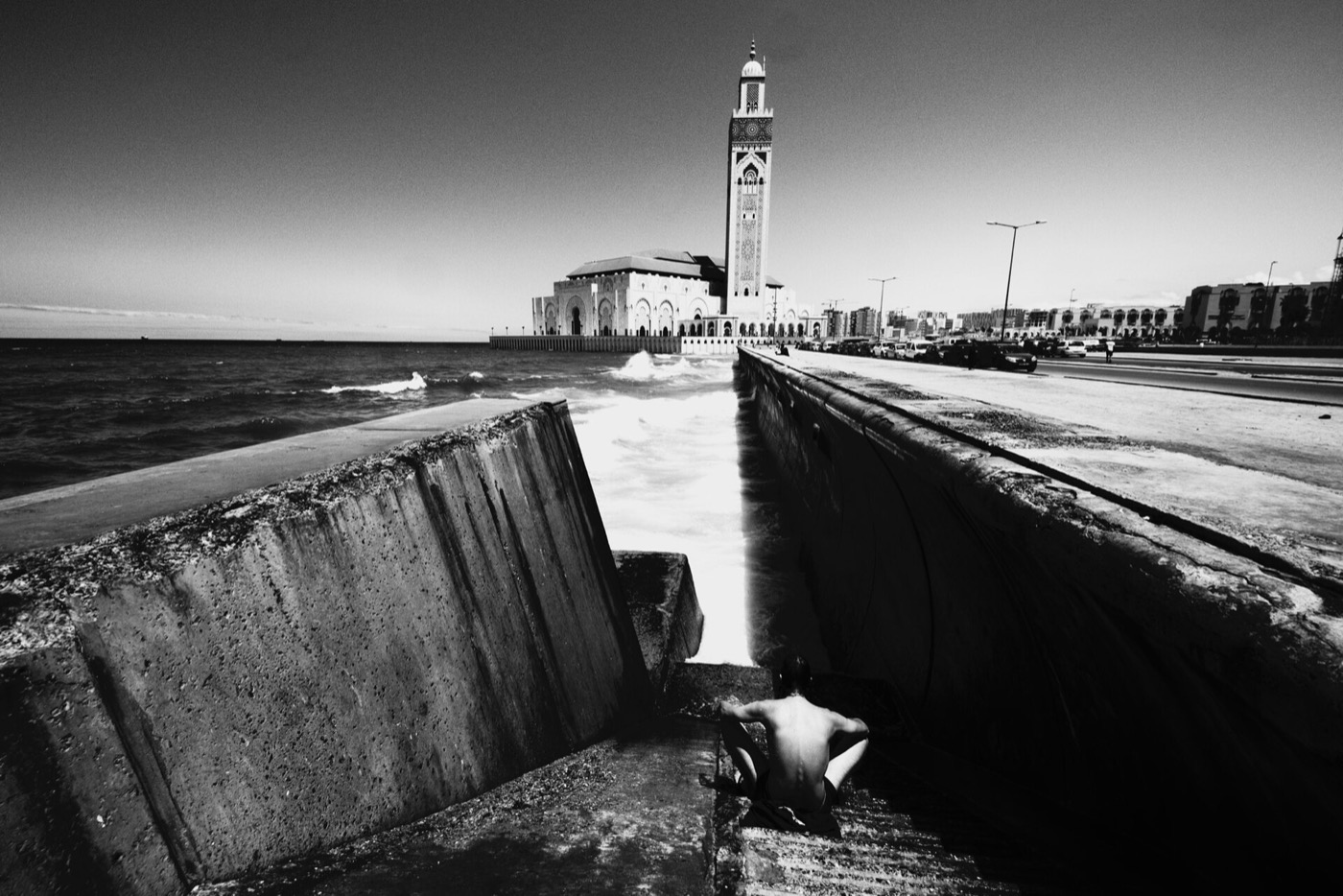
Hassan II Mosque was built between 1986 and 1993 on an Atlantic platform through a royal commission and a large Moroccan craft programme. The route ends here because the post-independence monument recasts the city's relationship with state power, skilled labour and the sea at national scale. The outdoor esplanade is free but exposed; interior visits are timed, ticketed and separate.


.jpeg)
Local context
Before you go
The published route starts at Place Mohammed V, 20105 Casablanca, Maroc. It begins at Mohammed V Square and Civic Ensemble and ends at Hassan II Mosque.
On the ground
Access and surfaces
The planned-centre section uses broad but traffic-heavy boulevards. Old medina lanes are narrow, crowded and uneven, with occasional curb changes and limited step-free alternatives. The port edge and Hassan II Mosque esplanade are exposed to wind and sun. Religious interiors, the synagogue, the bastion restaurant and the market keep their own hours; every stop is scoped to work from a public exterior stand-point.
Frequently asked
Plan the walk
- How long is the Casablanca audio walking tour?
- Allow about 145 minutes. The self-guided route covers 4.2 km (2.6 mi) in 9 stops, including walking and listening time.
- Where does the Casablanca tour start and end?
- It starts at Place Mohammed V, 20105 Casablanca, Maroc. The published route begins at Mohammed V Square and Civic Ensemble and ends at Hassan II Mosque.
- Will the Casablanca audio tour work offline?
- Yes, after download. Audio, stop text, images, and GPS triggering work without data; the live map background still needs a connection.