Bukhara · Bukhara Region, Uzbekistan
Bukhara — The Noble City of the Silk Road
Bukhara got rich carrying the world's goods and spent the money on holiness — minarets, madrasas and mausoleums built beside the bazaars that paid for them.
Narration in English · Stop 1 is free
 Tour no. 25
- Stops
- 11
- Distance
- 3.1 km (1.9 mi)
- Time
- About 150 minutes
- Route
- Easy city route
Listen before you buy
Stop 1 · Ismail Samani Mausoleum
Stop 1 is free. Listen before you buy.
The walk
A self-guided audio tour of Bukhara
Bukhara got rich carrying the world's goods and spent the money on holiness — minarets, madrasas and mausoleums built beside the bazaars that paid for them. This walk runs west to east through the old town: the oldest brick building in Central Asia, the fortress of the emirs, the great minaret even Genghis Khan spared, the covered trading domes still working their original trades, and the last surviving pool of a city that once lived by its ponds.
Route notes
The stops
About each stop · narration stays in the app
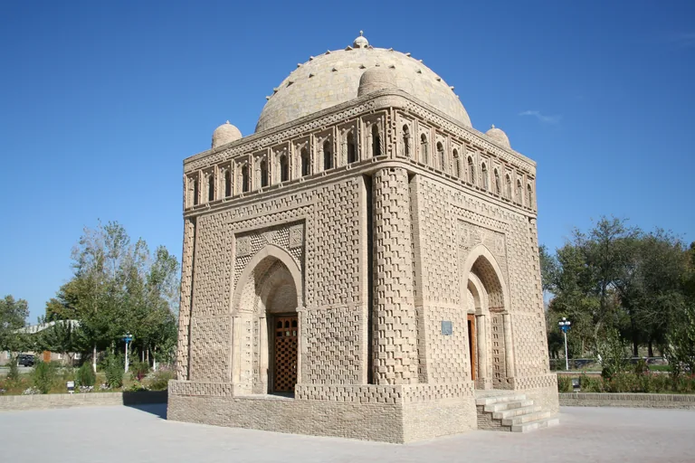
Photo: Patrickringgenberg · Wikimedia Commons source · CC BY-SA 3.0 · Cropped to the recorded 3:2 source rectangle and resized from the original. Ismail Samani Mausoleum
The Ismail Samani Mausoleum is a late-ninth- or early-tenth-century dynastic tomb built almost entirely from patterned fired brick. The route begins here because the small building shows brick serving as structure, surface and ornament before Bukhara's larger tiled monuments appear. The mausoleum stands in a public park; entry conditions are simple but thresholds and surrounding paths can be uneven.
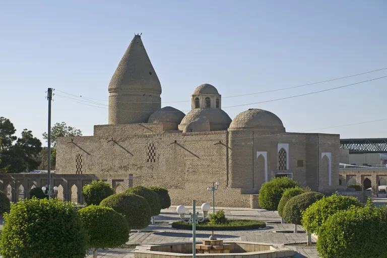
Photo: Ymblanter · Wikimedia Commons source · CC BY-SA 4.0 · Cropped to the recorded 3:2 source rectangle and resized from the original. Chashma-Ayub Mausoleum
Chashma-Ayub is a repeatedly rebuilt mausoleum complex gathered around a spring traditionally associated with the prophet Job, recognisable by its conical Khwarazmian-style dome. It follows the Samanid tomb to show how sacred tradition and water shaped a monument over several building campaigns. The exterior is free to view; interior access and museum use can change, and the spring tradition should not be treated as archaeological proof.
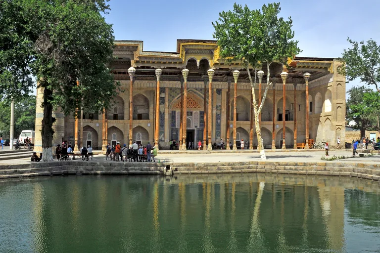
Photo: LBM1948 · Wikimedia Commons source · CC BY-SA 4.0 · Cropped to the recorded 3:2 source rectangle and resized from the original. Bolo Hauz Mosque
Bolo Hauz Mosque is an eighteenth-century Friday mosque facing a pool, with a tall timber porch added in the early twentieth century. The route includes it because the reflected façade and forest of carved columns show a lighter civic architecture opposite the Ark's massive walls. The courtyard is an active religious space: dress respectfully, avoid prayer times and do not assume visitor access to the interior.
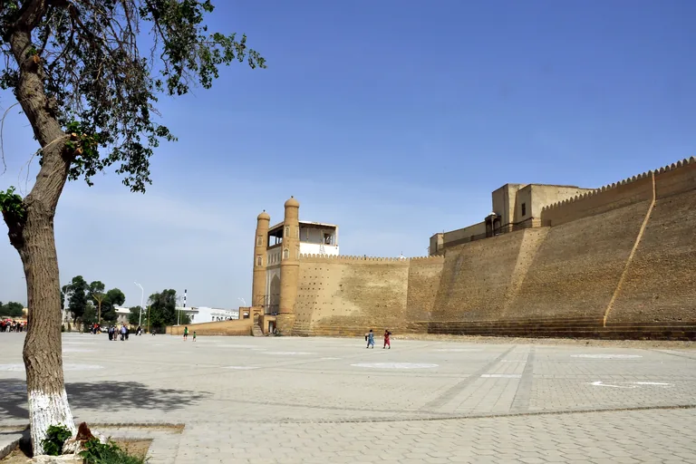
Photo: LBM1948 · Wikimedia Commons source · CC BY-SA 4.0 · Cropped to the recorded 3:2 source rectangle and resized from the original. Ark of Bukhara
The Ark is Bukhara's fortified citadel, rebuilt many times as the residence and administrative centre of the city's rulers until the early twentieth century. It is the route's political set-piece because its ramp, walls and surviving courts separate the ruler's city from the commercial streets below. The exterior is free; museum areas require admission, climb steeply and preserve only part of the pre-1920 complex.
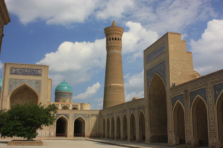
Photo: RK · Wikimedia Commons source · CC BY-SA 4.0 · Cropped to the recorded 3:2 source rectangle and resized from the original. Po-i-Kalyan: Minaret, Mosque and Mir-i-Arab Madrasa
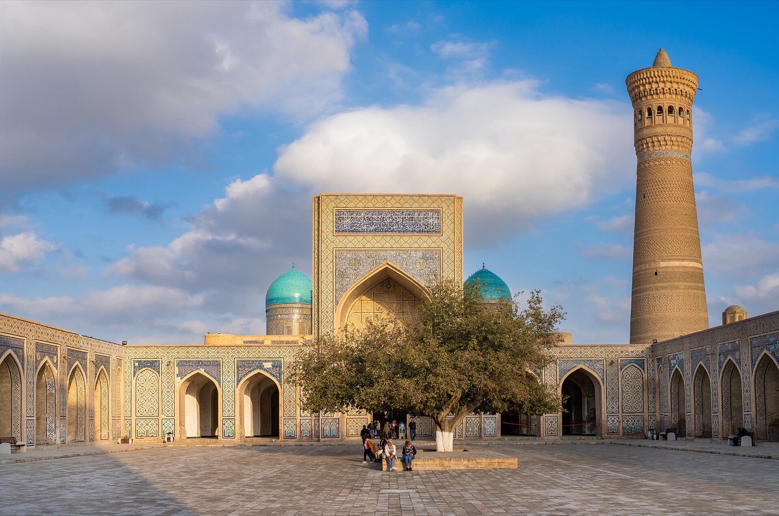
Po-i-Kalyan brings together the twelfth-century Kalyan Minaret, the large sixteenth-century congregational mosque and the still-functioning Mir-i-Arab Madrasa. The route pauses here because one square makes Bukhara's religious architecture readable across several centuries and different institutional uses. The plaza and mosque courtyard may be accessible, but the madrasa remains an educational institution and prayer or study takes priority.
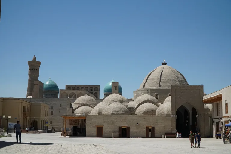
Photo: Adam Harangozó · Wikimedia Commons source · CC BY-SA 4.0 · Cropped to the recorded 3:2 source rectangle and resized from the original. Toqi Zargaron Trading Dome
Toqi Zargaron is the sixteenth-century trading dome traditionally associated with jewellers, built where major market streets cross. The route enters it to show commerce organised by architecture that channels movement, light and specialised trade beneath a roof. The passage is public and active, with shop displays and uneven thresholds narrowing the route.
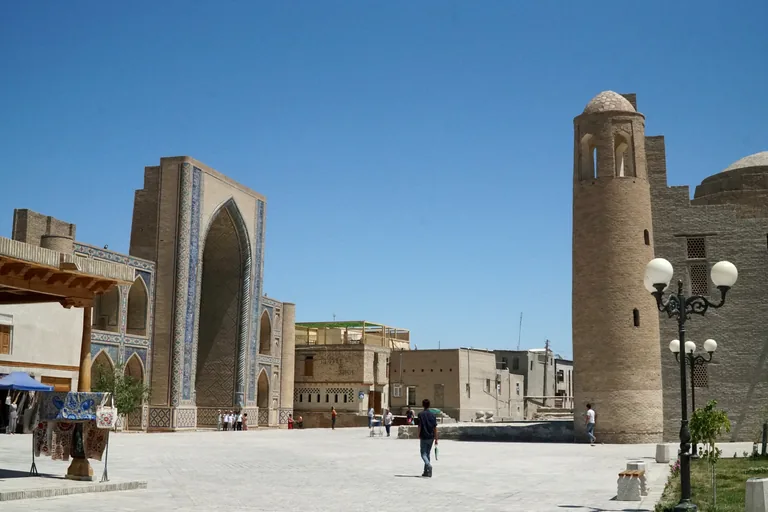
Photo: Adam Harangozó · Wikimedia Commons source · CC BY-SA 4.0 · Cropped to the recorded 3:2 source rectangle and resized from the original. Ulugh Beg and Abdulaziz Khan Madrasas
The Ulugh Beg Madrasa of 1417 faces the seventeenth-century Abdulaziz Khan Madrasa, setting Timurid geometric restraint against a later, more lavish decorative programme. The route pairs them because the same street frontage makes changing ideas of scholarly patronage and architectural display directly comparable. Courtyard or interior access varies between the two buildings; use the public street view if doors are closed and respect any active use.
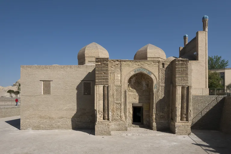
Photo: Petar Milošević · Wikimedia Commons source · CC BY-SA 4.0 · Cropped to the recorded 3:2 source rectangle and resized from the original. Magok-i-Attari Mosque
Magok-i-Attari Mosque is a mosque rebuilt over earlier layers and now set below present street level, with a richly carved twelfth-century portal. It is included because the sunken position makes Bukhara's accumulated ground levels visible while the portal preserves pre-Mongol brick and terracotta work. The exterior depression is visible from public paths; museum or interior access is ticketed and reached by steps.
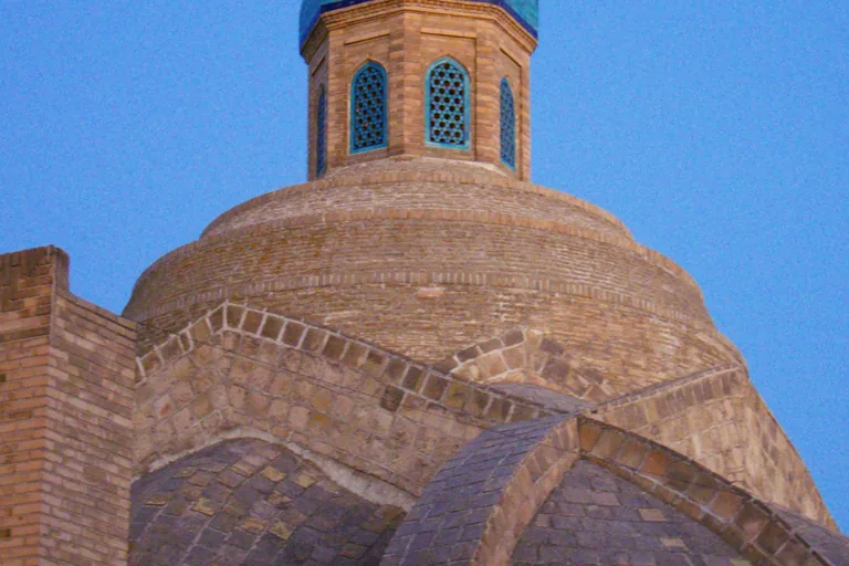
Photo: Fulvio Spada from Torino, Italy · Wikimedia Commons source · CC BY-SA 2.0 · Cropped to the recorded 3:2 source rectangle and resized from the original. Toqi Sarrafon Trading Dome
Toqi Sarrafon is the money-changers' trading dome, one of the covered intersections that structured Bukhara's sixteenth-century market network. The route passes through it to compare specialised finance and exchange with the jewellers' dome earlier in the walk. The passage remains public commercial space, so expect active shops, crowds and uneven surfaces rather than a controlled museum visit.
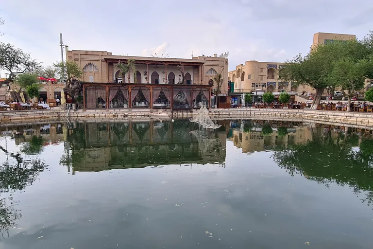
Photo: BeshevI · Wikimedia Commons source · CC BY-SA 4.0 · Cropped to the recorded 3:2 source rectangle and resized from the original. Lyab-i Hauz
Lyab-i Hauz is the ensemble around a seventeenth-century pool, framed by the Kukeldash Madrasa and the Nadir Divan-Begi khanaka and madrasa. The route pauses here because water, shade, teaching, lodging and trade were deliberately assembled into Bukhara's most sociable open space. The square is free and has places to rest, but the pool edge is unguarded in places and restaurant terraces can narrow circulation.
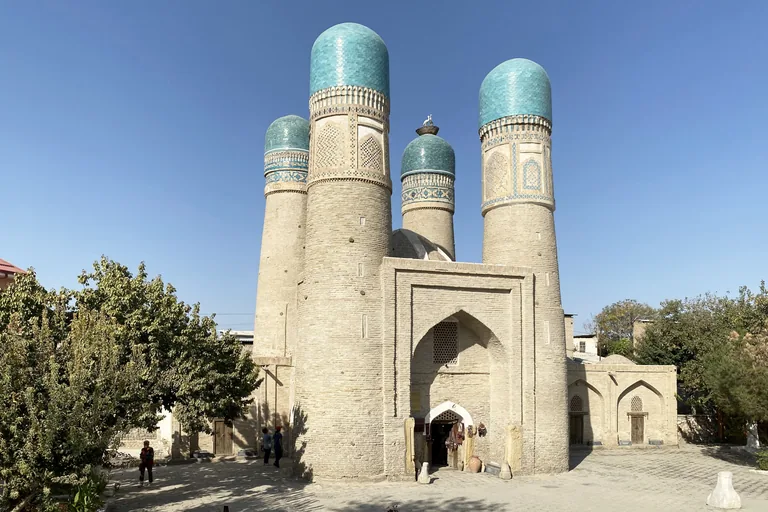
Photo: Bernard Gagnon · Wikimedia Commons source · CC0 · Cropped to the recorded 3:2 source rectangle and resized from the original. Chor Minor
Chor Minor is the four-towered gatehouse surviving from an early-nineteenth-century madrasa complex that has otherwise largely disappeared. It closes the route because its compact, idiosyncratic silhouette reveals how little of a once larger institution may remain above ground. The exterior is free in a residential area; any rooftop or interior access involves narrow stairs and should be confirmed on site.


.jpg)
.jpg)


Local context
Before you go
The published route starts at Mausoleo di Ismail Samani, Parco Somoniylar, 200100 Bukhara, Uzbekistan. It begins at Ismail Samani Mausoleum and ends at Chor Minor.
On the ground
Access and surfaces
Mostly flat, largely pedestrianized old town with uneven paving and some unshaded stretches — the western park section and the squares are exposed in summer heat. Interiors (Ark museums, the carpet museum, Mir-i-Arab's courtyard) may be ticketed or closed; every stop is written to remain complete from its public exterior stand-point.
Frequently asked
Plan the walk
- How long is the Bukhara audio walking tour?
- Allow about 150 minutes. The self-guided route covers 3.1 km (1.9 mi) in 11 stops, including walking and listening time.
- Where does the Bukhara tour start and end?
- It starts at Mausoleo di Ismail Samani, Parco Somoniylar, 200100 Bukhara, Uzbekistan. The published route begins at Ismail Samani Mausoleum and ends at Chor Minor.
- Will the Bukhara audio tour work offline?
- Yes, after download. Audio, stop text, images, and GPS triggering work without data; the live map background still needs a connection.