Amman · Amman Governorate, Jordan
Amman — From the Citadel to the Souq
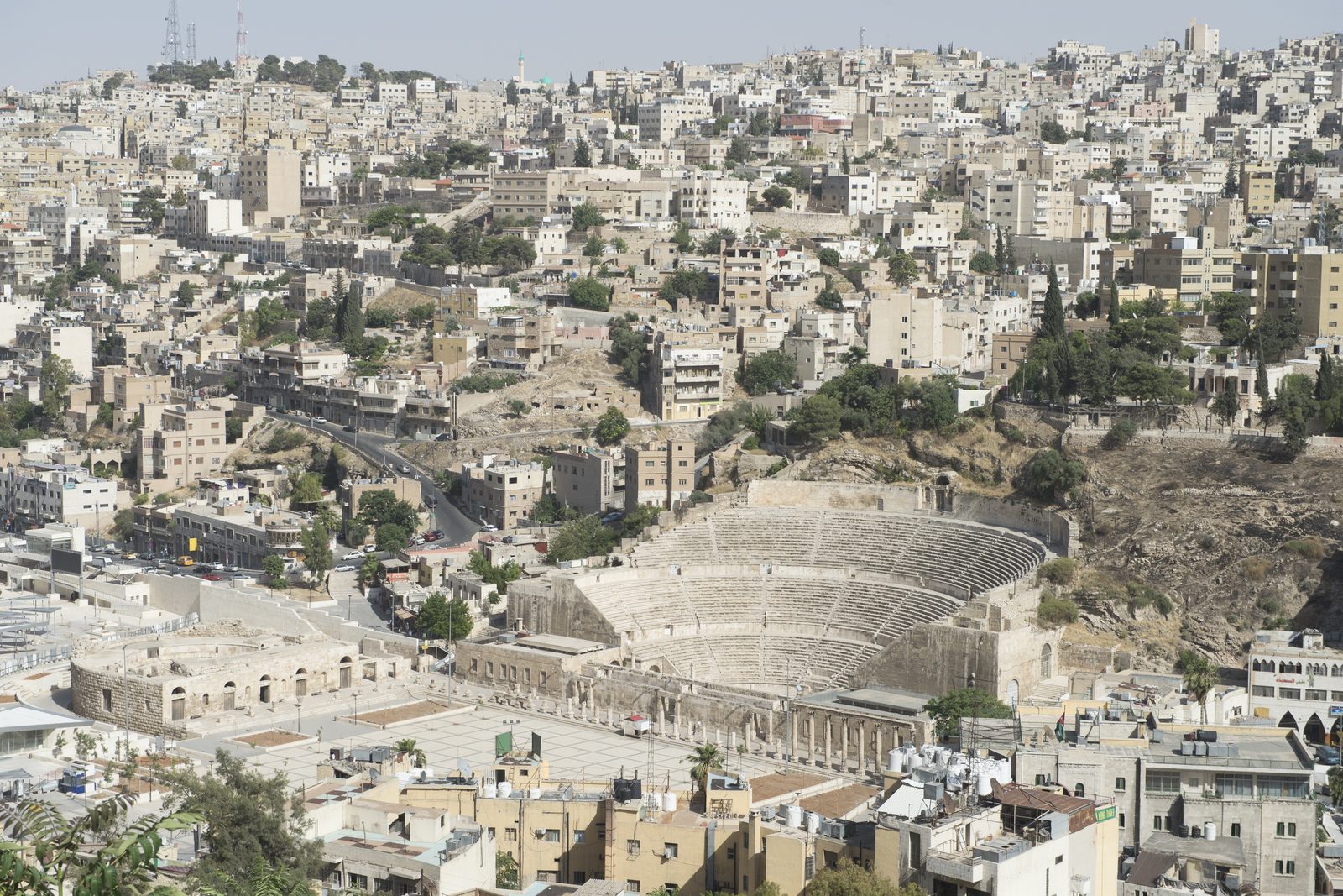
An audio walk through Amman, from the Ammonite hill of the Citadel and its Roman and Umayyad ruins down to the Roman Theatre, the old Roman fountain, the town's great mosque and the street where the capital of 1921 grew up.
Narration in English · Stop 1 is free
 Tour no. 44
- Stops
- 11
- Distance
- 2.5 km (1.6 mi)
- Time
- About 100 minutes
- Route
- Moderate walking route
Listen before you buy
Stop 1 · The Citadel terrace above the valley
Stop 1 is free. Listen before you buy.
The walk
An audio tour from the Citadel terraces down public stairs to the Roman Theatre, the Nymphaeum, the Grand Husseini Mosque and King Faisal Street, at your own pace
The Citadel hill was the capital of the Ammonites, Rabbath Ammon, and the city still carries that name today; a Greek king of Egypt renamed it Philadelphia in the third century BC, a name set aside again in the seventh century. The walk starts at the terrace above the valley and loops the hilltop: the Temple of Hercules, as the Great Temple is usually called, though its god is still debated, with the fingers and elbow of a colossal statue lying close by; a church of the sixth century; and the Umayyad governor's square of the early eighth century, where the domed entrance hall now wears a modern dome, and the great round cistern that supplied the palace.
From the Citadel gate public stairs lead down between the houses to the Roman Theatre, dedicated to the emperor Antoninus Pius in the second century, and to Hashemite Plaza and the Odeon, where Circassian refugee families made their homes among the ruins from 1878 and the town grew again once the railway arrived in 1903. The route then follows the roofed stream along Quraysh Street past the Nymphaeum, the Roman city's public fountain, to the Grand Husseini Mosque, rebuilt in 1924 on a site used for a mosque since Umayyad times, and ends on King Faisal Street at the Duke's Diwan, a house of 1924 that served as the town's post office and later as the Haifa Hotel, where the story turns to the refugees who turned a small town into a city.
Route notes
The stops
About each stop · narration stays in the app
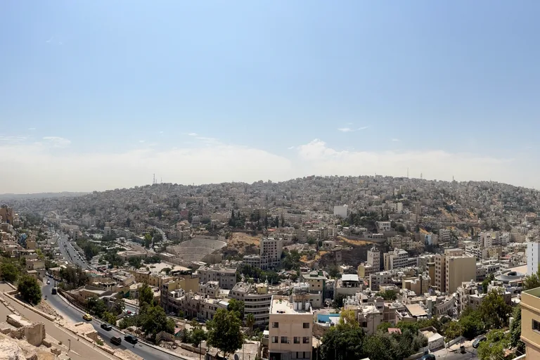
Photo: ほっきー · Wikimedia Commons source · CC0 1.0 · Cropped to the recorded 3:2 source rectangle and resized from the exact hash-bound source input. The Citadel terrace above the valley
The Citadel terrace is the south edge of the hill that rises above downtown Amman, the capital of the Ammonite kingdom, with the valley of the old town below. The route starts here for the hill's long record: archaeologists have worked on it since the 1920s and found a tomb of the Middle Bronze Age holding pottery and scarab seals, the Ammonite building inscription found here in 1961 is a white limestone block with eight damaged lines, and a great part of the hill is still unexcavated. The stop is inside the ticketed Citadel, on open, unshaded ground at the south edge of the hill about 130 metres from the visitor gate along gravel and old paving, with low walls and a drop at the edge.
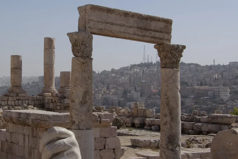
Photo: Berthold Werner · Wikimedia Commons source · CC BY-SA 3.0 · Cropped to the recorded 3:2 source rectangle and resized from the exact hash-bound source input. The Great Temple (Temple of Hercules)
The Temple of Hercules, as the Great Temple on the Citadel is usually called, stood on a high podium, and an inscription dates it to the years when Geminius Marcianus governed the Roman province of Arabia, between 161 and 166. The route stops here for the question of its god: the excavations of the 1990s found possibly cultic features and six votive figurines beneath the temple area, which may mean the place was already used for worship in the Iron Age, and one of the excavators counted Herakles and Astarte as the two dominant gods of the Roman city. The stop is on open, unshaded ground at the east end of the temple platform, with old paving and loose stones around the podium; the fragments are not for climbing.
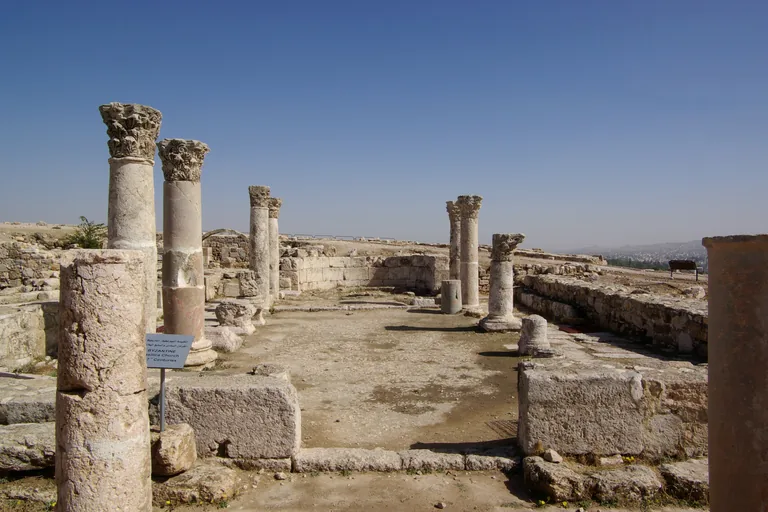
Photo: Berthold Werner · Wikimedia Commons source · CC BY-SA 3.0 · Cropped to the recorded 3:2 source rectangle and resized from the exact hash-bound source input. The Byzantine church on the Citadel
The Byzantine church on the Citadel is a basilica of the sixth century beside the Umayyad palace, with a nave between two aisles and a section for formal ceremonies at its east end. The route stops here for the Christian cult around the city: a floor mosaic from a martyr shrine at Khirbat Yajuz, about nine kilometres north east of Amman, records that the shrine of the martyrs Theodore and Kerykos was completed under a bishop named Theodosios, by the zeal of a presbyter called Elias and a supervisor called Ioannes, probably in the sixth century. The ruin is seen from the paths around it and from the information board on its east side, on uneven, unshaded ground inside the ticketed Citadel.
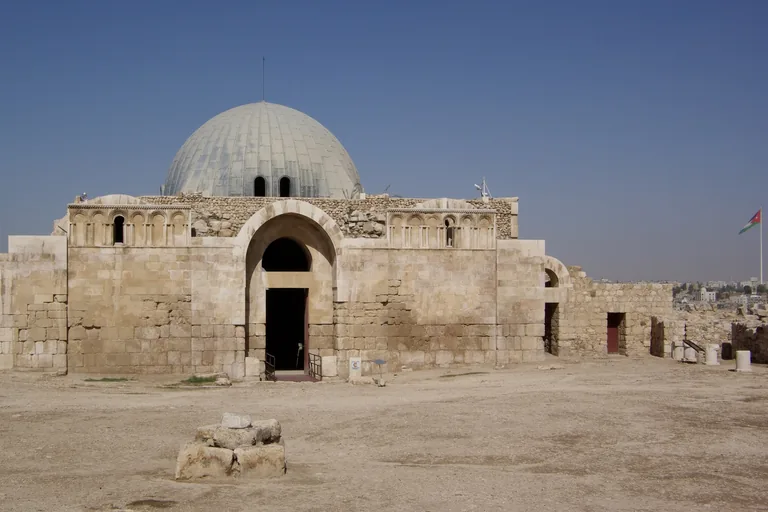
Photo: Berthold Werner · Wikimedia Commons source · CC BY-SA 3.0 · Cropped to the recorded 3:2 source rectangle and resized from the exact hash-bound source input. The Umayyad domed hall and the governor's square
The domed hall was the entrance hall of the Umayyad palace on the Citadel, built in the first third of the eighth century, and the square in front of it was the market that joined the palace on the north to the mosque on the south. The route stops here for the complex behind the hall: an Italian mission dug part of the palace between 1927 and 1938, a Spanish mission later excavated and restored the buildings with Spanish funding, and beyond the hall the palace held houses reached by its own streets and squares and, at its north end, an audience hall opening onto a courtyard and a domed throne room. The hall may be open to enter through its south door, with a step at the door and uneven ground inside and around it; the square is open and unshaded, inside the ticketed Citadel.
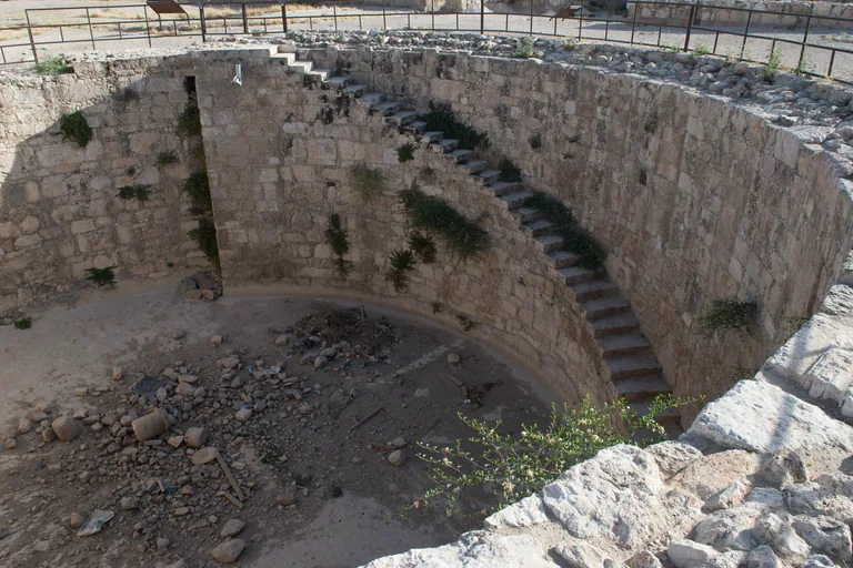
Photo: Dosseman · Wikimedia Commons source · CC BY-SA 4.0 · Cropped to the recorded 3:2 source rectangle and resized from the exact hash-bound source input. The Umayyad cistern
The Umayyad cistern is the large round tank beside the palace on the Citadel, open to the sky, which held the water for the palace, its baths and its latrines. The route stops here for the water behind the palace: the Spanish restorers note that the palace bath was placed close to this great circular reservoir because it secured the water supply, and the reservoir was restored as part of their work on the complex. The stop is on a paved path along the cistern's railing; the cistern is a deep open pit, so keep to the path, and from here the way out is back south to the single visitor gate, about 200 metres away.
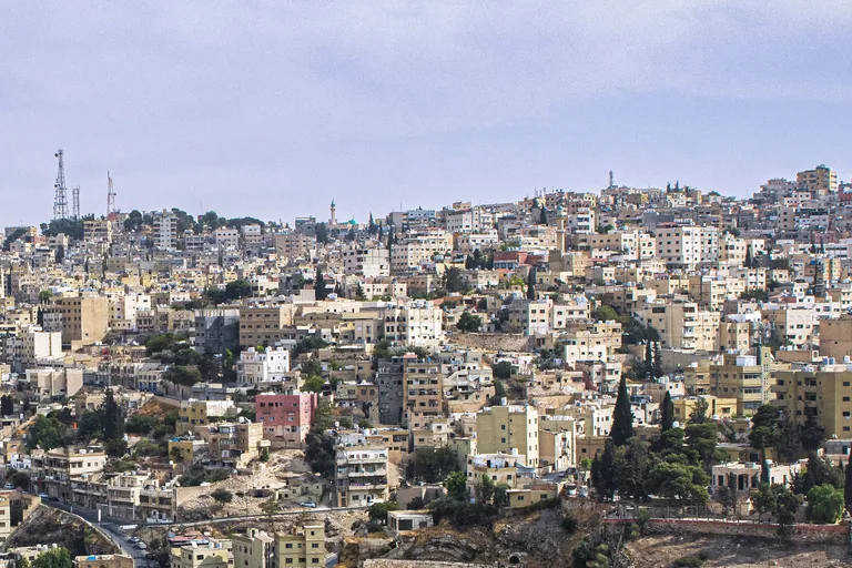
Photo: Hisham Mansour Zayadnh · Wikimedia Commons source · CC BY-SA 4.0 · Cropped to the recorded 3:2 source rectangle and resized from the exact hash-bound source input. On the stairs above the Roman Theatre
This stop is a landing on the public stairs that run down the slope of the Citadel hill between houses, looking across rooftops to the valley where the city of Philadelphia spread from the hill. The route stops here for the Roman city still under the streets: in 2020 work on a rainwater drain near Hashemite Plaza uncovered Roman baths with brick furnaces for heating water and two headless marble statues, and the remains were photographed and reburied for later excavation. The way down is two flights of steep, uneven public stairs between houses with no handrail mapped and no step free route to the theatre, so anyone who cannot manage stairs can take a taxi down to Al Hashimi Street.
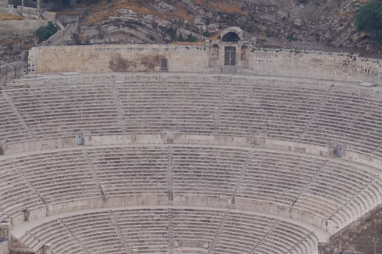
Photo: Zairon · Wikimedia Commons source · CC BY-SA 3.0 · Cropped to the recorded 3:2 source rectangle and resized from the exact hash-bound source input. The Roman Theatre
The Roman Theatre faces the Citadel from the hill opposite, built into the hillside on the south side of Hashemite Plaza, and was either built new or rebuilt and enlarged in the reign of the emperor Antoninus Pius. The route stops here for the rooms in its wings: side entrances at ground level once led to the orchestra and to the stage, and the rooms behind them now hold two small museums of Jordanian and Palestinian folklore, one of which first opened in 1971. The theatre is ticketed, with its two small museums in the same ticket; the seats are very steep stone steps without handrails, there is no shade in the orchestra at midday, and the theatre may be closed or set up for an event during festivals and concerts.
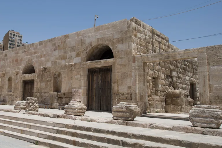
Photo: Dosseman · Wikimedia Commons source · CC BY-SA 4.0 · Cropped to the recorded 3:2 source rectangle and resized from the exact hash-bound source input. Hashemite Plaza and the Odeon
Hashemite Plaza is the paved public square between the Roman Theatre and the Odeon, the small Roman theatre of the second century on its east side, which has been renovated and is still used for performances. The route stops here for the people who restarted the town: Ismael Babouk, a Kabardian Circassian born in 1841, farmed and then traded livestock between Syria, Palestine and Lebanon, lived in 1885 on Italian Hospital Street, and as mayor from 1909 to 1911 brought Amman and Salt into closer contact; one of the downtown streets carries his name. The square is level, open and free to all, with cafes and benches but little shade at midday; the Odeon is fenced and may be locked outside events, and the roads around the square carry heavy traffic, so cross only at the crossings.
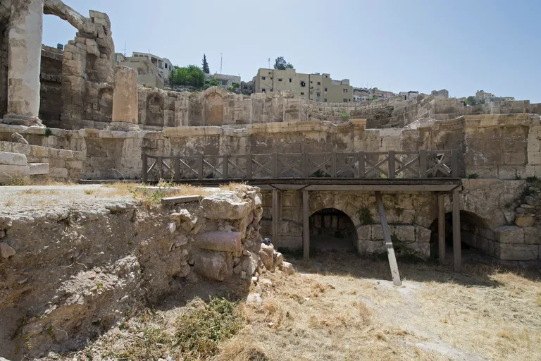
Photo: Dosseman · Wikimedia Commons source · CC BY-SA 4.0 · Cropped to the recorded 3:2 source rectangle and resized from the exact hash-bound source input. The Nymphaeum
The Nymphaeum is the Roman public fountain at the crossing of Quraysh and Ibn al Atheer streets, built in the second century beside the stream that once ran through the valley. The route stops here for the stream's longer story: in biblical times the watercourse was known as the Upper Jabbok, nineteenth century visitors knew it as Amman's water or Amman's river, and the Romans built vaults, arches and underground channels to control the floods that rushed into the valley from the hills around. The stop is on the pavement of Quraysh Street, a busy road with fast traffic, beside the fenced site; whether its gate is open was not verified, so plan to see it from the pavement, with little shade.
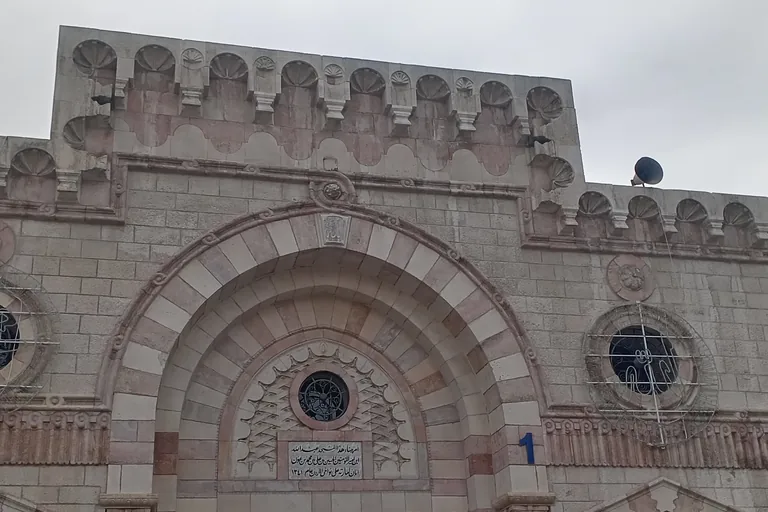
Photo: Justwiki · Wikimedia Commons source · CC BY 4.0 · Cropped to the recorded 3:2 source rectangle and resized from the exact hash-bound source input. The Grand Husseini Mosque
The Grand Husseini Mosque is the Friday mosque of downtown Amman, rebuilt in 1924 on the site of a mosque of the Umayyad period, with a small square in front of it among the market lanes. The route stops here for the building's later history: the stone top of its minaret fell in the earthquake of 1927, and since then the courtyard has been enlarged with a fountain for ablution and the mosque repaired after a fire. It is a working mosque and the stop is written to be heard from the square outside; entry for non Muslim visitors is not confirmed, so ask at the gate if you wish to go in, never during prayer and dressed modestly, and expect the square to fill around the Friday midday prayer.
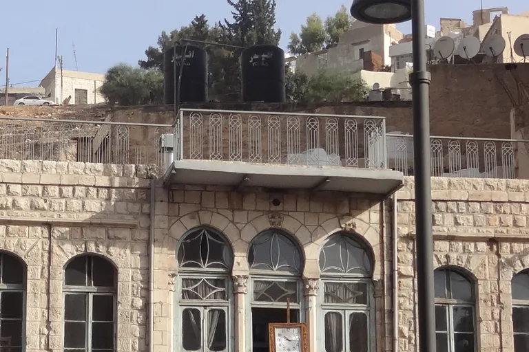
Photo: Tarawneh · Wikimedia Commons source · CC BY-SA 3.0 · Cropped to the recorded 3:2 source rectangle and resized from the exact hash-bound source input. King Faisal Street and the Duke's Diwan
King Faisal Street is a main street of downtown Amman, about 250 metres long, and the Duke's Diwan on it is a stone house of 1924 that served as the town's post office and today houses a cultural centre and house museum. The route ends here for the street's later life: the gold market with its dozens of jewellery shops opens off it, the municipal building of 1909 that stood at its end was pulled down in the 1940s to widen the roads, and inside the Diwan restored furniture of the 1920s, a freestanding stove, a vintage radio and sketches of Amman's Ottoman and Roman ruins recall the town as it was. The street is a busy one way road lined with shops, so keep to the crowded pavements and use the crossings; the Diwan is privately run and its opening hours were not verified, and the way back up to the Citadel is steep, with taxis on the surrounding streets.


Local context
Before you go
The walk covers about two and a half kilometres one way, downhill or on the level, from the Citadel's visitor entrance on the hill above the old town to King Faisal Street in Al Balad. The steep part is a long descent by public stairs from the Citadel to the Roman Theatre; at the end you can pick up a taxi on the nearby streets.
On the ground
Access and surfaces
About two and a half kilometres, all downhill or on the level, from the top of the Citadel to King Faisal Street in Al Balad. Between the Citadel and the Roman Theatre the route goes down public stairs, a drop of about sixty metres; they are steep and uneven, may lack a handrail in places and are slippery when wet. No step free route was found, and walkers who cannot manage stairs can take a taxi between the Citadel gate and the theatre. The Citadel and the Roman Theatre each need a ticket; check prices, opening hours and whether your Jordan Pass covers them locally. The Citadel terraces have almost no shade: in summer start early, carry water and wear a hat. In the old town the pavements are narrow and crowded and the walk crosses busy streets; use the crossings. On Friday the midday prayer fills the mosque and its square and many shops close for the day or until the afternoon. The mosque stop works from outside; dress modestly.
Frequently asked
Plan the walk
- How long is the Amman audio walking tour?
- Allow about 100 minutes. The route covers 2.5 km (1.6 mi) one way in 11 stops, including walking and listening time.
- Where does the Amman tour start and end?
- It starts at the Citadel's visitor entrance on the hill above the old town and ends on King Faisal Street in Al Balad. The way back up to the Citadel is steep; you can pick up a taxi on the nearby streets.
- Do I need a ticket for the walk?
- For two of the sites. The Citadel and the Roman Theatre each need a ticket; check prices, opening hours and whether your Jordan Pass covers them locally. The streets of the old town are free to walk.
- Is the route hard going?
- In places. The walk is downhill or level, but the public stairs from the Citadel to the Roman Theatre are steep, uneven and slippery when wet, and no step free route was found; a taxi between the Citadel gate and the theatre avoids them. The Citadel has almost no shade, so in summer start early and carry water.
- Will the Amman audio tour work offline?
- Yes, after download. Audio, stop text, images, and GPS triggering work without data; the live map background still needs a connection.