Agrigento · Sicily, Italy
Agrigento — What the Ruins Kept
Agrigento's temples did not survive by standing still.
Narration in English · Stop 1 is free
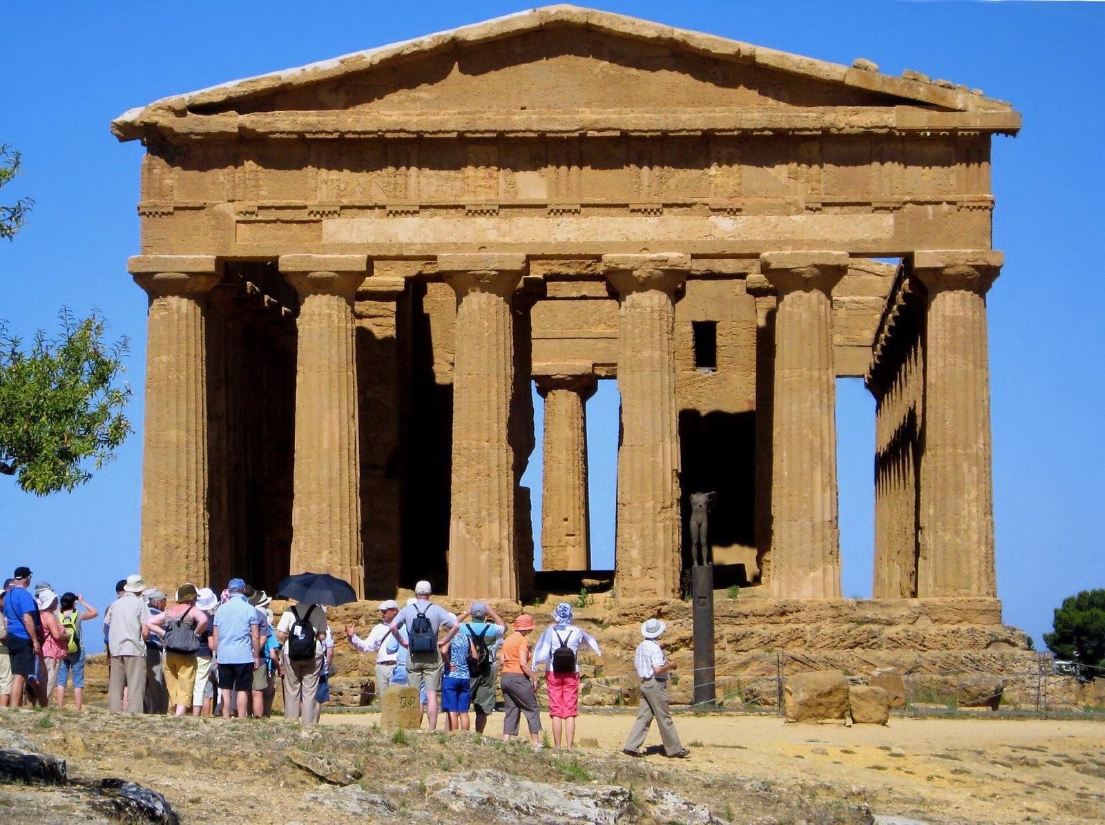 Tour no. 18
- Stops
- 10
- Distance
- 2.5 km (1.6 mi)
- Time
- About 150 minutes
- Route
- Moderate walking route
Listen before you buy
Stop 1 · Temple of Juno
Stop 1 is free. Listen before you buy.
The walk
A self-guided audio tour of Agrigento
Agrigento's temples did not survive by standing still. Fire marked one, a church remade another, graves cut through the old defensive ridge, and modern excavators chose which columns to raise again. This east-to-west walk follows the sacred hill downhill from the Temple of Juno to the Kolymbethra garden, reading the visible ruins as records of reuse rather than frozen remains of a single Greek moment.
Route notes
The stops
About each stop · narration stays in the app
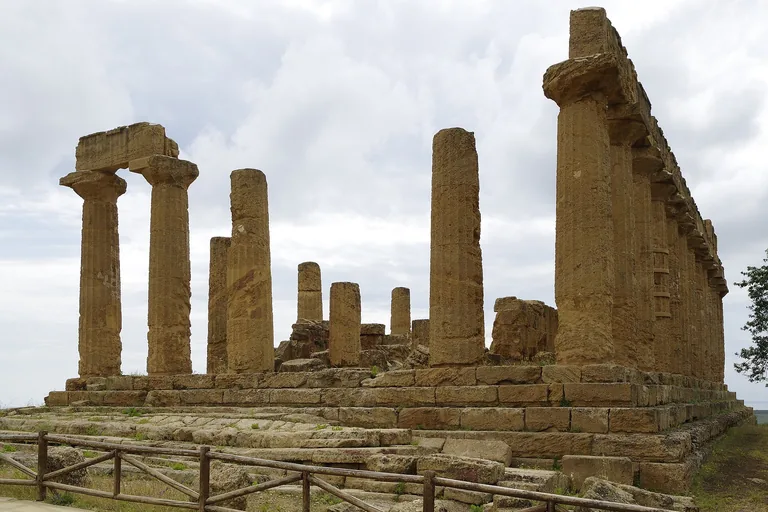
Photo: Berthold Werner · Wikimedia Commons source · CC BY-SA 4.0 · Cropped to the recorded 3:2 source rectangle and resized from the exact hash-bound source input. Temple of Juno
The ridge-top temple conventionally called Juno combines ancient fabric, traces of fire and later repairs, while its exact ancient dedication remains uncertain. It begins the route by showing that familiar modern names can be less secure than the standing archaeology. The ticketed park approach climbs over uneven, exposed ground; the stop does not require mounting the temple platform.
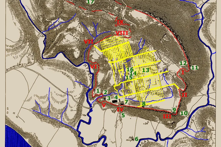
Photo: Robert Koldewey · Wikimedia Commons source · CC0 · Cropped to the recorded 3:2 source rectangle and resized from the exact hash-bound source input. Gate III and the City Wall
Gate III is a fragmentary entrance through Akragas's defensive ridge, where road traces, wall remains and later burials overlap. This short stop shifts attention from a monumental temple to the infrastructure that controlled movement into the ancient city. Remain on the marked park path because the low remains are difficult to distinguish from the walking surface.
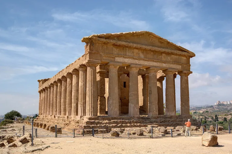
Photo: Berthold Werner · Wikimedia Commons source · CC BY-SA 3.0 · Cropped to the recorded 3:2 source rectangle and resized from the exact hash-bound source input. Temple of Concordia
The Temple of Concordia owes much of its survival to conversion into a Christian church, which altered its entrances and opened arches through the cella walls. It is included to replace the idea of an untouched classical survivor with a building preserved through repeated reuse and restoration. Broad park paths reach the exterior view, but the ancient steps and interior are not part of the walking route.
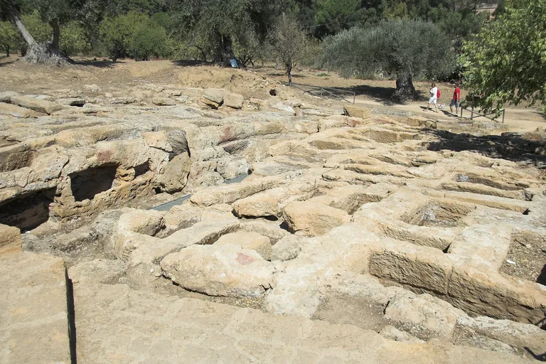
Photo: Zde · Wikimedia Commons source · CC BY-SA 4.0 · Cropped to the recorded 3:2 source rectangle and resized from the exact hash-bound source input. Early Christian Necropolis
The Early Christian Necropolis consists of tombs and burial chambers cut into and around the earlier Greek defensive ridge. It follows Concordia to show later communities inserting their dead into the city's older monumental landscape. Outdoor tomb cuttings are visible from the park route; separately managed underground passages involve confined spaces and steps and are optional.
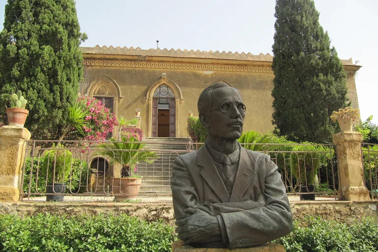
Photo: Palickap · Wikimedia Commons source · CC BY-SA 4.0 · Cropped to the recorded 3:2 source rectangle and resized from the exact hash-bound source input. Villa Aurea and Alexander Hardcastle
Villa Aurea was the Agrigento home of Alexander Hardcastle, whose funding supported excavation, conservation and the re-erection of columns at the Temple of Heracles. The stop makes modern patronage and archaeological decision-making visible before viewing the restoration it helped create. The route works from the outdoor garden side; any antiquarium or interior access follows separate current hours.
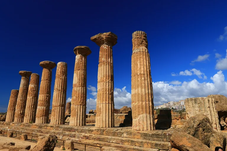
Photo: Benjamin Smith · Wikimedia Commons source · CC BY-SA 4.0 · Cropped to the recorded 3:2 source rectangle and resized from the exact hash-bound source input. Temple of Heracles
The temple conventionally attributed to Heracles is now recognised by a line of columns re-erected through twentieth-century anastylosis using ancient pieces. It pays off the Villa Aurea stop by separating the ancient ruin from the modern silhouette visitors photograph. View the temple from the park path and do not cross barriers or walk among the fallen blocks.
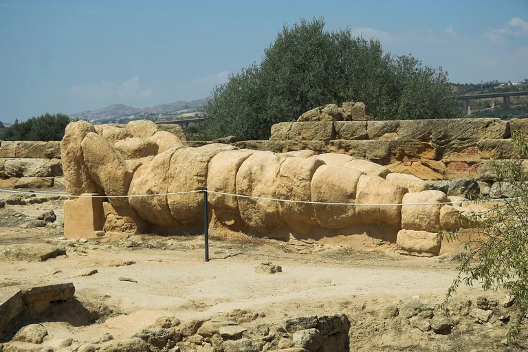
Photo: Zde · Wikimedia Commons source · CC BY-SA 4.0 · Cropped to the recorded 3:2 source rectangle and resized from the exact hash-bound source input. Olympieion and the Telamon
The immense Olympieion survives as dispersed masonry and fragments of nearly eight-metre telamons whose original placement remains debated. It is the route's scale set-piece and its clearest lesson in how incomplete evidence limits architectural reconstruction. Use the marked outdoor route across uneven ground; entering the temple footprint or climbing on blocks is unnecessary and unsafe.
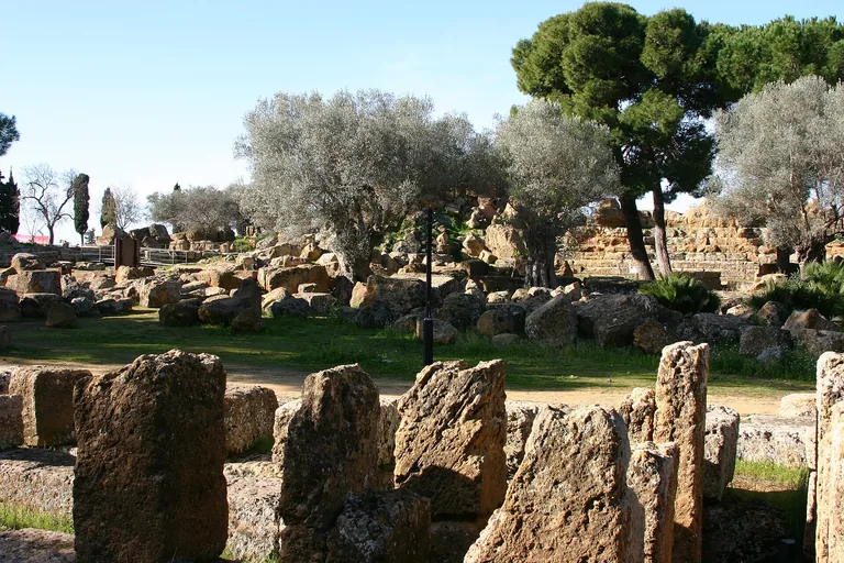
Photo: José Luiz · Wikimedia Commons source · CC BY-SA 4.0 · Cropped to the recorded 3:2 source rectangle and resized from the exact hash-bound source input. Great Altar of Zeus
The broad remains beside the Olympieion belong to its monumental altar complex rather than to a separate complete building. The stop reconnects temple, sculpture fragments and sacrificial space as parts of one large ceremonial landscape. The remains are read from the western park path and should not be crossed or used as seating.
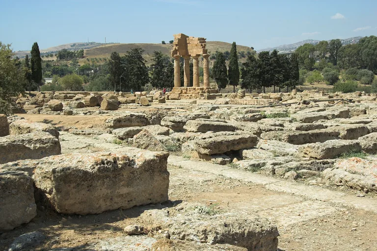
Photo: Zde · Wikimedia Commons source · CC BY-SA 4.0 · Cropped to the recorded 3:2 source rectangle and resized from the exact hash-bound source input. Sanctuary of the Chthonic Deities
The Sanctuary of the Chthonic Deities is a dispersed complex of enclosures, altars and small sacred structures rather than one dominant temple. It broadens the route from monumental architecture to repeated offerings and communal ritual, while correcting the famous four-column reconstruction assembled from mixed fragments. Paths are uneven among low ruins, so use the interpretation point and avoid approaching reconstructed fabric across archaeological ground.
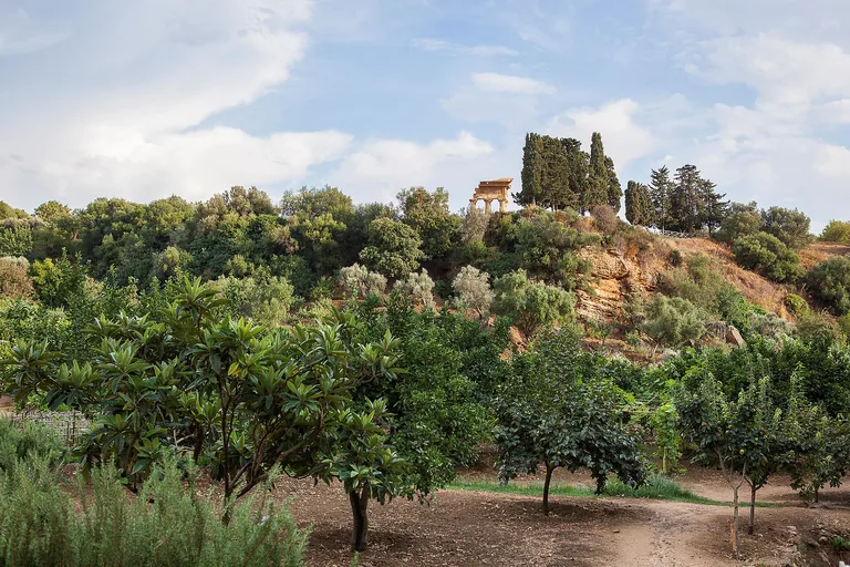
Photo: Vincenzo Cammarata, 2013 © FAI - Fondo per l'Ambiente Italiano · Wikimedia Commons source · CC BY-SA 4.0 · Cropped to the recorded 3:2 source rectangle and resized from the exact hash-bound source input. Kolymbethra Garden
Kolymbethra is a cultivated valley where ancient water-management traditions, later farming and modern restoration have produced today's citrus and olive landscape. The route ends with continuity sustained by labour rather than with another isolated stone monument. The park-side overlook completes the stop; entering the separately managed garden may require a ticket and a descent on uneven paths.


.jpg)


Local context
Before you go
The published route starts at Ingresso Tempio di Giunone, Via Panoramica dei Templi, 92100 Agrigento AG, Italia. It begins at Temple of Juno and ends at Kolymbethra Garden.
On the ground
Access and surfaces
This is a one-way route inside the ticketed Valley of the Temples park, beginning at the eastern Juno entrance and ending near the Kolymbethra garden entrance. The route is exposed to sun and has long stretches of uneven stone, compacted earth, slopes and occasional steps; carry water and check the park's current access arrangements. The core stops are written from outdoor paths and do not require entering restricted ruins. Entry into the FAI-managed Kolymbethra garden may require a separate ticket; stop 10 works from the public park-side overlook/entrance.
Frequently asked
Plan the walk
- How long is the Agrigento audio walking tour?
- Allow about 150 minutes. The self-guided route covers 2.5 km (1.6 mi) in 10 stops, including walking and listening time.
- Where does the Agrigento tour start and end?
- It starts at Ingresso Tempio di Giunone, Via Panoramica dei Templi, 92100 Agrigento AG, Italia. The published route begins at Temple of Juno and ends at Kolymbethra Garden.
- Will the Agrigento audio tour work offline?
- Yes, after download. Audio, stop text, images, and GPS triggering work without data; the live map background still needs a connection.